Property Record
900 Doverside Dr, Apex, NC 27523
NEARBY LISTINGS FOR SALE OR LEASE
-
-
View all Apex listings for sale on LoopNet.com
Property Detail
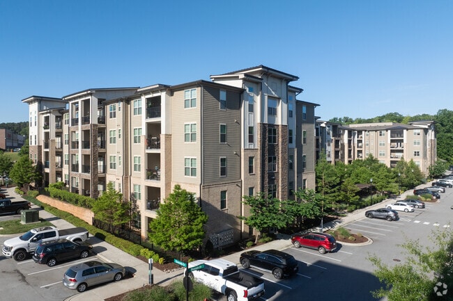
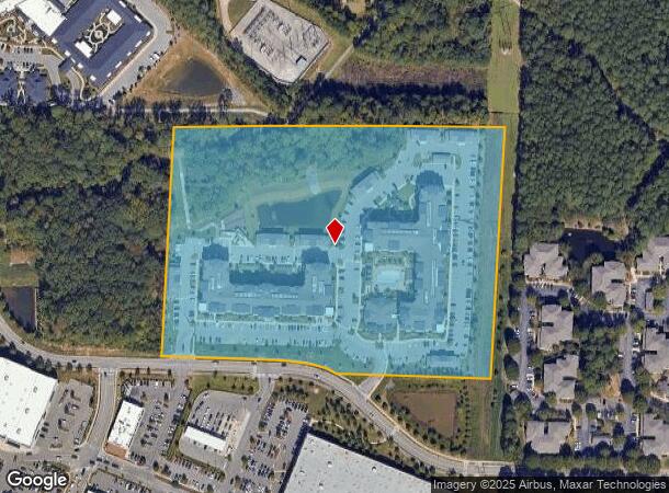
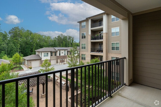
900 Doverside Dr
Raleigh, NC
Chatham Nichols Plaza Llc
0752.05-17-2582-000
LO1 CHATHAM NICHOLS PLAZA LLC BM2017-015
Apartment
Wake
X
North Carolina
3720075200K
1
2025
15.38 AC
2025
Cary Crossroads/Apex
053435
Raleigh/Durham
280,706 SF
DEMOGRAPHICS near 900 Doverside Dr
1 Mile
3 Mile
5 Mile
2024 Total Population
9,054
76,303
194,606
2029 Population
9,870
82,445
210,800
Pop Growth 2024-2029
+ 9.01%
+ 8.05%
+ 8.32%
Average Age
41
41
39
2024 Total Households
3,488
29,562
74,294
HH Growth 2024-2029
+ 9.12%
+ 8.08%
+ 8.33%
Median Household Inc
$118,977
$116,541
$115,103
Avg Household Size
2.60
2.60
2.60
2024 Avg HH Vehicles
2.00
2.00
2.00
Median Home Value
$408,992
$403,965
$431,711
Median Year Built
1992
1994
1996
Nearby Places
Map Layers
Map Styles
 Street
 Aerial
- Restaurants
- Banks
- Shops
- Fitness
- Groceries
PUBLIC TRANSPORTATION
COMMUTER RAIL
Cary Station (Piedmont - North Carolina by Train (NC Train))
DRIVE
WALK
Distance
Cary Station (Piedmont - North Carolina by Train (NC Train))
10 min
4.9 mi
AIRPORT
Raleigh-Durham International
DRIVE
WALK
Distance
Raleigh-Durham International
24 min
12.2 mi
Freight Ports
Port of Wilmington
DRIVE
WALK
Distance
Port of Wilmington
166 min
143.3 mi
Nearby Properties
Address
Land Use
TOTAL SIZE
Lot Size
Zoning
Address
Land Use
TOTAL SIZE
Lot Size
Zoning
517,812 SF
18.51 AC
RMFP
Address
Land Use
TOTAL SIZE
Lot Size
Zoning
633,930 SF
23.01 AC
OI
Address
Land Use
TOTAL SIZE
Lot Size
Zoning
433,914 SF
11.81 AC
MXD
Address
Land Use
TOTAL SIZE
Lot Size
Zoning
441,502 SF
15.42 AC
OIM
Address
Land Use
TOTAL SIZE
Lot Size
Zoning
450,107 SF
30.16 AC
HD MF
Address
Land Use
TOTAL SIZE
Lot Size
Zoning
313,623 SF
23.92 AC
HD MF
Address
Land Use
TOTAL SIZE
Lot Size
Zoning
364,972 SF
35.18 AC
RMF-C
Address
Land Use
TOTAL SIZE
Lot Size
Zoning
194,462 SF
21.62 AC
OICU
Address
Land Use
TOTAL SIZE
Lot Size
Zoning
338,234 SF
18.77 AC
PUD-C
Address
Land Use
TOTAL SIZE
Lot Size
Zoning
260,809 SF
18.80 AC
HD MF
Address
Land Use
TOTAL SIZE
Lot Size
Zoning
285,822 SF
24.57 AC
RMFP
Address
Land Use
TOTAL SIZE
Lot Size
Zoning
260,777 SF
22.54 AC
GCCU
Address
Land Use
TOTAL SIZE
Lot Size
Zoning
270,753 SF
20.56 AC
RMFP
Address
Land Use
TOTAL SIZE
Lot Size
Zoning
209,936 SF
55.26 AC
R8
Address
Land Use
TOTAL SIZE
Lot Size
Zoning
291,597 SF
20.58 AC
OIP
Address
Land Use
TOTAL SIZE
Lot Size
Zoning
145,001 SF
20.31 AC
PC-CZ
Address
Land Use
TOTAL SIZE
Lot Size
Zoning
225,296 SF
9.57 AC
PUD-C
Address
Land Use
TOTAL SIZE
Lot Size
Zoning
140,005 SF
16.89 AC
LD
Address
Land Use
TOTAL SIZE
Lot Size
Zoning
210,686 SF
14.57 AC
PUD-C
Address
Land Use
TOTAL SIZE
Lot Size
Zoning
157,686 SF
35.03 AC
RA
Address
Land Use
TOTAL SIZE
Lot Size
Zoning
209,191 SF
48.77 AC
LD
Address
Land Use
TOTAL SIZE
Lot Size
Zoning
121,224 SF
11.47 AC
MD
Address
Land Use
TOTAL SIZE
Lot Size
Zoning
174,376 SF
17.47 AC
RMFP
Address
Land Use
TOTAL SIZE
Lot Size
Zoning
207,360 SF
12.80 AC
RMFP
Address
Land Use
TOTAL SIZE
Lot Size
Zoning
183,716 SF
18.22 AC
RMF-C
Address
Land Use
TOTAL SIZE
Lot Size
Zoning
142,976 SF
12.82 AC
GCP
Address
Land Use
TOTAL SIZE
Lot Size
Zoning
302,498 SF
25.99 AC
LI-CZ
Address
Land Use
TOTAL SIZE
Lot Size
Zoning
161,210 SF
12.70 AC
RMFP
Address
Land Use
TOTAL SIZE
Lot Size
Zoning
206,382 SF
14.90 AC
GCP
The World's #1 Commercial Real Estate Marketplace
Connect with us
© 2025 CoStar Group
The information above has been obtained from sources believed reliable. While we do not doubt its accuracy we have not verified it and make no guarantee, warranty or representation about it. It is your responsibility to independently confirm its accuracy and completeness. Any projections, opinions, assumptions, or estimates used are for example only and do not represent the current or future performance of the property. The value of this transaction to you depends on tax and other factors which should be evaluated by your tax, financial, and legal advisors. You and your advisors should conduct a careful, independent investigation of the property to determine to your satisfaction the suitability of the property for your needs.