Property Record
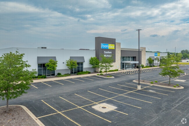
900 E Boughton Rd, Woodridge, IL 60517


NEARBY LISTINGS FOR SALE OR LEASE
Property Detail
900 E Boughton Rd
Chicago-Naperville-Elgin, IL-IN-WI
Boughton Woodward Commercial Center Sub
10-06-100-017
BOUGHTON WOODWARD COMMERCIAL CENTER SUB THAT PRT LYG IN DUPAGE COUNTY
Commercialnec
DuPage
X
Illinois
17043C0257J
4
2024
5.49 AC
2024
Western East/West Corr
845809
Chicago
68,407 SF
DEMOGRAPHICS near 900 E Boughton Rd
1 Mile
3 Mile
5 Mile
2024 Total Population
8,031
78,521
218,201
2029 Population
7,877
77,537
215,552
Pop Growth 2024-2029
(1.92%)
(1.25%)
(1.21%)
Average Age
43
41
41
2024 Total Households
2,914
29,981
84,052
HH Growth 2024-2029
(1.99%)
(1.27%)
(1.26%)
Median Household Inc
$113,790
$88,426
$95,705
Avg Household Size
2.70
2.60
2.50
2024 Avg HH Vehicles
2.00
2.00
2.00
Median Home Value
$358,385
$306,876
$340,668
Median Year Built
1985
1978
1978
Nearby Places
Map Layers
Map Styles
 Street
 Aerial
- Restaurants
- Banks
- Shops
- Fitness
- Groceries
PUBLIC TRANSPORTATION
COMMUTER RAIL
Belmont Station (Burlington Northern-Santa Fe Railway Line - Northeast Illinois Regional Commuter Railroad (Metra))
DRIVE
WALK
Distance
Belmont Station (Burlington Northern-Santa Fe Railway Line - Northeast Illinois Regional Commuter Railroad (Metra))
13 min
5.1 mi
Lemont Station (Heritage Corridor Line - Northeast Illinois Regional Commuter Railroad (Metra))
DRIVE
WALK
Distance
Lemont Station (Heritage Corridor Line - Northeast Illinois Regional Commuter Railroad (Metra))
11 min
5.3 mi
AIRPORT
Chicago Midway International
DRIVE
WALK
Distance
Chicago Midway International
26 min
17.4 mi
Chicago O'Hare International
DRIVE
WALK
Distance
Chicago O'Hare International
43 min
27.4 mi
Nearby Properties
Address
Land Use
TOTAL SIZE
Lot Size
Zoning
Address
Land Use
TOTAL SIZE
Lot Size
Zoning
22.17 AC
M
Address
Land Use
TOTAL SIZE
Lot Size
Zoning
21,520 SF
32.67 AC
Address
Land Use
TOTAL SIZE
Lot Size
Zoning
13.53 AC
M
Address
Land Use
TOTAL SIZE
Lot Size
Zoning
373,827 SF
21.30 AC
Address
Land Use
TOTAL SIZE
Lot Size
Zoning
759,709 SF
41.75 AC
Address
Land Use
TOTAL SIZE
Lot Size
Zoning
21.12 AC
Address
Land Use
TOTAL SIZE
Lot Size
Zoning
18.23 AC
M
Address
Land Use
TOTAL SIZE
Lot Size
Zoning
315,708 SF
21.95 AC
M
Address
Land Use
TOTAL SIZE
Lot Size
Zoning
19.02 AC
M
Address
Land Use
TOTAL SIZE
Lot Size
Zoning
14.98 AC
M
Address
Land Use
TOTAL SIZE
Lot Size
Zoning
308,196 SF
17.65 AC
M
Address
Land Use
TOTAL SIZE
Lot Size
Zoning
334,656 SF
17.72 AC
I
Address
Land Use
TOTAL SIZE
Lot Size
Zoning
9.58 AC
M
Address
Land Use
TOTAL SIZE
Lot Size
Zoning
353,286 SF
19.84 AC
Address
Land Use
TOTAL SIZE
Lot Size
Zoning
28.89 AC
Address
Land Use
TOTAL SIZE
Lot Size
Zoning
173,098 SF
16.32 AC
R-6
Address
Land Use
TOTAL SIZE
Lot Size
Zoning
264,310 SF
12.21 AC
I
Address
Land Use
TOTAL SIZE
Lot Size
Zoning
173,459 SF
14.58 AC
C
Address
Land Use
TOTAL SIZE
Lot Size
Zoning
513,805 SF
23.84 AC
Address
Land Use
TOTAL SIZE
Lot Size
Zoning
126,165 SF
20.34 AC
Address
Land Use
TOTAL SIZE
Lot Size
Zoning
9.97 AC
M
Address
Land Use
TOTAL SIZE
Lot Size
Zoning
13.42 AC
Address
Land Use
TOTAL SIZE
Lot Size
Zoning
351,257 SF
16.39 AC
I
Address
Land Use
TOTAL SIZE
Lot Size
Zoning
432,522 SF
20.38 AC
Address
Land Use
TOTAL SIZE
Lot Size
Zoning
396,546 SF
20.33 AC
I
Address
Land Use
TOTAL SIZE
Lot Size
Zoning
13.46 AC
M
Address
Land Use
TOTAL SIZE
Lot Size
Zoning
367,990 SF
17.32 AC
I
Address
Land Use
TOTAL SIZE
Lot Size
Zoning
268,566 SF
15.24 AC
M
Address
Land Use
TOTAL SIZE
Lot Size
Zoning
Address
Land Use
TOTAL SIZE
Lot Size
Zoning
314,196 SF
21.08 AC
The World's #1 Commercial Real Estate Marketplace
Connect with us
© 2025 CoStar Group
The information above has been obtained from sources believed reliable. While we do not doubt its accuracy we have not verified it and make no guarantee, warranty or representation about it. It is your responsibility to independently confirm its accuracy and completeness. Any projections, opinions, assumptions, or estimates used are for example only and do not represent the current or future performance of the property. The value of this transaction to you depends on tax and other factors which should be evaluated by your tax, financial, and legal advisors. You and your advisors should conduct a careful, independent investigation of the property to determine to your satisfaction the suitability of the property for your needs.