Property Record
900 Hartford Tpke, Waterford, CT 06385


NEARBY LISTINGS FOR SALE OR LEASE
-
-
View all Waterford listings for sale on LoopNet.com
Property Detail
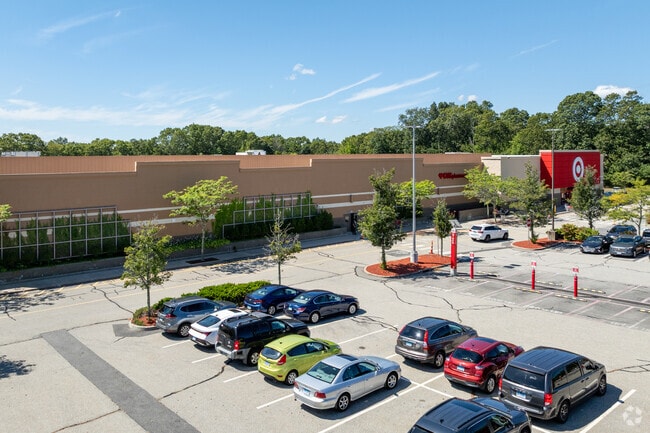
900 Hartford Tpke
WATE-000091-000000-003252
New London
Commercialbuilding
Connecticut
X
3252
09011C0344G
18.96 AC
2025
New London
2025
Hartford
693700
Norwich-New London-Willimantic, CT
127,574 SF
DEMOGRAPHICS near 900 Hartford Tpke
1 Mile
3 Mile
5 Mile
2024 Total Population
1,181
30,230
78,263
2029 Population
1,171
30,065
78,185
Pop Growth 2024-2029
(0.85%)
(0.55%)
(0.10%)
Average Age
44
39
40
2024 Total Households
481
11,294
31,375
HH Growth 2024-2029
(0.83%)
(0.49%)
(0.11%)
Median Household Inc
$117,129
$64,496
$73,822
Avg Household Size
2.40
2.30
2.20
2024 Avg HH Vehicles
2.00
2.00
2.00
Median Home Value
$275,730
$260,908
$273,990
Median Year Built
1976
1960
1965
Nearby Places
Map Layers
Map Styles
 Street
 Aerial
- Restaurants
- Banks
- Shops
- Fitness
- Groceries
PUBLIC TRANSPORTATION
COMMUTER RAIL
New London (Shore Line East - Shore Line East)
DRIVE
WALK
Distance
New London (Shore Line East - Shore Line East)
7 min
3.6 mi
Freight Ports
Port of New Haven
DRIVE
WALK
Distance
Port of New Haven
57 min
44.0 mi
Nearby Properties
Address
Land Use
TOTAL SIZE
Lot Size
Zoning
Address
Land Use
TOTAL SIZE
Lot Size
Zoning
45,582 SF
39.40 AC
WCI-1
Address
Land Use
TOTAL SIZE
Lot Size
Zoning
296,000 SF
46.82 AC
C-T
Address
Land Use
TOTAL SIZE
Lot Size
Zoning
49.32 AC
R-3
Address
Land Use
TOTAL SIZE
Lot Size
Zoning
54.80 AC
INST
Address
Land Use
TOTAL SIZE
Lot Size
Zoning
21.84 AC
C-2
Address
Land Use
TOTAL SIZE
Lot Size
Zoning
41.89 AC
SDD
Address
Land Use
TOTAL SIZE
Lot Size
Zoning
47,148 SF
101.29 AC
IP-1
Address
Land Use
TOTAL SIZE
Lot Size
Zoning
55,766 SF
1.33 AC
R-4
Address
Land Use
TOTAL SIZE
Lot Size
Zoning
68,774 SF
53.34 AC
C-T
Address
Land Use
TOTAL SIZE
Lot Size
Zoning
69,658 SF
16.31 AC
VR-10
Address
Land Use
TOTAL SIZE
Lot Size
Zoning
79,535 SF
3.03 AC
R-2
Address
Land Use
TOTAL SIZE
Lot Size
Zoning
68,244 SF
25.67 AC
R-40
Address
Land Use
TOTAL SIZE
Lot Size
Zoning
135,113 SF
2.51 AC
LI-O
Address
Land Use
TOTAL SIZE
Lot Size
Zoning
129,890 SF
40.95 AC
R-20
Address
Land Use
TOTAL SIZE
Lot Size
Zoning
5.65 AC
R-2
Address
Land Use
TOTAL SIZE
Lot Size
Zoning
4.31 AC
WCI-2
Address
Land Use
TOTAL SIZE
Lot Size
Zoning
56.50 AC
C-R
Address
Land Use
TOTAL SIZE
Lot Size
Zoning
70,318 SF
5.20 AC
C-G
Address
Land Use
TOTAL SIZE
Lot Size
Zoning
12.55 AC
C-2
Address
Land Use
TOTAL SIZE
Lot Size
Zoning
79,469 SF
17.98 AC
IP-1
Address
Land Use
TOTAL SIZE
Lot Size
Zoning
18.76 AC
INST
Address
Land Use
TOTAL SIZE
Lot Size
Zoning
21.08 AC
C-G
Address
Land Use
TOTAL SIZE
Lot Size
Zoning
70.27 AC
R-40
Address
Land Use
TOTAL SIZE
Lot Size
Zoning
64,040 SF
4.57 AC
OS
Address
Land Use
TOTAL SIZE
Lot Size
Zoning
201,755 SF
58.13 AC
C-R
Address
Land Use
TOTAL SIZE
Lot Size
Zoning
68,045 SF
15.56 AC
IP-1
Address
Land Use
TOTAL SIZE
Lot Size
Zoning
99,569 SF
1.40 AC
R-4
Address
Land Use
TOTAL SIZE
Lot Size
Zoning
7.31 AC
R-1
Address
Land Use
TOTAL SIZE
Lot Size
Zoning
50,024 SF
10.35 AC
I-G
Address
Land Use
TOTAL SIZE
Lot Size
Zoning
2.22 AC
R-4
The World's #1 Commercial Real Estate Marketplace
Connect with us
© 2026 CoStar Group
The information above has been obtained from sources believed reliable. While we do not doubt its accuracy we have not verified it and make no guarantee, warranty or representation about it. It is your responsibility to independently confirm its accuracy and completeness. Any projections, opinions, assumptions, or estimates used are for example only and do not represent the current or future performance of the property. The value of this transaction to you depends on tax and other factors which should be evaluated by your tax, financial, and legal advisors. You and your advisors should conduct a careful, independent investigation of the property to determine to your satisfaction the suitability of the property for your needs.