Property Record
900 Marietta Hwy, Roswell, GA 30075


NEARBY LISTINGS FOR SALE OR LEASE
Property Detail
900 Marietta Hwy
Regionalshoppingcenterormallwithanchorstore
Fulton
X
Georgia
13057C0375E
10 AC
2024
Roswell/Alpharetta
2025
Atlanta
011422
Atlanta-Sandy Springs-Roswell, GA
91,439 SF
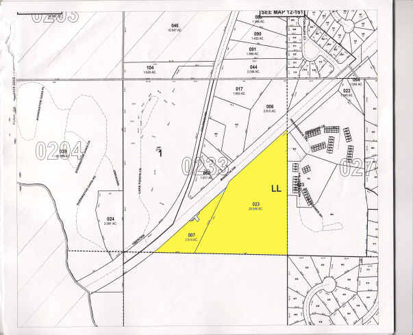
12-1620-0233-023-4
DEMOGRAPHICS near 900 Marietta Hwy
1 Mile
3 Mile
5 Mile
2024 Total Population
5,686
65,084
189,459
2029 Population
5,774
65,821
191,789
Pop Growth 2024-2029
+ 1.55%
+ 1.13%
+ 1.23%
Average Age
40
41
40
2024 Total Households
2,008
25,605
73,598
HH Growth 2024-2029
+ 1.59%
+ 1.16%
+ 1.30%
Median Household Inc
$166,105
$120,314
$118,798
Avg Household Size
2.70
2.50
2.50
2024 Avg HH Vehicles
2.00
2.00
2.00
Median Home Value
$621,001
$553,800
$487,130
Median Year Built
1986
1985
1984
Nearby Places
Map Layers
Map Styles
 Street
 Aerial
- Restaurants
- Banks
- Shops
- Fitness
- Groceries
PUBLIC TRANSPORTATION
AIRPORT
Hartsfield - Jackson Atlanta International
DRIVE
WALK
Distance
Hartsfield - Jackson Atlanta International
48 min
32.0 mi
Nearby Properties
Address
Land Use
TOTAL SIZE
Lot Size
Zoning
Address
Land Use
TOTAL SIZE
Lot Size
Zoning
1,078,010 SF
3.80 AC
OPC
Address
Land Use
TOTAL SIZE
Lot Size
Zoning
12,342,500 SF
125.51 AC
AC
Address
Land Use
TOTAL SIZE
Lot Size
Zoning
380,453 SF
10.28 AC
R4
Address
Land Use
TOTAL SIZE
Lot Size
Zoning
258,955 SF
29.70 AC
CRC/LRO
Address
Land Use
TOTAL SIZE
Lot Size
Zoning
7,258,269 SF
38.75 AC
AC
Address
Land Use
TOTAL SIZE
Lot Size
Zoning
1,909,285 SF
22.39 AC
OI
Address
Land Use
TOTAL SIZE
Lot Size
Zoning
10,614,240 SF
24.05 AC
A
Address
Land Use
TOTAL SIZE
Lot Size
Zoning
8,014,916 SF
28.58 AC
R4
Address
Land Use
TOTAL SIZE
Lot Size
Zoning
10,866,920 SF
31.48 AC
AC
Address
Land Use
TOTAL SIZE
Lot Size
Zoning
3,714,740 SF
45.91 AC
A1
Address
Land Use
TOTAL SIZE
Lot Size
Zoning
647,376 SF
22.43 AC
AC
Address
Land Use
TOTAL SIZE
Lot Size
Zoning
287,388 SF
44.90 AC
ACOND
Address
Land Use
TOTAL SIZE
Lot Size
Zoning
305,733 SF
10.93 AC
OIC
Address
Land Use
TOTAL SIZE
Lot Size
Zoning
1,957,333 SF
19.86 AC
AC
Address
Land Use
TOTAL SIZE
Lot Size
Zoning
5,499,045 SF
22.17 AC
AC
Address
Land Use
TOTAL SIZE
Lot Size
Zoning
690,426 SF
34.99 AC
AC
Address
Land Use
TOTAL SIZE
Lot Size
Zoning
2,932,336 SF
20.37 AC
AC
Address
Land Use
TOTAL SIZE
Lot Size
Zoning
1,024,880 SF
23.70 AC
AC
Address
Land Use
TOTAL SIZE
Lot Size
Zoning
1,647,821 SF
10.90 AC
OIC
Address
Land Use
TOTAL SIZE
Lot Size
Zoning
1,198,136 SF
30.94 AC
E2
Address
Land Use
TOTAL SIZE
Lot Size
Zoning
2,658,204 SF
21.53 AC
AC
Address
Land Use
TOTAL SIZE
Lot Size
Zoning
2,395,332 SF
18.14 AC
AC
Address
Land Use
TOTAL SIZE
Lot Size
Zoning
2,359,060 SF
16.50 AC
AC
Address
Land Use
TOTAL SIZE
Lot Size
Zoning
4,357,008 SF
24.37 AC
AC
Address
Land Use
TOTAL SIZE
Lot Size
Zoning
166,048 SF
20.29 AC
GC
Address
Land Use
TOTAL SIZE
Lot Size
Zoning
2,360,402 SF
17.38 AC
AC
Address
Land Use
TOTAL SIZE
Lot Size
Zoning
194,453 SF
17.71 AC
CRC/WS
Address
Land Use
TOTAL SIZE
Lot Size
Zoning
2,746,952 SF
21.22 AC
AC
Address
Land Use
TOTAL SIZE
Lot Size
Zoning
1,081,675 SF
25.80 AC
AC
Address
Land Use
TOTAL SIZE
Lot Size
Zoning
809,496 SF
11.33 AC
AC
The World's #1 Commercial Real Estate Marketplace
Connect with us
© 2025 CoStar Group
The information above has been obtained from sources believed reliable. While we do not doubt its accuracy we have not verified it and make no guarantee, warranty or representation about it. It is your responsibility to independently confirm its accuracy and completeness. Any projections, opinions, assumptions, or estimates used are for example only and do not represent the current or future performance of the property. The value of this transaction to you depends on tax and other factors which should be evaluated by your tax, financial, and legal advisors. You and your advisors should conduct a careful, independent investigation of the property to determine to your satisfaction the suitability of the property for your needs.