Property Record
900 N Bethlehem Pike, Ambler, PA 19002


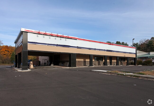
This Property Is For Sale
NEARBY LISTINGS FOR SALE OR LEASE
Property Detail
900 N Bethlehem Pike
39-00-00229-002
ASSESSOR BLOCK-UNIT NUMBER 17C-11
Restaurantbuilding
Montgomery
X
Pennsylvania
42091C0286G
11
2024
1.88 AC
2025
Ft Wash/Spring House
201203
Philadelphia
16,962 SF
Philadelphia-Camden-Wilmington, PA-NJ-DE-MD
DEMOGRAPHICS near 900 N Bethlehem Pike
1 Mile
3 Mile
5 Mile
2024 Total Population
4,160
47,713
136,291
2029 Population
4,257
48,576
138,570
Pop Growth 2024-2029
+ 2.33%
+ 1.81%
+ 1.67%
Average Age
48
43
43
2024 Total Households
1,646
17,877
51,467
HH Growth 2024-2029
+ 2.31%
+ 1.79%
+ 1.62%
Median Household Inc
$153,741
$128,262
$124,949
Avg Household Size
2.40
2.60
2.60
2024 Avg HH Vehicles
2.00
2.00
2.00
Median Home Value
$605,536
$489,144
$455,222
Median Year Built
1977
1974
1979
Nearby Places
Map Layers
Map Styles
 Street
 Aerial
- Restaurants
- Banks
- Shops
- Fitness
- Groceries
PUBLIC TRANSPORTATION
COMMUTER RAIL
Penllyn (R5 - Southeastern Pennsylvania Transportation Authority Regional Rail (SEPTA Regional Rail))
DRIVE
WALK
Distance
Penllyn (R5 - Southeastern Pennsylvania Transportation Authority Regional Rail (SEPTA Regional Rail))
4 min
1.6 mi
Gwynedd Valley (R5 - Southeastern Pennsylvania Transportation Authority Regional Rail (SEPTA Regional Rail))
DRIVE
WALK
Distance
Gwynedd Valley (R5 - Southeastern Pennsylvania Transportation Authority Regional Rail (SEPTA Regional Rail))
5 min
2.5 mi
AIRPORT
Philadelphia International
DRIVE
WALK
Distance
Philadelphia International
51 min
29.3 mi
Trenton Mercer
DRIVE
WALK
Distance
Trenton Mercer
47 min
33.9 mi
Freight Ports
Port of Philadelphia
DRIVE
WALK
Distance
Port of Philadelphia
30 min
17.8 mi
Nearby Properties
Address
Land Use
TOTAL SIZE
Lot Size
Zoning
Address
Land Use
TOTAL SIZE
Lot Size
Zoning
688,123 SF
190.06 AC
IN
Address
Land Use
TOTAL SIZE
Lot Size
Zoning
832,797 SF
171.68 AC
A
Address
Land Use
TOTAL SIZE
Lot Size
Zoning
614,768 SF
30.16 AC
R7
Address
Land Use
TOTAL SIZE
Lot Size
Zoning
483,618 SF
142.84 AC
A
Address
Land Use
TOTAL SIZE
Lot Size
Zoning
371,340 SF
53 AC
A
Address
Land Use
TOTAL SIZE
Lot Size
Zoning
657,589 SF
100.81 AC
MF3A
Address
Land Use
TOTAL SIZE
Lot Size
Zoning
262,457 SF
40.75 AC
E
Address
Land Use
TOTAL SIZE
Lot Size
Zoning
422,429 SF
35.90 AC
A
Address
Land Use
TOTAL SIZE
Lot Size
Zoning
456,997 SF
7.91 AC
INST
Address
Land Use
TOTAL SIZE
Lot Size
Zoning
259,956 SF
79.17 AC
A
Address
Land Use
TOTAL SIZE
Lot Size
Zoning
464,943 SF
56.24 AC
MF3
Address
Land Use
TOTAL SIZE
Lot Size
Zoning
110,113 SF
13.35 AC
SC1
Address
Land Use
TOTAL SIZE
Lot Size
Zoning
287,030 SF
106.42 AC
INST
Address
Land Use
TOTAL SIZE
Lot Size
Zoning
245,273 SF
32.49 AC
MD
Address
Land Use
TOTAL SIZE
Lot Size
Zoning
59,634 SF
16 AC
A
Address
Land Use
TOTAL SIZE
Lot Size
Zoning
228,026 SF
24.47 AC
MF3
Address
Land Use
TOTAL SIZE
Lot Size
Zoning
103,435 SF
41.35 AC
A
Address
Land Use
TOTAL SIZE
Lot Size
Zoning
140,582 SF
52.93 AC
R2
Address
Land Use
TOTAL SIZE
Lot Size
Zoning
146,631 SF
10.21 AC
IN
Address
Land Use
TOTAL SIZE
Lot Size
Zoning
152,000 SF
154.42 AC
F1
Address
Land Use
TOTAL SIZE
Lot Size
Zoning
191,042 SF
9.59 AC
R6
Address
Land Use
TOTAL SIZE
Lot Size
Zoning
93,657 SF
27.40 AC
A1
Address
Land Use
TOTAL SIZE
Lot Size
Zoning
105,435 SF
12.70 AC
D2
Address
Land Use
TOTAL SIZE
Lot Size
Zoning
128,248 SF
4.61 AC
HI
Address
Land Use
TOTAL SIZE
Lot Size
Zoning
96,146 SF
42.09 AC
A
Address
Land Use
TOTAL SIZE
Lot Size
Zoning
99,390 SF
13.93 AC
C
Address
Land Use
TOTAL SIZE
Lot Size
Zoning
61,032 SF
16.40 AC
A
Address
Land Use
TOTAL SIZE
Lot Size
Zoning
136,966 SF
25.32 AC
D1
Address
Land Use
TOTAL SIZE
Lot Size
Zoning
81,925 SF
16.19 AC
D2
Address
Land Use
TOTAL SIZE
Lot Size
Zoning
101,742 SF
14.46 AC
INST
The World's #1 Commercial Real Estate Marketplace
Connect with us
© 2026 CoStar Group
The information above has been obtained from sources believed reliable. While we do not doubt its accuracy we have not verified it and make no guarantee, warranty or representation about it. It is your responsibility to independently confirm its accuracy and completeness. Any projections, opinions, assumptions, or estimates used are for example only and do not represent the current or future performance of the property. The value of this transaction to you depends on tax and other factors which should be evaluated by your tax, financial, and legal advisors. You and your advisors should conduct a careful, independent investigation of the property to determine to your satisfaction the suitability of the property for your needs.