Property Record
900 Northwest Hwy, Fox River Grove, IL 60021


NEARBY LISTINGS FOR SALE OR LEASE
-
-
View all Fox River Grove listings for sale on LoopNet.com
Property Detail
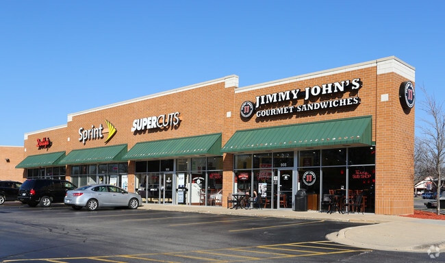
900 Northwest Hwy
20-20-251-026
DOC 2003R0026154 PT SW1/4 NE1/4 /EX CIR CT 88ED9/
Commercialnec
McHenry
X
Illinois
17097C0205K
2.09 AC
2024
Far Northwest
2024
Chicago
871402
Chicago-Naperville-Elgin, IL-IN-WI
20,649 SF
DEMOGRAPHICS near 900 Northwest Hwy
1 Mile
3 Mile
5 Mile
2024 Total Population
5,439
26,703
83,311
2029 Population
5,429
26,672
82,966
Pop Growth 2024-2029
(0.18%)
(0.12%)
(0.41%)
Average Age
42
42
42
2024 Total Households
2,043
9,683
30,370
HH Growth 2024-2029
(0.20%)
(0.10%)
(0.45%)
Median Household Inc
$115,996
$116,023
$104,314
Avg Household Size
2.60
2.70
2.70
2024 Avg HH Vehicles
2.00
2.00
2.00
Median Home Value
$278,375
$311,883
$295,650
Median Year Built
1974
1979
1981
Nearby Places
Map Layers
Map Styles
 Street
 Aerial
- Restaurants
- Banks
- Shops
- Fitness
- Groceries
PUBLIC TRANSPORTATION
COMMUTER RAIL
Fox River Grove Station (Union Pacific Northwest Line - Northeast Illinois Regional Commuter Railroad (Metra))
DRIVE
WALK
Distance
Fox River Grove Station (Union Pacific Northwest Line - Northeast Illinois Regional Commuter Railroad (Metra))
2 min
15 min
0.8 mi
Cary Station (Union Pacific Northwest Line - Northeast Illinois Regional Commuter Railroad (Metra))
DRIVE
WALK
Distance
Cary Station (Union Pacific Northwest Line - Northeast Illinois Regional Commuter Railroad (Metra))
4 min
2.2 mi
AIRPORT
Chicago O'Hare International
DRIVE
WALK
Distance
Chicago O'Hare International
41 min
28.1 mi
Freight Ports
Port Milwaukee
DRIVE
WALK
Distance
Port Milwaukee
92 min
68.9 mi
Nearby Properties
Address
Land Use
TOTAL SIZE
Lot Size
Zoning
Address
Land Use
TOTAL SIZE
Lot Size
Zoning
Address
Land Use
TOTAL SIZE
Lot Size
Zoning
217,182 SF
22.43 AC
Address
Land Use
TOTAL SIZE
Lot Size
Zoning
504,206 SF
11.06 AC
Address
Land Use
TOTAL SIZE
Lot Size
Zoning
18.42 AC
Address
Land Use
TOTAL SIZE
Lot Size
Zoning
55,547 SF
0.60 AC
Address
Land Use
TOTAL SIZE
Lot Size
Zoning
72,173 SF
5.23 AC
Address
Land Use
TOTAL SIZE
Lot Size
Zoning
35,452 SF
105.76 AC
Address
Land Use
TOTAL SIZE
Lot Size
Zoning
Address
Land Use
TOTAL SIZE
Lot Size
Zoning
4.74 AC
Address
Land Use
TOTAL SIZE
Lot Size
Zoning
229.01 AC
Address
Land Use
TOTAL SIZE
Lot Size
Zoning
4.34 AC
Address
Land Use
TOTAL SIZE
Lot Size
Zoning
59,003 SF
5 AC
Address
Land Use
TOTAL SIZE
Lot Size
Zoning
2,852 SF
15.66 AC
Address
Land Use
TOTAL SIZE
Lot Size
Zoning
Address
Land Use
TOTAL SIZE
Lot Size
Zoning
26,015 SF
3.45 AC
Address
Land Use
TOTAL SIZE
Lot Size
Zoning
84,342 SF
1.70 AC
Address
Land Use
TOTAL SIZE
Lot Size
Zoning
Address
Land Use
TOTAL SIZE
Lot Size
Zoning
Address
Land Use
TOTAL SIZE
Lot Size
Zoning
6.41 AC
Address
Land Use
TOTAL SIZE
Lot Size
Zoning
49,591 SF
3 AC
Address
Land Use
TOTAL SIZE
Lot Size
Zoning
83,164 SF
4.76 AC
Address
Land Use
TOTAL SIZE
Lot Size
Zoning
76,437 SF
6 AC
Address
Land Use
TOTAL SIZE
Lot Size
Zoning
Address
Land Use
TOTAL SIZE
Lot Size
Zoning
51,796 SF
2.30 AC
Address
Land Use
TOTAL SIZE
Lot Size
Zoning
3.17 AC
Address
Land Use
TOTAL SIZE
Lot Size
Zoning
Address
Land Use
TOTAL SIZE
Lot Size
Zoning
103,303 SF
1.27 AC
Address
Land Use
TOTAL SIZE
Lot Size
Zoning
28,340 SF
0.85 AC
The World's #1 Commercial Real Estate Marketplace
Connect with us
© 2025 CoStar Group
The information above has been obtained from sources believed reliable. While we do not doubt its accuracy we have not verified it and make no guarantee, warranty or representation about it. It is your responsibility to independently confirm its accuracy and completeness. Any projections, opinions, assumptions, or estimates used are for example only and do not represent the current or future performance of the property. The value of this transaction to you depends on tax and other factors which should be evaluated by your tax, financial, and legal advisors. You and your advisors should conduct a careful, independent investigation of the property to determine to your satisfaction the suitability of the property for your needs.