Property Record
900 Portland Cobalt Rd, Portland, CT 06480
NEARBY LISTINGS FOR SALE OR LEASE
-
-
View all Portland listings for lease on LoopNet.com
Property Detail
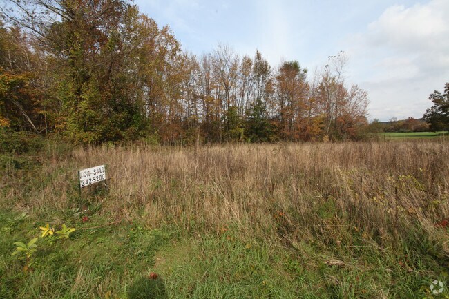
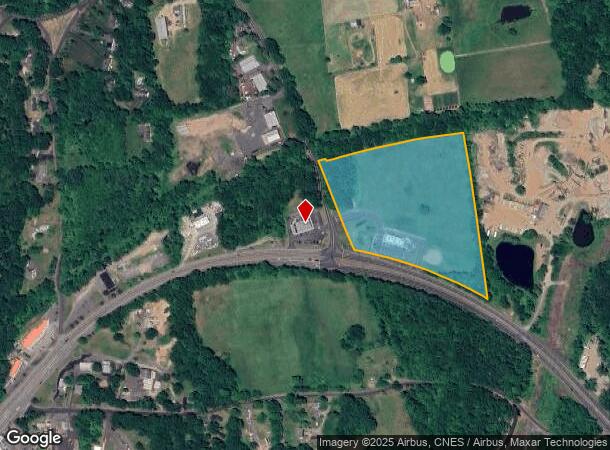
900 Portland Cobalt Rd
Restaurantbuilding
Middlesex
X
Connecticut
09007C0128G
13.51 AC
2024
East Hampton/East Haddam
2025
Hartford
560100
Hartford-West Hartford-East Hartford, CT
3,656 SF
PORT-000031-000000-000029
DEMOGRAPHICS near 900 Portland Cobalt Rd
1 Mile
3 Mile
5 Mile
2024 Total Population
1,049
22,360
62,681
2029 Population
1,048
22,156
62,302
Pop Growth 2024-2029
(0.10%)
(0.91%)
(0.60%)
Average Age
45
41
42
2024 Total Households
445
8,915
26,104
HH Growth 2024-2029
(0.22%)
(0.71%)
(0.53%)
Median Household Inc
$139,204
$74,325
$85,009
Avg Household Size
2.30
2.20
2.20
2024 Avg HH Vehicles
2.00
2.00
2.00
Median Home Value
$271,563
$255,775
$266,710
Median Year Built
1962
1949
1968
Nearby Places
Map Layers
Map Styles
 Street
 Aerial
- Restaurants
- Banks
- Shops
- Fitness
- Groceries
PUBLIC TRANSPORTATION
AIRPORT
Tweed/New Haven
DRIVE
WALK
Distance
Tweed/New Haven
47 min
33.1 mi
Bradley International
DRIVE
WALK
Distance
Bradley International
55 min
35.9 mi
Freight Ports
Port of New Haven
DRIVE
WALK
Distance
Port of New Haven
43 min
30.7 mi
SALE & LEASE HISTORY
LISTING DATE
SALE/LEASE

Jan 18, 2019
For Lease
Apr 30, 2024
For Lease
Nearby Properties
Address
Land Use
TOTAL SIZE
Lot Size
Zoning
Address
Land Use
TOTAL SIZE
Lot Size
Zoning
32 AC
R-45
Address
Land Use
TOTAL SIZE
Lot Size
Zoning
65.89 AC
R-45
Address
Land Use
TOTAL SIZE
Lot Size
Zoning
105 AC
R-45
Address
Land Use
TOTAL SIZE
Lot Size
Zoning
0.56 AC
B-1
Address
Land Use
TOTAL SIZE
Lot Size
Zoning
2.33 AC
ID
Address
Land Use
TOTAL SIZE
Lot Size
Zoning
4.90 AC
ID
Address
Land Use
TOTAL SIZE
Lot Size
Zoning
35.14 AC
R-30
Address
Land Use
TOTAL SIZE
Lot Size
Zoning
7.79 AC
ID
Address
Land Use
TOTAL SIZE
Lot Size
Zoning
1.62 AC
ID
Address
Land Use
TOTAL SIZE
Lot Size
Zoning
65,615 SF
1.46 AC
ID
Address
Land Use
TOTAL SIZE
Lot Size
Zoning
92,766 SF
1.79 AC
ID
Address
Land Use
TOTAL SIZE
Lot Size
Zoning
10.10 AC
IND
Address
Land Use
TOTAL SIZE
Lot Size
Zoning
3.58 AC
DVD
Address
Land Use
TOTAL SIZE
Lot Size
Zoning
2.49 AC
ID
Address
Land Use
TOTAL SIZE
Lot Size
Zoning
102,239 SF
1.02 AC
B-1
Address
Land Use
TOTAL SIZE
Lot Size
Zoning
63.50 AC
I-3
Address
Land Use
TOTAL SIZE
Lot Size
Zoning
15.26 AC
MX
Address
Land Use
TOTAL SIZE
Lot Size
Zoning
14.29 AC
MXC
Address
Land Use
TOTAL SIZE
Lot Size
Zoning
18.50 AC
MXI
Address
Land Use
TOTAL SIZE
Lot Size
Zoning
146.96 AC
IND
Address
Land Use
TOTAL SIZE
Lot Size
Zoning
45,934 SF
7.60 AC
RPZ
Address
Land Use
TOTAL SIZE
Lot Size
Zoning
177,765 SF
1.10 AC
B-1
Address
Land Use
TOTAL SIZE
Lot Size
Zoning
77,786 SF
6.57 AC
B-2
Address
Land Use
TOTAL SIZE
Lot Size
Zoning
58,398 SF
4.80 AC
R-15
Address
Land Use
TOTAL SIZE
Lot Size
Zoning
19,161 SF
0.82 AC
DVD
Address
Land Use
TOTAL SIZE
Lot Size
Zoning
110,708 SF
2.99 AC
MXC
Address
Land Use
TOTAL SIZE
Lot Size
Zoning
32,640 SF
1.80 AC
B-1
Address
Land Use
TOTAL SIZE
Lot Size
Zoning
19,258 SF
1.11 AC
IRA
Address
Land Use
TOTAL SIZE
Lot Size
Zoning
64.70 AC
R-45
Address
Land Use
TOTAL SIZE
Lot Size
Zoning
26,736 SF
0.46 AC
MXC
The World's #1 Commercial Real Estate Marketplace
Connect with us
© 2026 CoStar Group
The information above has been obtained from sources believed reliable. While we do not doubt its accuracy we have not verified it and make no guarantee, warranty or representation about it. It is your responsibility to independently confirm its accuracy and completeness. Any projections, opinions, assumptions, or estimates used are for example only and do not represent the current or future performance of the property. The value of this transaction to you depends on tax and other factors which should be evaluated by your tax, financial, and legal advisors. You and your advisors should conduct a careful, independent investigation of the property to determine to your satisfaction the suitability of the property for your needs.