Property Record
900 S Latson Rd, Howell, MI 48843
NEARBY LISTINGS FOR SALE OR LEASE
Property Detail
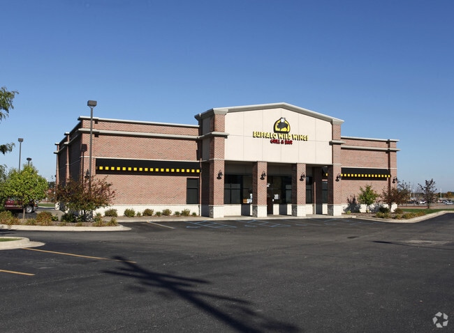
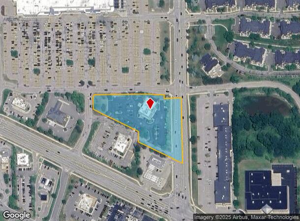
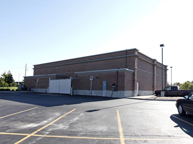
900 S Latson Rd
11-05-400-059
SEC 5 T2N R5E COMM AT SE COR TH N02*11'26"E 854.58 FT TO POB TH N60*51'00"W 287.02 FT TH N02*11'26"E 60.59 FT TH N60*51'00"W
Commercialnec
Livingston
X
Michigan
26093C0309D
2.87 AC
2025
Livingston County
2025
Detroit
742403
Detroit-Warren-Dearborn, MI
7,388 SF
DEMOGRAPHICS near 900 S Latson Rd
1 mile
3 mile
5 mile
2024 Total Population
3,244
20,728
51,243
2029 Population
3,338
21,367
52,734
Pop Growth 2024-2029
+ 2.90%
+ 3.08%
+ 2.91%
Average Age
41
42
43
2024 Total Households
1,432
8,194
20,521
HH Growth 2024-2029
+ 2.79%
+ 3.05%
+ 2.91%
Median Household Inc
$79,096
$92,487
$87,255
Avg Household Size
2.30
2.50
2.40
2024 Avg HH Vehicles
2.00
2.00
2.00
Median Home Value
$285,886
$298,937
$301,140
Median Year Built
1999
1996
1992
Nearby Places
Map Layers
Map Styles
 Street
 Aerial
Transit
 Traffic
 Biking
Places
Listings with unknown addresses are not visible on the map
- Restaurants
- Banks
- Shops
- Fitness
- Groceries
PUBLIC TRANSPORTATION
AIRPORT
Bishop International
Drive
Walk
Distance
Bishop International
53 min
35.1 mi
Nearby Properties
Address
Land Use
TOTAL SIZE
Lot Size
Zoning
Address
Land Use
TOTAL SIZE
Lot Size
Zoning
1,296 SF
19.42 AC
MUPUD
Address
Land Use
TOTAL SIZE
Lot Size
Zoning
93,620 SF
17.47 AC
MUPUD
Address
Land Use
TOTAL SIZE
Lot Size
Zoning
199,635 SF
19.85 AC
RPUD
Address
Land Use
TOTAL SIZE
Lot Size
Zoning
210,003 SF
29.17 AC
MUPUD
Address
Land Use
TOTAL SIZE
Lot Size
Zoning
15.74 AC
RM
Address
Land Use
TOTAL SIZE
Lot Size
Zoning
161,366 SF
18.67 AC
HDR
Address
Land Use
TOTAL SIZE
Lot Size
Zoning
165,868 SF
27.80 AC
HDR
Address
Land Use
TOTAL SIZE
Lot Size
Zoning
87,349 SF
9.68 AC
C,RM,PUD
Address
Land Use
TOTAL SIZE
Lot Size
Zoning
60,900 SF
5.74 AC
NRPUD
Address
Land Use
TOTAL SIZE
Lot Size
Zoning
166,550 SF
20 AC
IND
Address
Land Use
TOTAL SIZE
Lot Size
Zoning
53,494 SF
10 AC
MUPUD
Address
Land Use
TOTAL SIZE
Lot Size
Zoning
220,091 SF
21.88 AC
NRPUD
Address
Land Use
TOTAL SIZE
Lot Size
Zoning
134,688 SF
14.97 AC
NRPUD
Address
Land Use
TOTAL SIZE
Lot Size
Zoning
5,947 SF
104.68 AC
MHP
Address
Land Use
TOTAL SIZE
Lot Size
Zoning
96,896 SF
12.11 AC
HDR
Address
Land Use
TOTAL SIZE
Lot Size
Zoning
91,380 SF
11.55 AC
HDR
Address
Land Use
TOTAL SIZE
Lot Size
Zoning
57,582 SF
5.32 AC
C,RM,PUD
Address
Land Use
TOTAL SIZE
Lot Size
Zoning
79,801 SF
10.60 AC
B-2
Address
Land Use
TOTAL SIZE
Lot Size
Zoning
121,850 SF
11.85 AC
I-1
Address
Land Use
TOTAL SIZE
Lot Size
Zoning
121,265 SF
15.10 AC
RCD
Address
Land Use
TOTAL SIZE
Lot Size
Zoning
65,560 SF
2.56 AC
NRPUD
Address
Land Use
TOTAL SIZE
Lot Size
Zoning
73,296 SF
7 AC
HDR
Address
Land Use
TOTAL SIZE
Lot Size
Zoning
116,885 SF
13.78 AC
RCD
Address
Land Use
TOTAL SIZE
Lot Size
Zoning
12,870 SF
5.04 AC
C,RM,PUD
Address
Land Use
TOTAL SIZE
Lot Size
Zoning
88,520 SF
9.45 AC
NRPUD
Address
Land Use
TOTAL SIZE
Lot Size
Zoning
69,866 SF
9.21 AC
GCD
Address
Land Use
TOTAL SIZE
Lot Size
Zoning
56,960 SF
11.27 AC
GCD
Address
Land Use
TOTAL SIZE
Lot Size
Zoning
44,100 SF
5.24 AC
MUPUD
Address
Land Use
TOTAL SIZE
Lot Size
Zoning
58,111 SF
6.21 AC
IND
Address
Land Use
TOTAL SIZE
Lot Size
Zoning
4,032 SF
22.33 AC
PRF
The World's #1 Commercial Real Estate Marketplace
Connect with us
© 2026 CoStar Group
The information above has been obtained from sources believed reliable. While we do not doubt its accuracy we have not verified it and make no guarantee, warranty or representation about it. It is your responsibility to independently confirm its accuracy and completeness. Any projections, opinions, assumptions, or estimates used are for example only and do not represent the current or future performance of the property. The value of this transaction to you depends on tax and other factors which should be evaluated by your tax, financial, and legal advisors. You and your advisors should conduct a careful, independent investigation of the property to determine to your satisfaction the suitability of the property for your needs.