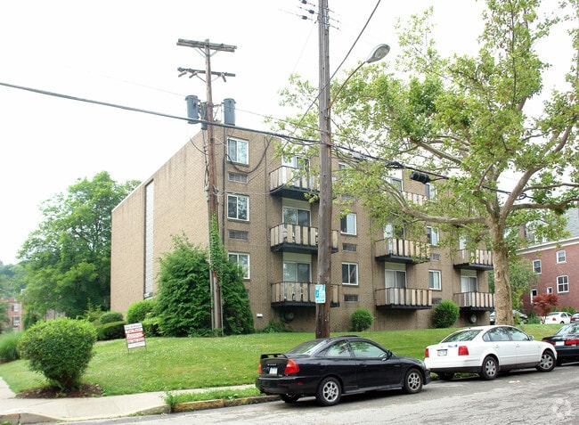
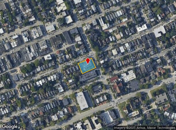
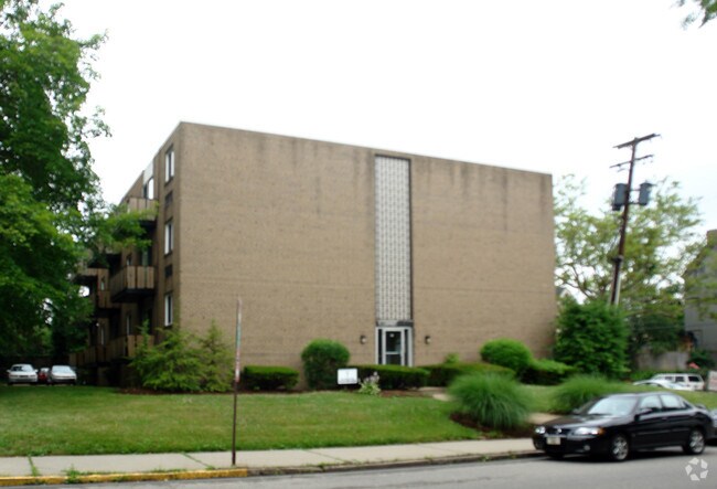
Property Record
900 S Negley Ave, Pittsburgh, PA 15232
NEARBY LISTINGS FOR SALE OR LEASE
Property Detail
900 S Negley Ave
Pittsburgh, PA
LOT 110XAVG153.98X115.16 SO NEGLEY AVE COR HOWE ST 3 STY BRK & C B APT BLDG 900
0085-A-00131-0000-00
Allegheny
Apartment
Pennsylvania
X
131
42003C0358H
0.34 AC
2024
Shadyside
2025
Pittsburgh
070300
DEMOGRAPHICS near 900 S Negley Ave
1 Mile
3 Mile
5 Mile
2024 Total Population
37,489
181,823
355,934
2029 Population
36,873
180,229
352,673
Pop Growth 2024-2029
(1.64%)
(0.88%)
(0.92%)
Average Age
35
38
39
2024 Total Households
17,643
85,348
166,509
HH Growth 2024-2029
(2.09%)
(1.03%)
(0.98%)
Median Household Inc
$68,609
$55,819
$55,553
Avg Household Size
1.80
1.90
2.00
2024 Avg HH Vehicles
1.00
1.00
1.00
Median Home Value
$456,809
$269,383
$185,675
Median Year Built
1952
1948
1949
Nearby Places
Map Layers
Map Styles
 Street
 Aerial
- Restaurants
- Banks
- Shops
- Fitness
- Groceries
PUBLIC TRANSPORTATION
COMMUTER RAIL
DRIVE
WALK
Distance
10 min
4.4 mi
AIRPORT
Pittsburgh International
DRIVE
WALK
Distance
Pittsburgh International
34 min
21.2 mi
Arnold Palmer Regional
DRIVE
WALK
Distance
Arnold Palmer Regional
66 min
39.6 mi
Nearby Properties
Address
Land Use
TOTAL SIZE
Lot Size
Zoning
Address
Land Use
TOTAL SIZE
Lot Size
Zoning
Address
Land Use
TOTAL SIZE
Lot Size
Zoning
6.99 AC
Address
Land Use
TOTAL SIZE
Lot Size
Zoning
31.36 AC
Address
Land Use
TOTAL SIZE
Lot Size
Zoning
13.53 AC
Address
Land Use
TOTAL SIZE
Lot Size
Zoning
3.35 AC
Address
Land Use
TOTAL SIZE
Lot Size
Zoning
5.11 AC
Address
Land Use
TOTAL SIZE
Lot Size
Zoning
13.85 AC
Address
Land Use
TOTAL SIZE
Lot Size
Zoning
10.22 AC
Address
Land Use
TOTAL SIZE
Lot Size
Zoning
5.77 AC
Address
Land Use
TOTAL SIZE
Lot Size
Zoning
4.05 AC
Address
Land Use
TOTAL SIZE
Lot Size
Zoning
19.39 AC
Address
Land Use
TOTAL SIZE
Lot Size
Zoning
12.80 AC
Address
Land Use
TOTAL SIZE
Lot Size
Zoning
0.92 AC
Address
Land Use
TOTAL SIZE
Lot Size
Zoning
8.97 AC
Address
Land Use
TOTAL SIZE
Lot Size
Zoning
363.56 AC
Address
Land Use
TOTAL SIZE
Lot Size
Zoning
2.67 AC
Address
Land Use
TOTAL SIZE
Lot Size
Zoning
2.52 AC
Address
Land Use
TOTAL SIZE
Lot Size
Zoning
2.31 AC
Address
Land Use
TOTAL SIZE
Lot Size
Zoning
1.43 AC
Address
Land Use
TOTAL SIZE
Lot Size
Zoning
Address
Land Use
TOTAL SIZE
Lot Size
Zoning
Address
Land Use
TOTAL SIZE
Lot Size
Zoning
7.89 AC
Address
Land Use
TOTAL SIZE
Lot Size
Zoning
160.63 AC
Address
Land Use
TOTAL SIZE
Lot Size
Zoning
4.10 AC
Address
Land Use
TOTAL SIZE
Lot Size
Zoning
1.36 AC
Address
Land Use
TOTAL SIZE
Lot Size
Zoning
1.19 AC
Address
Land Use
TOTAL SIZE
Lot Size
Zoning
5.90 AC
Address
Land Use
TOTAL SIZE
Lot Size
Zoning
1.22 AC
Address
Land Use
TOTAL SIZE
Lot Size
Zoning
1.54 AC
Address
Land Use
TOTAL SIZE
Lot Size
Zoning
3.13 AC
The World's #1 Commercial Real Estate Marketplace
Connect with us
© 2025 CoStar Group
The information above has been obtained from sources believed reliable. While we do not doubt its accuracy we have not verified it and make no guarantee, warranty or representation about it. It is your responsibility to independently confirm its accuracy and completeness. Any projections, opinions, assumptions, or estimates used are for example only and do not represent the current or future performance of the property. The value of this transaction to you depends on tax and other factors which should be evaluated by your tax, financial, and legal advisors. You and your advisors should conduct a careful, independent investigation of the property to determine to your satisfaction the suitability of the property for your needs.