Property Record
209 Mansfield Ave, Shelby, OH 44875

Save to a Folder
{{folder.Name}}
{{folder.ListingIds.length}} Properties
{{folder.ListingIds.length}} Property
Create a New Folder
Property Detail
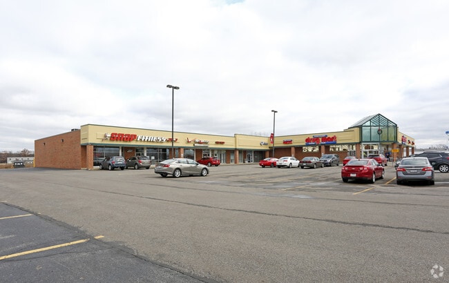
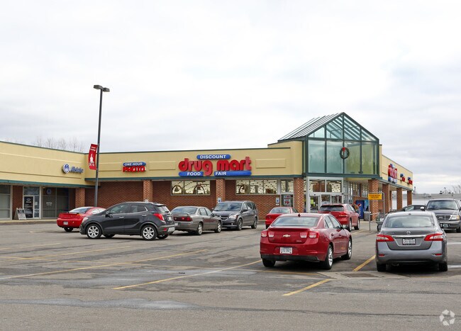
209 Mansfield Ave
Mansfield, OH
NW A 4.1992 LT 5 PT
017-80-239-48-003
RICHLAND
Storebuilding
Ohio
B and X Area of moderate flood hazard, usually the area between the limits of the 100-year and 500-year floods.
5
2025
4.20 AC
2025
Richland County
002700
Cleveland
38,140 SF
NEARBY LISTINGS FOR SALE OR LEASE
DEMOGRAPHICS near 209 Mansfield Ave
1 mile
3 mile
5 mile
2025 Total Population
2,358
11,472
14,048
2030 Population
2,324
11,360
13,895
Pop Growth 2025-2030
(1.44%)
(0.98%)
(1.09%)
Average Age
43
42
42
2025 Total Households
994
4,790
5,791
HH Growth 2025-2030
(1.51%)
(1.00%)
(1.11%)
Median Household Inc
$69,827
$57,378
$58,197
Avg Household Size
2.30
2.30
2.30
2025 Avg HH Vehicles
2.00
2.00
2.00
Median Home Value
$186,991
$161,386
$166,901
Median Year Built
1959
1957
1958
Nearby Places
Map Layers
Map Styles
 Street
 Aerial
Layers
 Traffic
 Biking
Places
Listings with unknown addresses are not visible on the map
- Restaurants
- Banks
- Shops
- Fitness
- Groceries
SALE & LEASE HISTORY
LISTING DATE
SALE/LEASE

Sep 26, 2018
For Sale
Jun 24, 2020
For Lease
Nearby Properties
Address
Land Use
TOTAL SIZE
Lot Size
Zoning
Address
Land Use
TOTAL SIZE
Lot Size
Zoning
88,924 SF
42.72 AC
Address
Land Use
TOTAL SIZE
Lot Size
Zoning
241,745 SF
36 AC
Address
Land Use
TOTAL SIZE
Lot Size
Zoning
495,925 SF
48.19 AC
Address
Land Use
TOTAL SIZE
Lot Size
Zoning
697,936 SF
84.59 AC
Address
Land Use
TOTAL SIZE
Lot Size
Zoning
64,487 SF
1.08 AC
Address
Land Use
TOTAL SIZE
Lot Size
Zoning
28,768 SF
28.16 AC
Address
Land Use
TOTAL SIZE
Lot Size
Zoning
78,448 SF
6.05 AC
Address
Land Use
TOTAL SIZE
Lot Size
Zoning
62,073 SF
3.31 AC
Address
Land Use
TOTAL SIZE
Lot Size
Zoning
5.13 AC
Address
Land Use
TOTAL SIZE
Lot Size
Zoning
2,400 SF
78.64 AC
Address
Land Use
TOTAL SIZE
Lot Size
Zoning
28,512 SF
15.28 AC
Address
Land Use
TOTAL SIZE
Lot Size
Zoning
75,600 SF
31.42 AC
Address
Land Use
TOTAL SIZE
Lot Size
Zoning
44,190 SF
5.46 AC
Address
Land Use
TOTAL SIZE
Lot Size
Zoning
30,763 SF
5.84 AC
Address
Land Use
TOTAL SIZE
Lot Size
Zoning
192,800 SF
16.35 AC
Address
Land Use
TOTAL SIZE
Lot Size
Zoning
6,944 SF
3.60 AC
Address
Land Use
TOTAL SIZE
Lot Size
Zoning
24,589 SF
14.85 AC
Address
Land Use
TOTAL SIZE
Lot Size
Zoning
4,683 SF
4.95 AC
Address
Land Use
TOTAL SIZE
Lot Size
Zoning
657,400 SF
25.14 AC
Address
Land Use
TOTAL SIZE
Lot Size
Zoning
88,537 SF
1.38 AC
Address
Land Use
TOTAL SIZE
Lot Size
Zoning
15,300 SF
5.42 AC
Address
Land Use
TOTAL SIZE
Lot Size
Zoning
24,642 SF
8.38 AC
Address
Land Use
TOTAL SIZE
Lot Size
Zoning
29,490 SF
8.72 AC
Address
Land Use
TOTAL SIZE
Lot Size
Zoning
172,800 SF
8.71 AC
Address
Land Use
TOTAL SIZE
Lot Size
Zoning
34,560 SF
3.01 AC
Address
Land Use
TOTAL SIZE
Lot Size
Zoning
12,248 SF
162.16 AC
Address
Land Use
TOTAL SIZE
Lot Size
Zoning
15,914 SF
1.27 AC
Address
Land Use
TOTAL SIZE
Lot Size
Zoning
22,653 SF
3.58 AC
Address
Land Use
TOTAL SIZE
Lot Size
Zoning
170.79 AC
The World's #1 Commercial Real Estate Marketplace
Connect with us
© 2026 CoStar Group
The information above has been obtained from sources believed reliable. While we do not doubt its accuracy we have not verified it and make no guarantee, warranty or representation about it. It is your responsibility to independently confirm its accuracy and completeness. Any projections, opinions, assumptions, or estimates used are for example only and do not represent the current or future performance of the property. The value of this transaction to you depends on tax and other factors which should be evaluated by your tax, financial, and legal advisors. You and your advisors should conduct a careful, independent investigation of the property to determine to your satisfaction the suitability of the property for your needs.