Property Record
900 Twp Rd, Chesapeake, OH 45619
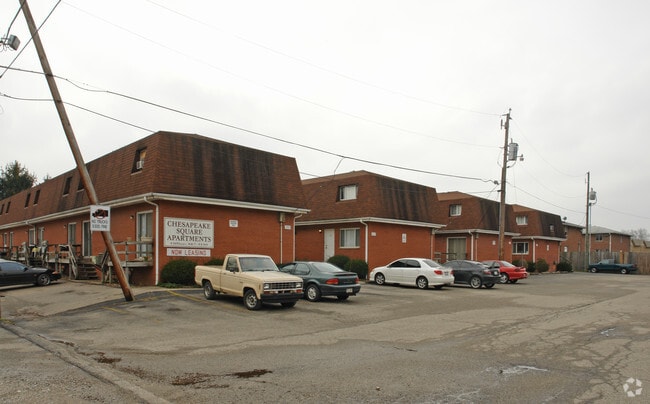


Property Detail
900 Twp Rd
Huntington-Ashland, WV-KY-OH
16-01-32 PT LOT 3 AUDITOR PLAT OF 1895 TRACT C 0001.05A
23-174-0602-000
LAWRENCE
Apartment
Ohio
AE The base floodplain where base flood elevations are provided. AE Zones are now used on new format FIRMs instead of A1-A30 Zones.
3
2025
1.05 AC
2025
Lawrence County
051200
Huntington/Ashland
22,300 SF
NEARBY LISTINGS FOR SALE OR LEASE
DEMOGRAPHICS near 900 Twp Rd
1 mile
3 mile
5 mile
2025 Total Population
5,398
37,999
63,027
2030 Population
5,403
37,730
62,239
Pop Growth 2025-2030
+ 0.09%
(0.71%)
(1.25%)
Average Age
40
40
40
2025 Total Households
2,404
16,296
27,008
HH Growth 2025-2030
0.00%
(0.71%)
(1.29%)
Median Household Inc
$46,572
$44,313
$49,921
Avg Household Size
2.10
2.10
2.20
2025 Avg HH Vehicles
1.00
1.00
1.00
Median Home Value
$91,481
$144,749
$146,303
Median Year Built
1957
1957
1959
Nearby Places
Map Layers
Map Styles
 Street
 Aerial
Layers
 Traffic
 Biking
Places
Listings with unknown addresses are not visible on the map
- Restaurants
- Banks
- Shops
- Fitness
- Groceries
PUBLIC TRANSPORTATION
COMMUTER RAIL
Huntington Amtrak Station (Cardinal - Amtrak)
Drive
Walk
Distance
Huntington Amtrak Station (Cardinal - Amtrak)
7 min
2.6 mi
AIRPORT
Tri-State/Milton J Ferguson Field
Drive
Walk
Distance
Tri-State/Milton J Ferguson Field
21 min
13.7 mi
Freight Ports
Port of Toledo
Drive
Walk
Distance
Port of Toledo
347 min
269.3 mi
Nearby Properties
Address
Land Use
TOTAL SIZE
Lot Size
Zoning
Address
Land Use
TOTAL SIZE
Lot Size
Zoning
14.62 AC
Address
Land Use
TOTAL SIZE
Lot Size
Zoning
26.52 AC
Address
Land Use
TOTAL SIZE
Lot Size
Zoning
1.35 AC
Address
Land Use
TOTAL SIZE
Lot Size
Zoning
Address
Land Use
TOTAL SIZE
Lot Size
Zoning
0.20 AC
Address
Land Use
TOTAL SIZE
Lot Size
Zoning
93.36 AC
Address
Land Use
TOTAL SIZE
Lot Size
Zoning
0.27 AC
Address
Land Use
TOTAL SIZE
Lot Size
Zoning
0.79 AC
Address
Land Use
TOTAL SIZE
Lot Size
Zoning
6.28 AC
Address
Land Use
TOTAL SIZE
Lot Size
Zoning
1.61 AC
Address
Land Use
TOTAL SIZE
Lot Size
Zoning
4.71 AC
Address
Land Use
TOTAL SIZE
Lot Size
Zoning
1.08 AC
Address
Land Use
TOTAL SIZE
Lot Size
Zoning
Address
Land Use
TOTAL SIZE
Lot Size
Zoning
16.47 AC
Address
Land Use
TOTAL SIZE
Lot Size
Zoning
0.55 AC
Address
Land Use
TOTAL SIZE
Lot Size
Zoning
4.05 AC
Address
Land Use
TOTAL SIZE
Lot Size
Zoning
4.12 AC
Address
Land Use
TOTAL SIZE
Lot Size
Zoning
1.34 AC
Address
Land Use
TOTAL SIZE
Lot Size
Zoning
1.04 AC
Address
Land Use
TOTAL SIZE
Lot Size
Zoning
Address
Land Use
TOTAL SIZE
Lot Size
Zoning
1.25 AC
Address
Land Use
TOTAL SIZE
Lot Size
Zoning
1.54 AC
Address
Land Use
TOTAL SIZE
Lot Size
Zoning
48.80 AC
Address
Land Use
TOTAL SIZE
Lot Size
Zoning
Address
Land Use
TOTAL SIZE
Lot Size
Zoning
Address
Land Use
TOTAL SIZE
Lot Size
Zoning
18,540 SF
4.37 AC
Address
Land Use
TOTAL SIZE
Lot Size
Zoning
2,136 SF
0.17 AC
Address
Land Use
TOTAL SIZE
Lot Size
Zoning
3.97 AC
Address
Land Use
TOTAL SIZE
Lot Size
Zoning
Address
Land Use
TOTAL SIZE
Lot Size
Zoning
0.32 AC
The World's #1 Commercial Real Estate Marketplace
Connect with us
© 2026 CoStar Group
The information above has been obtained from sources believed reliable. While we do not doubt its accuracy we have not verified it and make no guarantee, warranty or representation about it. It is your responsibility to independently confirm its accuracy and completeness. Any projections, opinions, assumptions, or estimates used are for example only and do not represent the current or future performance of the property. The value of this transaction to you depends on tax and other factors which should be evaluated by your tax, financial, and legal advisors. You and your advisors should conduct a careful, independent investigation of the property to determine to your satisfaction the suitability of the property for your needs.