Property Record
900 W 63Rd St, Chicago, IL 60621
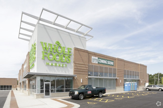

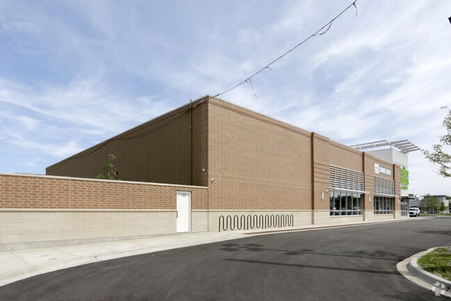
Property Detail
900 W 63Rd St
Commercialbuilding
COOK
PD 1227
Illinois
B and X Area of moderate flood hazard, usually the area between the limits of the 100-year and 500-year floods.
4.11 AC
2023
South Chicago
2025
Chicago
834800
Chicago-Naperville-Elgin, IL-IN
40,560 SF
20-17-431-037-0000
NEARBY LISTINGS FOR SALE OR LEASE
DEMOGRAPHICS near 900 W 63Rd St
1 mile
3 mile
5 mile
2025 Total Population
25,048
296,983
729,548
2030 Population
25,180
292,997
719,147
Pop Growth 2025-2030
+ 0.53%
(1.34%)
(1.43%)
Average Age
38
38
39
2025 Total Households
9,836
110,174
277,306
HH Growth 2025-2030
+ 0.39%
(1.34%)
(1.31%)
Median Household Inc
$27,555
$42,512
$52,411
Avg Household Size
2.40
2.50
2.50
2025 Avg HH Vehicles
1.00
1.00
1.00
Median Home Value
$171,479
$221,521
$244,060
Median Year Built
1949
1948
1949
Nearby Places
Map Layers
Map Styles
 Street
 Aerial
Layers
 Traffic
 Biking
Places
Listings with unknown addresses are not visible on the map
- Restaurants
- Banks
- Shops
- Fitness
- Groceries
PUBLIC TRANSPORTATION
TRANSIT/SUBWAY
Halsted Station (Green Line) (Green Line - Chicago Transit Authority "L" Trains (The "L"))
Drive
Walk
Distance
Halsted Station (Green Line) (Green Line - Chicago Transit Authority "L" Trains (The "L"))
1 min
4 min
0.2 mi
63Rd Street Station (Red Line - Chicago Transit Authority "L" Trains (The "L"))
Drive
Walk
Distance
63Rd Street Station (Red Line - Chicago Transit Authority "L" Trains (The "L"))
8 min
16 min
0.9 mi
Ashland & 63Rd Street Station (Green Line - Chicago Transit Authority "L" Trains (The "L"))
Drive
Walk
Distance
Ashland & 63Rd Street Station (Green Line - Chicago Transit Authority "L" Trains (The "L"))
2 min
18 min
0.9 mi
COMMUTER RAIL
Gresham Station (Rock Island District Line - Northeast Illinois Regional Commuter Railroad (Metra))
Drive
Walk
Distance
Gresham Station (Rock Island District Line - Northeast Illinois Regional Commuter Railroad (Metra))
6 min
3.1 mi
63Rd Street Station (Metra Electric Line - Northeast Illinois Regional Commuter Railroad (Metra), South Shore Line - Northeast Illinois Regional Commuter Railroad (Metra))
Drive
Walk
Distance
63Rd Street Station (Metra Electric Line - Northeast Illinois Regional Commuter Railroad (Metra), South Shore Line - Northeast Illinois Regional Commuter Railroad (Metra))
8 min
3.4 mi
AIRPORT
Chicago Midway International
Drive
Walk
Distance
Chicago Midway International
12 min
6.6 mi
Chicago O'Hare International
Drive
Walk
Distance
Chicago O'Hare International
39 min
25.4 mi
Freight Ports
Port Milwaukee
Drive
Walk
Distance
Port Milwaukee
117 min
93.6 mi
SALE & LEASE HISTORY
LISTING DATE
SALE/LEASE

Jan 10, 2023
For Lease
Nearby Properties
Address
Land Use
TOTAL SIZE
Lot Size
Zoning
Address
Land Use
TOTAL SIZE
Lot Size
Zoning
134,800 SF
2.53 AC
PD 1273
Address
Land Use
TOTAL SIZE
Lot Size
Zoning
0.91 AC
PD 1177
Address
Land Use
TOTAL SIZE
Lot Size
Zoning
87,830 SF
0.76 AC
B1-1
Address
Land Use
TOTAL SIZE
Lot Size
Zoning
633,057 SF
34.96 AC
PMD 8
Address
Land Use
TOTAL SIZE
Lot Size
Zoning
260,481 SF
12.93 AC
PD 463
Address
Land Use
TOTAL SIZE
Lot Size
Zoning
283,180 SF
1.41 AC
M2-3
Address
Land Use
TOTAL SIZE
Lot Size
Zoning
7,200 SF
0.22 AC
B3-3
Address
Land Use
TOTAL SIZE
Lot Size
Zoning
PD 43
Address
Land Use
TOTAL SIZE
Lot Size
Zoning
Address
Land Use
TOTAL SIZE
Lot Size
Zoning
0.29 AC
PD 1548
Address
Land Use
TOTAL SIZE
Lot Size
Zoning
4,900 SF
0.29 AC
PD 1548
Address
Land Use
TOTAL SIZE
Lot Size
Zoning
151,303 SF
0.88 AC
PD 568
Address
Land Use
TOTAL SIZE
Lot Size
Zoning
1.65 AC
B2-3
Address
Land Use
TOTAL SIZE
Lot Size
Zoning
PD 43
Address
Land Use
TOTAL SIZE
Lot Size
Zoning
78,000 SF
0.62 AC
RM-5
Address
Land Use
TOTAL SIZE
Lot Size
Zoning
36,365 SF
Address
Land Use
TOTAL SIZE
Lot Size
Zoning
7.47 AC
RT-4
Address
Land Use
TOTAL SIZE
Lot Size
Zoning
352,529 SF
12.77 AC
PMD 8
Address
Land Use
TOTAL SIZE
Lot Size
Zoning
283,228 SF
14.47 AC
PMD 8
Address
Land Use
TOTAL SIZE
Lot Size
Zoning
13,700 SF
0.33 AC
B3-2
Address
Land Use
TOTAL SIZE
Lot Size
Zoning
168,120 SF
8.06 AC
PMD 8
Address
Land Use
TOTAL SIZE
Lot Size
Zoning
258,000 SF
13.22 AC
PMD 8
Address
Land Use
TOTAL SIZE
Lot Size
Zoning
141,165 SF
7.82 AC
PD 966
Address
Land Use
TOTAL SIZE
Lot Size
Zoning
0.18 AC
PD 43
Address
Land Use
TOTAL SIZE
Lot Size
Zoning
65,186 SF
10.47 AC
PD 566
Address
Land Use
TOTAL SIZE
Lot Size
Zoning
184,487 SF
0.66 AC
RM-5,RS-3
Address
Land Use
TOTAL SIZE
Lot Size
Zoning
743,663 SF
7.14 AC
RT-4
Address
Land Use
TOTAL SIZE
Lot Size
Zoning
2.51 AC
RT-4,PD 12
Address
Land Use
TOTAL SIZE
Lot Size
Zoning
15,600 SF
0.18 AC
C2-1
Address
Land Use
TOTAL SIZE
Lot Size
Zoning
105,818 SF
9.17 AC
PD 910
The World's #1 Commercial Real Estate Marketplace
Connect with us
© 2026 CoStar Group
The information above has been obtained from sources believed reliable. While we do not doubt its accuracy we have not verified it and make no guarantee, warranty or representation about it. It is your responsibility to independently confirm its accuracy and completeness. Any projections, opinions, assumptions, or estimates used are for example only and do not represent the current or future performance of the property. The value of this transaction to you depends on tax and other factors which should be evaluated by your tax, financial, and legal advisors. You and your advisors should conduct a careful, independent investigation of the property to determine to your satisfaction the suitability of the property for your needs.