Property Record
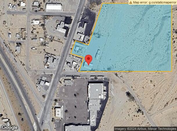
900 W Broadway St, Needles, CA 92363

NEARBY LISTINGS FOR SALE OR LEASE
Property Detail
900 W Broadway St
0186-241-61
PTN SEC 32 TP 9N R 23E DESC AS BEG E 1/4 COR SD SEC TH S 0 DEG 02 MIN E 551.41 FT TO TRUE POB TH S 0 DEG 02 MIN E 769.83 FT TO SE COR SE 1/4 SD SEC TH S 89 DEG 54 MIN 20 SECONDS W ALG SLY LI SD SEC 1040.91 FT TO SELY BOUNDARY LI OF C H MC CLURE PROPE
Storebuilding
San Bernardino
X
California
04015C5375J
16.07 AC
2024
San Bernardino Outlying
2025
Inland Empire (California)
010700
Riverside-San Bernardino-Ontario, CA
7,734 SF
DEMOGRAPHICS near 900 W Broadway St
1 Mile
3 Mile
5 Mile
2024 Total Population
1,909
8,870
10,925
2029 Population
1,997
9,534
11,796
Pop Growth 2024-2029
+ 4.61%
+ 7.49%
+ 7.97%
Average Age
41
42
43
2024 Total Households
801
3,576
4,389
HH Growth 2024-2029
+ 4.62%
+ 7.52%
+ 8.09%
Median Household Inc
$31,591
$41,037
$42,455
Avg Household Size
2.40
2.50
2.50
2024 Avg HH Vehicles
2.00
2.00
2.00
Median Home Value
$97,553
$162,365
$197,499
Median Year Built
1975
1986
1986
Nearby Places
Map Layers
Map Styles
 Street
 Aerial
- Restaurants
- Banks
- Shops
- Fitness
- Groceries
PUBLIC TRANSPORTATION
COMMUTER RAIL
Needles Amtrak (Southwest Chief - Amtrak)
DRIVE
WALK
Distance
Needles Amtrak (Southwest Chief - Amtrak)
2 min
1.5 mi
AIRPORT
Laughlin/Bullhead International
DRIVE
WALK
Distance
Laughlin/Bullhead International
46 min
27.7 mi
Freight Ports
Port of San Diego
DRIVE
WALK
Distance
Port of San Diego
355 min
321.9 mi
Nearby Properties
Address
Land Use
TOTAL SIZE
Lot Size
Zoning
Address
Land Use
TOTAL SIZE
Lot Size
Zoning
46,499 SF
1.56 AC
Address
Land Use
TOTAL SIZE
Lot Size
Zoning
42,840 SF
2.57 AC
Address
Land Use
TOTAL SIZE
Lot Size
Zoning
80,000 SF
4.53 AC
Address
Land Use
TOTAL SIZE
Lot Size
Zoning
46,400 SF
1.60 AC
Address
Land Use
TOTAL SIZE
Lot Size
Zoning
164,720 SF
7.52 AC
Address
Land Use
TOTAL SIZE
Lot Size
Zoning
30,375 SF
14.89 AC
Address
Land Use
TOTAL SIZE
Lot Size
Zoning
46,500 SF
2.17 AC
Address
Land Use
TOTAL SIZE
Lot Size
Zoning
90,750 SF
6.07 AC
Address
Land Use
TOTAL SIZE
Lot Size
Zoning
107,025 SF
9.28 AC
Address
Land Use
TOTAL SIZE
Lot Size
Zoning
29,181 SF
1.42 AC
Address
Land Use
TOTAL SIZE
Lot Size
Zoning
31,450 SF
2.50 AC
Address
Land Use
TOTAL SIZE
Lot Size
Zoning
20,000 SF
1.87 AC
Address
Land Use
TOTAL SIZE
Lot Size
Zoning
54,291 SF
6.96 AC
Address
Land Use
TOTAL SIZE
Lot Size
Zoning
61,750 SF
2.07 AC
Address
Land Use
TOTAL SIZE
Lot Size
Zoning
24,726 SF
2.15 AC
Address
Land Use
TOTAL SIZE
Lot Size
Zoning
51,234 SF
3.40 AC
Address
Land Use
TOTAL SIZE
Lot Size
Zoning
76,032 SF
6.45 AC
Address
Land Use
TOTAL SIZE
Lot Size
Zoning
4,941 SF
0.52 AC
Address
Land Use
TOTAL SIZE
Lot Size
Zoning
12,400 SF
0.21 AC
Address
Land Use
TOTAL SIZE
Lot Size
Zoning
40,136 SF
4.52 AC
Address
Land Use
TOTAL SIZE
Lot Size
Zoning
69,900 SF
5.89 AC
Address
Land Use
TOTAL SIZE
Lot Size
Zoning
12,500 SF
0.80 AC
Address
Land Use
TOTAL SIZE
Lot Size
Zoning
9,100 SF
2.14 AC
Address
Land Use
TOTAL SIZE
Lot Size
Zoning
308,000 SF
Address
Land Use
TOTAL SIZE
Lot Size
Zoning
48,384 SF
2.46 AC
Address
Land Use
TOTAL SIZE
Lot Size
Zoning
6,875 SF
0.41 AC
The World's #1 Commercial Real Estate Marketplace
Connect with us
© 2025 CoStar Group
The information above has been obtained from sources believed reliable. While we do not doubt its accuracy we have not verified it and make no guarantee, warranty or representation about it. It is your responsibility to independently confirm its accuracy and completeness. Any projections, opinions, assumptions, or estimates used are for example only and do not represent the current or future performance of the property. The value of this transaction to you depends on tax and other factors which should be evaluated by your tax, financial, and legal advisors. You and your advisors should conduct a careful, independent investigation of the property to determine to your satisfaction the suitability of the property for your needs.