Property Record
9000 N Lindbergh Dr, Peoria, IL 61615


NEARBY LISTINGS FOR SALE OR LEASE
Property Detail
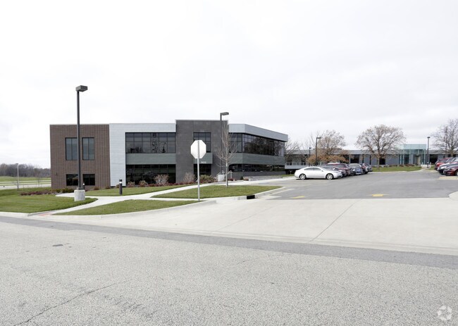
9000 N Lindbergh Dr
Peoria
Knoxville Square Sub
Peoria, IL
LINDBERGH SUB SEC 1 NE 1/4 SEC 5-9N-8E LOT 1 & W 25 OF S 145.03 OF N 170.03 VAC LINDBERGH CT LYING E OF & ADJ THERETO; ALSO LOT 2 & N 1/2 VAC LINDBERGH CT LYING S & ADJ THERETO (EXC KNOXVILLE SQUARE SUB; ALSO EXC LINDBERGH DR ROW PER SURVEY 96-37622)
14/05/201/016
Peoria
Commercialnec
Illinois
2024
1
2024
0.60 AC
003403
North Peoria
DEMOGRAPHICS near 9000 N Lindbergh Dr
1 Mile
3 Mile
5 Mile
2024 Total Population
3,181
31,297
71,166
2029 Population
3,069
30,361
69,123
Pop Growth 2024-2029
(3.52%)
(2.99%)
(2.87%)
Average Age
39
40
41
2024 Total Households
1,460
13,074
30,857
HH Growth 2024-2029
(3.70%)
(3.10%)
(3.02%)
Median Household Inc
$74,961
$79,212
$67,956
Avg Household Size
2.20
2.30
2.20
2024 Avg HH Vehicles
2.00
2.00
2.00
Median Home Value
$172,160
$214,461
$172,784
Median Year Built
1990
1982
1974
Nearby Places
Map Layers
Map Styles
 Street
 Aerial
- Restaurants
- Banks
- Shops
- Fitness
- Groceries
PUBLIC TRANSPORTATION
AIRPORT
General Downing - Peoria International
DRIVE
WALK
Distance
General Downing - Peoria International
22 min
14.6 mi
Freight Ports
Port Milwaukee
DRIVE
WALK
Distance
Port Milwaukee
260 min
218.3 mi
Nearby Properties
Address
Land Use
TOTAL SIZE
Lot Size
Zoning
Address
Land Use
TOTAL SIZE
Lot Size
Zoning
46.02 AC
Address
Land Use
TOTAL SIZE
Lot Size
Zoning
7.75 AC
Address
Land Use
TOTAL SIZE
Lot Size
Zoning
22.10 AC
Address
Land Use
TOTAL SIZE
Lot Size
Zoning
28.05 AC
Address
Land Use
TOTAL SIZE
Lot Size
Zoning
17.65 AC
Address
Land Use
TOTAL SIZE
Lot Size
Zoning
11.62 AC
Address
Land Use
TOTAL SIZE
Lot Size
Zoning
6.05 AC
Address
Land Use
TOTAL SIZE
Lot Size
Zoning
12.22 AC
Address
Land Use
TOTAL SIZE
Lot Size
Zoning
10.41 AC
Address
Land Use
TOTAL SIZE
Lot Size
Zoning
Address
Land Use
TOTAL SIZE
Lot Size
Zoning
17.21 AC
Address
Land Use
TOTAL SIZE
Lot Size
Zoning
17.08 AC
Address
Land Use
TOTAL SIZE
Lot Size
Zoning
8.74 AC
Address
Land Use
TOTAL SIZE
Lot Size
Zoning
20.51 AC
Address
Land Use
TOTAL SIZE
Lot Size
Zoning
26.61 AC
Address
Land Use
TOTAL SIZE
Lot Size
Zoning
5.39 AC
Address
Land Use
TOTAL SIZE
Lot Size
Zoning
14.34 AC
Address
Land Use
TOTAL SIZE
Lot Size
Zoning
19.50 AC
Address
Land Use
TOTAL SIZE
Lot Size
Zoning
7.31 AC
Address
Land Use
TOTAL SIZE
Lot Size
Zoning
10.84 AC
Address
Land Use
TOTAL SIZE
Lot Size
Zoning
7.21 AC
Address
Land Use
TOTAL SIZE
Lot Size
Zoning
0.63 AC
Address
Land Use
TOTAL SIZE
Lot Size
Zoning
Address
Land Use
TOTAL SIZE
Lot Size
Zoning
11.09 AC
Address
Land Use
TOTAL SIZE
Lot Size
Zoning
5.01 AC
Address
Land Use
TOTAL SIZE
Lot Size
Zoning
37.92 AC
Address
Land Use
TOTAL SIZE
Lot Size
Zoning
3.51 AC
Address
Land Use
TOTAL SIZE
Lot Size
Zoning
1.88 AC
Address
Land Use
TOTAL SIZE
Lot Size
Zoning
9.43 AC
The World's #1 Commercial Real Estate Marketplace
Connect with us
© 2025 CoStar Group
The information above has been obtained from sources believed reliable. While we do not doubt its accuracy we have not verified it and make no guarantee, warranty or representation about it. It is your responsibility to independently confirm its accuracy and completeness. Any projections, opinions, assumptions, or estimates used are for example only and do not represent the current or future performance of the property. The value of this transaction to you depends on tax and other factors which should be evaluated by your tax, financial, and legal advisors. You and your advisors should conduct a careful, independent investigation of the property to determine to your satisfaction the suitability of the property for your needs.