Property Record
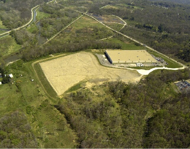
9000/9010 E Rio Nero Dr, Independence, OH 44131

Property Detail
9000/9010 E Rio Nero Dr
564-22-007
OL 24 30 LOT 2 FF 159.40 38.181 AC
Multitenantindustrial
CUYAHOGA
U-5A
Ohio
B and X Area of moderate flood hazard, usually the area between the limits of the 100-year and 500-year floods.
2
2025
38.18 AC
2025
South
156102
Cleveland
260,000 SF
Cleveland-Elyria, OH
NEARBY LISTINGS FOR SALE OR LEASE
DEMOGRAPHICS near 9000/9010 E Rio Nero Dr
1 mile
3 mile
5 mile
2025 Total Population
1,066
25,896
122,896
2030 Population
1,042
25,530
121,402
Pop Growth 2025-2030
(2.25%)
(1.41%)
(1.22%)
Average Age
45
45
43
2025 Total Households
421
10,420
51,849
HH Growth 2025-2030
(2.38%)
(1.57%)
(1.33%)
Median Household Inc
$101,225
$98,081
$74,044
Avg Household Size
2.50
2.40
2.30
2025 Avg HH Vehicles
2.00
2.00
2.00
Median Home Value
$283,806
$301,505
$220,398
Median Year Built
1953
1966
1962
Nearby Places
Map Layers
Map Styles
 Street
 Aerial
Layers
 Traffic
 Biking
Places
Listings with unknown addresses are not visible on the map
- Restaurants
- Banks
- Shops
- Fitness
- Groceries
PUBLIC TRANSPORTATION
COMMUTER RAIL
Canal Exploration Center (National Park Scenic Railway - Cuyahoga Valley Scenic Railroad)
Drive
Walk
Distance
Canal Exploration Center (National Park Scenic Railway - Cuyahoga Valley Scenic Railroad)
7 min
3.0 mi
Rockside (National Park Scenic Railway - Cuyahoga Valley Scenic Railroad)
Drive
Walk
Distance
Rockside (National Park Scenic Railway - Cuyahoga Valley Scenic Railroad)
11 min
4.6 mi
AIRPORT
Cleveland-Hopkins International
Drive
Walk
Distance
Cleveland-Hopkins International
29 min
16.9 mi
Freight Ports
Port of Toledo
Drive
Walk
Distance
Port of Toledo
143 min
117.8 mi
Nearby Properties
Address
Land Use
TOTAL SIZE
Lot Size
Zoning
Address
Land Use
TOTAL SIZE
Lot Size
Zoning
376,124 SF
71.73 AC
Address
Land Use
TOTAL SIZE
Lot Size
Zoning
202,152 SF
21.04 AC
U-1
Address
Land Use
TOTAL SIZE
Lot Size
Zoning
228,253 SF
32.51 AC
C-F
Address
Land Use
TOTAL SIZE
Lot Size
Zoning
285,065 SF
5.43 AC
D-1
Address
Land Use
TOTAL SIZE
Lot Size
Zoning
227,141 SF
23.76 AC
U-4
Address
Land Use
TOTAL SIZE
Lot Size
Zoning
60,989 SF
9.31 AC
U-4
Address
Land Use
TOTAL SIZE
Lot Size
Zoning
124,224 SF
25.99 AC
U-1
Address
Land Use
TOTAL SIZE
Lot Size
Zoning
54,055 SF
3.11 AC
U-4
Address
Land Use
TOTAL SIZE
Lot Size
Zoning
141,785 SF
9.13 AC
U-5
Address
Land Use
TOTAL SIZE
Lot Size
Zoning
336,730 SF
38.51 AC
U-11A
Address
Land Use
TOTAL SIZE
Lot Size
Zoning
37.77 AC
U-5A
Address
Land Use
TOTAL SIZE
Lot Size
Zoning
56,002 SF
6.76 AC
U-5
Address
Land Use
TOTAL SIZE
Lot Size
Zoning
99,916 SF
4.72 AC
U-3
Address
Land Use
TOTAL SIZE
Lot Size
Zoning
188,503 SF
23.72 AC
D-1
Address
Land Use
TOTAL SIZE
Lot Size
Zoning
80,559 SF
4.07 AC
R-20
Address
Land Use
TOTAL SIZE
Lot Size
Zoning
121,720 SF
4.71 AC
U-5
Address
Land Use
TOTAL SIZE
Lot Size
Zoning
251,780 SF
5.54 AC
U-5
Address
Land Use
TOTAL SIZE
Lot Size
Zoning
127,224 SF
10 AC
IG
Address
Land Use
TOTAL SIZE
Lot Size
Zoning
149,468 SF
16.42 AC
U.5
Address
Land Use
TOTAL SIZE
Lot Size
Zoning
14,950 SF
5.08 AC
IG
Address
Land Use
TOTAL SIZE
Lot Size
Zoning
136,516 SF
19.64 AC
IG
Address
Land Use
TOTAL SIZE
Lot Size
Zoning
158,824 SF
27.39 AC
U-8
Address
Land Use
TOTAL SIZE
Lot Size
Zoning
49,388 SF
29.19 AC
C-F
Address
Land Use
TOTAL SIZE
Lot Size
Zoning
49,811 SF
21.80 AC
A-1
Address
Land Use
TOTAL SIZE
Lot Size
Zoning
128,614 SF
3.16 AC
U-4
Address
Land Use
TOTAL SIZE
Lot Size
Zoning
127,930 SF
8.08 AC
Address
Land Use
TOTAL SIZE
Lot Size
Zoning
50,117 SF
2.80 AC
L-B
Address
Land Use
TOTAL SIZE
Lot Size
Zoning
116,800 SF
10 AC
IG
Address
Land Use
TOTAL SIZE
Lot Size
Zoning
37,452 SF
16.24 AC
D-1
Address
Land Use
TOTAL SIZE
Lot Size
Zoning
205,592 SF
6.33 AC
U-5
The World's #1 Commercial Real Estate Marketplace
Connect with us
© 2026 CoStar Group
The information above has been obtained from sources believed reliable. While we do not doubt its accuracy we have not verified it and make no guarantee, warranty or representation about it. It is your responsibility to independently confirm its accuracy and completeness. Any projections, opinions, assumptions, or estimates used are for example only and do not represent the current or future performance of the property. The value of this transaction to you depends on tax and other factors which should be evaluated by your tax, financial, and legal advisors. You and your advisors should conduct a careful, independent investigation of the property to determine to your satisfaction the suitability of the property for your needs.