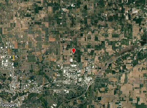
Property Record
9001 Quincy St, Zeeland, MI 49464
NEARBY LISTINGS FOR SALE OR LEASE
-
-
View all Zeeland listings for sale on LoopNet.com
Property Detail
9001 Quincy St
70-16-09-100-012
PART NE 1/4 NW 1/4 COM 32789 FT S 89D 59M 18S W OF N 1/4 COR, TH S 00D 42M 04S E 119213 FT, S 89D 59M 39S W 32975 FT, N 0D
Residentialacreage
Ottawa
X
Michigan
26005C0050G
8.95 AC
2024
Holland North
2025
West Michigan
021904
Grand Rapids-Wyoming, MI
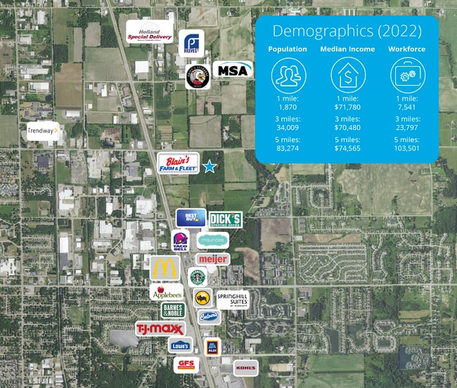
DEMOGRAPHICS near 9001 Quincy St
1 Mile
3 Mile
5 Mile
2024 Total Population
2,418
31,540
80,903
2029 Population
2,583
32,990
84,584
Pop Growth 2024-2029
+ 6.82%
+ 4.60%
+ 4.55%
Average Age
35
37
38
2024 Total Households
896
11,440
29,573
HH Growth 2024-2029
+ 7.03%
+ 4.79%
+ 4.74%
Median Household Inc
$70,807
$69,540
$72,229
Avg Household Size
2.70
2.70
2.60
2024 Avg HH Vehicles
2.00
2.00
2.00
Median Home Value
$252,710
$222,233
$234,877
Median Year Built
1997
1992
1984
Nearby Places
Map Layers
Map Styles
 Street
 Aerial
- Restaurants
- Banks
- Shops
- Fitness
- Groceries
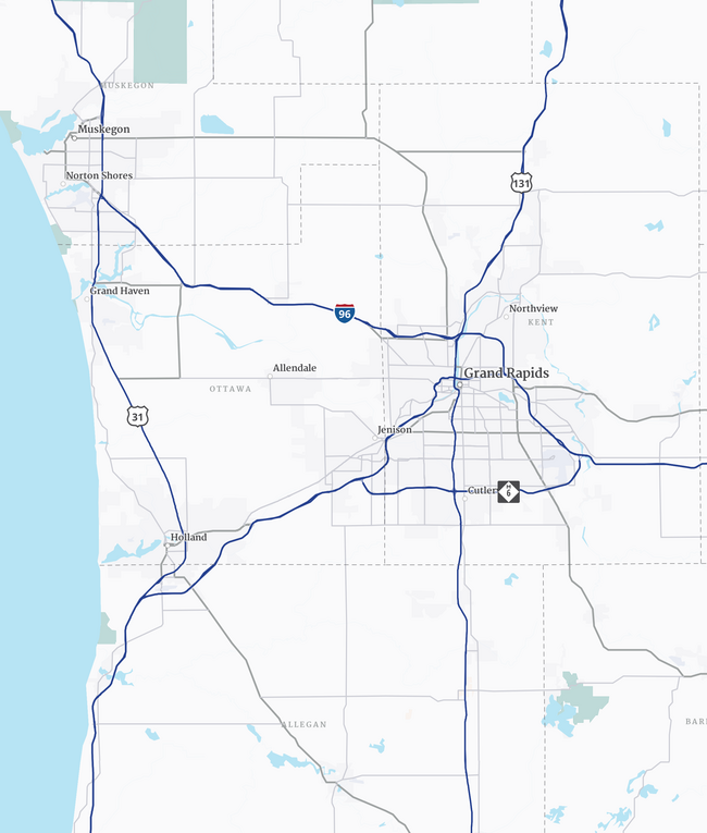
PUBLIC TRANSPORTATION
COMMUTER RAIL
Holland Amtrak Station (Pere Marquette - Amtrak)
DRIVE
WALK
Distance
Holland Amtrak Station (Pere Marquette - Amtrak)
14 min
7.7 mi
AIRPORT
Gerald R Ford International
DRIVE
WALK
Distance
Gerald R Ford International
44 min
31.5 mi
Freight Ports
Port Milwaukee
DRIVE
WALK
Distance
Port Milwaukee
287 min
243.6 mi
SALE & LEASE HISTORY
LISTING DATE
SALE/LEASE

Aug 03, 2023
For Sale
Nearby Properties
Address
Land Use
TOTAL SIZE
Lot Size
Zoning
Address
Land Use
TOTAL SIZE
Lot Size
Zoning
1,134,118 SF
73.70 AC
I-2
Address
Land Use
TOTAL SIZE
Lot Size
Zoning
255,407 SF
23.18 AC
I-2
Address
Land Use
TOTAL SIZE
Lot Size
Zoning
349,583 SF
I
Address
Land Use
TOTAL SIZE
Lot Size
Zoning
716,625 SF
123.22 AC
I-2
Address
Land Use
TOTAL SIZE
Lot Size
Zoning
594,031 SF
R-1
Address
Land Use
TOTAL SIZE
Lot Size
Zoning
82,556 SF
Address
Land Use
TOTAL SIZE
Lot Size
Zoning
259,200 SF
R-1
Address
Land Use
TOTAL SIZE
Lot Size
Zoning
6,000 SF
46.50 AC
I-2
Address
Land Use
TOTAL SIZE
Lot Size
Zoning
173,176 SF
28.57 AC
I-1
Address
Land Use
TOTAL SIZE
Lot Size
Zoning
35,715 SF
Address
Land Use
TOTAL SIZE
Lot Size
Zoning
230,020 SF
Address
Land Use
TOTAL SIZE
Lot Size
Zoning
109,988 SF
12.71 AC
OS-1
Address
Land Use
TOTAL SIZE
Lot Size
Zoning
3,880 SF
80 AC
RMH
Address
Land Use
TOTAL SIZE
Lot Size
Zoning
77,624 SF
27.32 AC
I-1
Address
Land Use
TOTAL SIZE
Lot Size
Zoning
50,000 SF
20.36 AC
I-2
Address
Land Use
TOTAL SIZE
Lot Size
Zoning
181,847 SF
12.99 AC
I-1
Address
Land Use
TOTAL SIZE
Lot Size
Zoning
376,204 SF
20.10 AC
I-1
Address
Land Use
TOTAL SIZE
Lot Size
Zoning
Address
Land Use
TOTAL SIZE
Lot Size
Zoning
88,093 SF
Address
Land Use
TOTAL SIZE
Lot Size
Zoning
243,795 SF
17.31 AC
AG
Address
Land Use
TOTAL SIZE
Lot Size
Zoning
Address
Land Use
TOTAL SIZE
Lot Size
Zoning
220,885 SF
10 AC
I-2
Address
Land Use
TOTAL SIZE
Lot Size
Zoning
222,251 SF
12.96 AC
I
Address
Land Use
TOTAL SIZE
Lot Size
Zoning
209,312 SF
10.01 AC
I-2
Address
Land Use
TOTAL SIZE
Lot Size
Zoning
203,840 SF
8.97 AC
I-2
Address
Land Use
TOTAL SIZE
Lot Size
Zoning
Address
Land Use
TOTAL SIZE
Lot Size
Zoning
172,480 SF
14.62 AC
I
Address
Land Use
TOTAL SIZE
Lot Size
Zoning
202,238 SF
14.87 AC
I-1
Address
Land Use
TOTAL SIZE
Lot Size
Zoning
103,171 SF
4.02 AC
ON
Address
Land Use
TOTAL SIZE
Lot Size
Zoning
42,863 SF
6.15 AC
C
The World's #1 Commercial Real Estate Marketplace
Connect with us
© 2025 CoStar Group
The information above has been obtained from sources believed reliable. While we do not doubt its accuracy we have not verified it and make no guarantee, warranty or representation about it. It is your responsibility to independently confirm its accuracy and completeness. Any projections, opinions, assumptions, or estimates used are for example only and do not represent the current or future performance of the property. The value of this transaction to you depends on tax and other factors which should be evaluated by your tax, financial, and legal advisors. You and your advisors should conduct a careful, independent investigation of the property to determine to your satisfaction the suitability of the property for your needs.