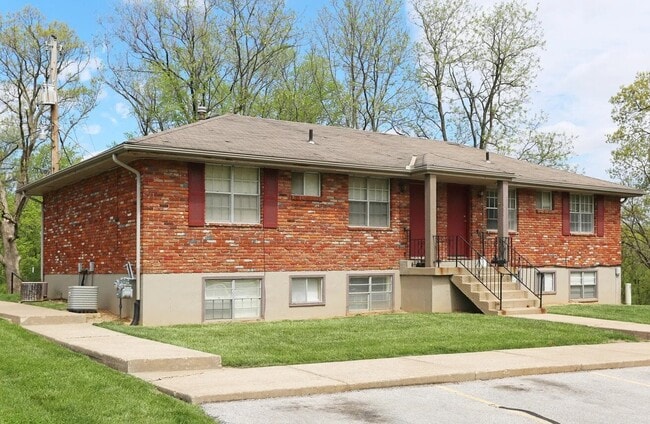
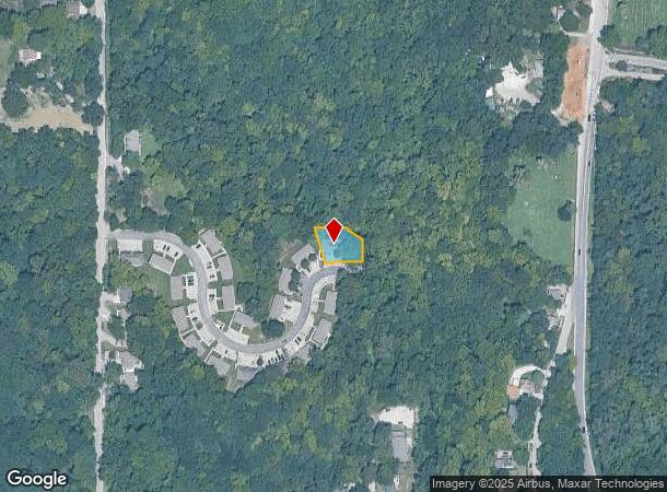
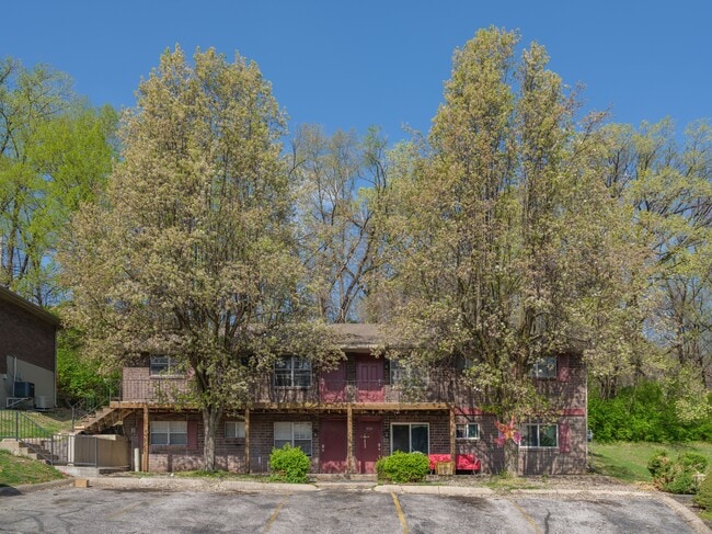
Property Record
9002 Nw 57Th St, Parkville, MO 64152
NEARBY LISTINGS FOR SALE OR LEASE
-
-
View all Parkville listings for sale on LoopNet.com
Property Detail
9002 Nw 57Th St
Kansas City, MO-KS
Parkville Hillside Addition
20-70-26-400-002-018-000
PARKVILLE HILLSIDE ADDITION LOT 1-3 AND 6-23
Apartment
Platte
X
Missouri
29095C0108G
23
2024
0.24 AC
2025
Outer Northland-Platte County
030309
Kansas City
2,994 SF
DEMOGRAPHICS near 9002 Nw 57Th St
1 Mile
3 Mile
5 Mile
2024 Total Population
4,553
35,410
105,585
2029 Population
5,049
38,738
113,027
Pop Growth 2024-2029
+ 10.89%
+ 9.40%
+ 7.05%
Average Age
40
40
39
2024 Total Households
1,780
14,174
41,449
HH Growth 2024-2029
+ 11.29%
+ 9.59%
+ 7.34%
Median Household Inc
$94,836
$85,103
$75,508
Avg Household Size
2.40
2.40
2.50
2024 Avg HH Vehicles
2.00
2.00
2.00
Median Home Value
$428,651
$293,740
$260,652
Median Year Built
1988
1985
1983
Nearby Places
Map Layers
Map Styles
 Street
 Aerial
- Restaurants
- Banks
- Shops
- Fitness
- Groceries
PUBLIC TRANSPORTATION
AIRPORT
Kansas City International
DRIVE
WALK
Distance
Kansas City International
20 min
12.0 mi
Freight Ports
Tulsa Port Of Catoosa
DRIVE
WALK
Distance
Tulsa Port Of Catoosa
278 min
245.4 mi
SALE & LEASE HISTORY
LISTING DATE
SALE/LEASE

May 08, 2025
For Sale
Jul 30, 2019
For Sale
Nearby Properties
Address
Land Use
TOTAL SIZE
Lot Size
Zoning
Address
Land Use
TOTAL SIZE
Lot Size
Zoning
404,594 SF
40.87 AC
Address
Land Use
TOTAL SIZE
Lot Size
Zoning
39,641 SF
70.67 AC
Address
Land Use
TOTAL SIZE
Lot Size
Zoning
370,998 SF
34.29 AC
Address
Land Use
TOTAL SIZE
Lot Size
Zoning
315,970 SF
30.23 AC
Address
Land Use
TOTAL SIZE
Lot Size
Zoning
195,876 SF
14.62 AC
Address
Land Use
TOTAL SIZE
Lot Size
Zoning
448,340 SF
6.42 AC
Address
Land Use
TOTAL SIZE
Lot Size
Zoning
207,491 SF
616.94 AC
KR1
Address
Land Use
TOTAL SIZE
Lot Size
Zoning
552,085 SF
21.81 AC
Address
Land Use
TOTAL SIZE
Lot Size
Zoning
656,640 SF
20.07 AC
Address
Land Use
TOTAL SIZE
Lot Size
Zoning
251,983 SF
15.77 AC
Address
Land Use
TOTAL SIZE
Lot Size
Zoning
245,507 SF
14.22 AC
Address
Land Use
TOTAL SIZE
Lot Size
Zoning
480,000 SF
20.10 AC
Address
Land Use
TOTAL SIZE
Lot Size
Zoning
221,952 SF
28.85 AC
Address
Land Use
TOTAL SIZE
Lot Size
Zoning
420,508 SF
13.95 AC
Address
Land Use
TOTAL SIZE
Lot Size
Zoning
165,610 SF
18.07 AC
Address
Land Use
TOTAL SIZE
Lot Size
Zoning
329,938 SF
12.02 AC
Address
Land Use
TOTAL SIZE
Lot Size
Zoning
358,806 SF
24.99 AC
Address
Land Use
TOTAL SIZE
Lot Size
Zoning
Address
Land Use
TOTAL SIZE
Lot Size
Zoning
153,055 SF
10.76 AC
Address
Land Use
TOTAL SIZE
Lot Size
Zoning
4,993 SF
11.02 AC
R2
Address
Land Use
TOTAL SIZE
Lot Size
Zoning
132,804 SF
8.17 AC
R4
Address
Land Use
TOTAL SIZE
Lot Size
Zoning
185,927 SF
5.91 AC
Address
Land Use
TOTAL SIZE
Lot Size
Zoning
48,952 SF
2.44 AC
Address
Land Use
TOTAL SIZE
Lot Size
Zoning
Address
Land Use
TOTAL SIZE
Lot Size
Zoning
88,200 SF
2.03 AC
Address
Land Use
TOTAL SIZE
Lot Size
Zoning
848,976 SF
5.68 AC
Address
Land Use
TOTAL SIZE
Lot Size
Zoning
62,503 SF
7.10 AC
Address
Land Use
TOTAL SIZE
Lot Size
Zoning
277,006 SF
54.64 AC
Address
Land Use
TOTAL SIZE
Lot Size
Zoning
200,794 SF
5.33 AC
Address
Land Use
TOTAL SIZE
Lot Size
Zoning
100,637 SF
2.16 AC
The World's #1 Commercial Real Estate Marketplace
Connect with us
© 2026 CoStar Group
The information above has been obtained from sources believed reliable. While we do not doubt its accuracy we have not verified it and make no guarantee, warranty or representation about it. It is your responsibility to independently confirm its accuracy and completeness. Any projections, opinions, assumptions, or estimates used are for example only and do not represent the current or future performance of the property. The value of this transaction to you depends on tax and other factors which should be evaluated by your tax, financial, and legal advisors. You and your advisors should conduct a careful, independent investigation of the property to determine to your satisfaction the suitability of the property for your needs.