Property Record
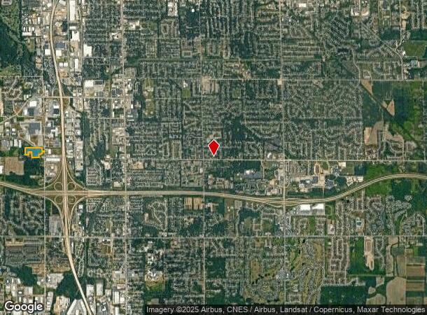
901 60Th St Se, Grand Rapids, MI 49508
Current Lease Availabilities
NEARBY LISTINGS FOR SALE OR LEASE
Property Detail
901 60Th St Se
41-17-35-476-006
S 1/2 SE 1/4 SE 1/4 EX S 229.64 FT OF W 142.0 FT OF E 432.03 FT & EX S 280.95 FT OF W 80.0 FT OF E 290.03 FT & EX E 210.03 FT
Residentialacreage
Kent
X
Michigan
26005C0125G
13.23 AC
2024
Southwestern Grand Rapids
2025
West Michigan
012703
Grand Rapids-Wyoming, MI
DEMOGRAPHICS near 901 60Th St Se
1 Mile
3 Mile
5 Mile
2024 Total Population
4,148
77,634
187,496
2029 Population
4,208
78,654
190,395
Pop Growth 2024-2029
+ 1.45%
+ 1.31%
+ 1.55%
Average Age
37
39
39
2024 Total Households
1,414
29,519
70,499
HH Growth 2024-2029
+ 1.56%
+ 1.38%
+ 1.58%
Median Household Inc
$68,937
$66,344
$68,183
Avg Household Size
2.90
2.60
2.60
2024 Avg HH Vehicles
2.00
2.00
2.00
Median Home Value
$219,807
$212,240
$220,773
Median Year Built
1991
1982
1978
Nearby Places
- Restaurants
- Banks
- Shops
- Fitness
- Groceries
PUBLIC TRANSPORTATION
COMMUTER RAIL
Grand Rapids Vernon J. Ehlers Station (Pere Marquette - Amtrak)
DRIVE
WALK
Distance
Grand Rapids Vernon J. Ehlers Station (Pere Marquette - Amtrak)
13 min
9.4 mi
AIRPORT
Gerald R Ford International
DRIVE
WALK
Distance
Gerald R Ford International
14 min
7.5 mi
Freight Ports
Port Milwaukee
DRIVE
WALK
Distance
Port Milwaukee
305 min
262.4 mi
Nearby Properties
Address
Land Use
TOTAL SIZE
Lot Size
Zoning
Address
Land Use
TOTAL SIZE
Lot Size
Zoning
290,627 SF
Address
Land Use
TOTAL SIZE
Lot Size
Zoning
385,631 SF
45.27 AC
R-PUD-1
Address
Land Use
TOTAL SIZE
Lot Size
Zoning
295,027 SF
51.42 AC
I3
Address
Land Use
TOTAL SIZE
Lot Size
Zoning
63,788 SF
124.62 AC
D1
Address
Land Use
TOTAL SIZE
Lot Size
Zoning
48.43 AC
PUD-PL UNI
Address
Land Use
TOTAL SIZE
Lot Size
Zoning
649,177 SF
55.67 AC
SD-IT
Address
Land Use
TOTAL SIZE
Lot Size
Zoning
941,968 SF
38.56 AC
SD-IT
Address
Land Use
TOTAL SIZE
Lot Size
Zoning
216,171 SF
32.06 AC
R4
Address
Land Use
TOTAL SIZE
Lot Size
Zoning
27.25 AC
SD-PRD
Address
Land Use
TOTAL SIZE
Lot Size
Zoning
487,739 SF
73.87 AC
RR
Address
Land Use
TOTAL SIZE
Lot Size
Zoning
1,426,319 SF
54.81 AC
SD-IT
Address
Land Use
TOTAL SIZE
Lot Size
Zoning
26.94 AC
Address
Land Use
TOTAL SIZE
Lot Size
Zoning
38.98 AC
PUD-PL UNI
Address
Land Use
TOTAL SIZE
Lot Size
Zoning
386,450 SF
29.10 AC
Address
Land Use
TOTAL SIZE
Lot Size
Zoning
264,739 SF
26.56 AC
I2
Address
Land Use
TOTAL SIZE
Lot Size
Zoning
25.05 AC
R3-MED RES
Address
Land Use
TOTAL SIZE
Lot Size
Zoning
465,772 SF
61.95 AC
I1
Address
Land Use
TOTAL SIZE
Lot Size
Zoning
153,571 SF
12.28 AC
SD-PRD
Address
Land Use
TOTAL SIZE
Lot Size
Zoning
179,436 SF
24.94 AC
I2
Address
Land Use
TOTAL SIZE
Lot Size
Zoning
165,085 SF
22.58 AC
R4
Address
Land Use
TOTAL SIZE
Lot Size
Zoning
2,593 SF
18 AC
PUD-PL UNI
Address
Land Use
TOTAL SIZE
Lot Size
Zoning
Address
Land Use
TOTAL SIZE
Lot Size
Zoning
158,240 SF
13.56 AC
R4
Address
Land Use
TOTAL SIZE
Lot Size
Zoning
349,885 SF
8.92 AC
I1
Address
Land Use
TOTAL SIZE
Lot Size
Zoning
229,572 SF
16.20 AC
PUD-PL UNI
Address
Land Use
TOTAL SIZE
Lot Size
Zoning
720 SF
74.47 AC
R4-MOBILE
Address
Land Use
TOTAL SIZE
Lot Size
Zoning
442,193 SF
17.90 AC
I1
Address
Land Use
TOTAL SIZE
Lot Size
Zoning
57,030 SF
17.74 AC
R3-MED RES
Address
Land Use
TOTAL SIZE
Lot Size
Zoning
151,032 SF
14.41 AC
MON-MDR
Address
Land Use
TOTAL SIZE
Lot Size
Zoning
175,360 SF
15.61 AC
R4
The World's #1 Commercial Real Estate Marketplace
Connect with us
© 2025 CoStar Group
The information above has been obtained from sources believed reliable. While we do not doubt its accuracy we have not verified it and make no guarantee, warranty or representation about it. It is your responsibility to independently confirm its accuracy and completeness. Any projections, opinions, assumptions, or estimates used are for example only and do not represent the current or future performance of the property. The value of this transaction to you depends on tax and other factors which should be evaluated by your tax, financial, and legal advisors. You and your advisors should conduct a careful, independent investigation of the property to determine to your satisfaction the suitability of the property for your needs.