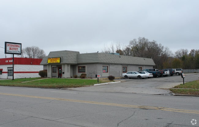
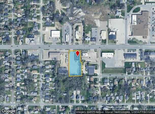
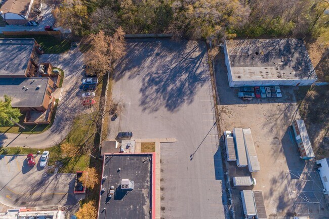
Property Record
901 E Euclid Ave, Des Moines, IA 50316
NEARBY LISTINGS FOR SALE OR LEASE
Property Detail
901 E Euclid Ave
Des Moines-West Des Moines, IA
Rocky Place
110-04591001000
-EX W 2F- LT 4 & ALL LT 5 & W 33.7F LT 6 & -EX W 143.5F & EX E 105.55F- LT 9 ROCKY PLACE
Restaurantbuilding
Polk
X
Iowa
19153C0215F
4
2024
0.94 AC
2025
Northeast
000500
Des Moines
4,250 SF
DEMOGRAPHICS near 901 E Euclid Ave
1 Mile
3 Mile
5 Mile
2024 Total Population
14,937
77,500
174,793
2029 Population
15,527
80,907
181,974
Pop Growth 2024-2029
+ 3.95%
+ 4.40%
+ 4.11%
Average Age
37
37
38
2024 Total Households
5,477
29,879
72,766
HH Growth 2024-2029
+ 4.25%
+ 4.71%
+ 4.37%
Median Household Inc
$52,105
$51,359
$58,151
Avg Household Size
2.40
2.40
2.30
2024 Avg HH Vehicles
2.00
2.00
2.00
Median Home Value
$124,582
$134,231
$164,202
Median Year Built
1948
1954
1958
Nearby Places
Map Layers
Map Styles
 Street
 Aerial
- Restaurants
- Banks
- Shops
- Fitness
- Groceries
PUBLIC TRANSPORTATION
AIRPORT
Des Moines International
DRIVE
WALK
Distance
Des Moines International
19 min
10.1 mi
Freight Ports
Port Milwaukee
DRIVE
WALK
Distance
Port Milwaukee
411 min
370.8 mi
SALE & LEASE HISTORY
LISTING DATE
SALE/LEASE

Nov 01, 2022
For Sale
Nearby Properties
Address
Land Use
TOTAL SIZE
Lot Size
Zoning
Address
Land Use
TOTAL SIZE
Lot Size
Zoning
2,157,357 SF
23.95 AC
PUD
Address
Land Use
TOTAL SIZE
Lot Size
Zoning
428,582 SF
6.87 AC
C-0
Address
Land Use
TOTAL SIZE
Lot Size
Zoning
481,030 SF
31.92 AC
PUD
Address
Land Use
TOTAL SIZE
Lot Size
Zoning
484,524 SF
2.03 AC
C-3
Address
Land Use
TOTAL SIZE
Lot Size
Zoning
529,814 SF
3.11 AC
C-3
Address
Land Use
TOTAL SIZE
Lot Size
Zoning
675,000 SF
65.27 AC
Address
Land Use
TOTAL SIZE
Lot Size
Zoning
600,000 SF
40.15 AC
Address
Land Use
TOTAL SIZE
Lot Size
Zoning
274,736 SF
10.27 AC
R-3
Address
Land Use
TOTAL SIZE
Lot Size
Zoning
311,655 SF
2.38 AC
C3
Address
Land Use
TOTAL SIZE
Lot Size
Zoning
162,578 SF
6.37 AC
Address
Land Use
TOTAL SIZE
Lot Size
Zoning
300,115 SF
2.48 AC
Address
Land Use
TOTAL SIZE
Lot Size
Zoning
461,246 SF
2.11 AC
C-3
Address
Land Use
TOTAL SIZE
Lot Size
Zoning
402,849 SF
0.83 AC
C-3
Address
Land Use
TOTAL SIZE
Lot Size
Zoning
122,364 SF
0.96 AC
C-0
Address
Land Use
TOTAL SIZE
Lot Size
Zoning
257,407 SF
1.43 AC
Address
Land Use
TOTAL SIZE
Lot Size
Zoning
312,500 SF
38.14 AC
Address
Land Use
TOTAL SIZE
Lot Size
Zoning
127,000 SF
1.92 AC
Address
Land Use
TOTAL SIZE
Lot Size
Zoning
249,188 SF
0.39 AC
Address
Land Use
TOTAL SIZE
Lot Size
Zoning
555,952 SF
2 AC
C-3
Address
Land Use
TOTAL SIZE
Lot Size
Zoning
123,535 SF
0.63 AC
Address
Land Use
TOTAL SIZE
Lot Size
Zoning
529,161 SF
33.60 AC
HI
Address
Land Use
TOTAL SIZE
Lot Size
Zoning
126,935 SF
28.61 AC
Address
Land Use
TOTAL SIZE
Lot Size
Zoning
130,496 SF
39.96 AC
HI
Address
Land Use
TOTAL SIZE
Lot Size
Zoning
275,000 SF
16.17 AC
HI
Address
Land Use
TOTAL SIZE
Lot Size
Zoning
603,502 SF
33.03 AC
M-1
Address
Land Use
TOTAL SIZE
Lot Size
Zoning
1,838,971 SF
76.24 AC
HI
Address
Land Use
TOTAL SIZE
Lot Size
Zoning
103,780 SF
3.39 AC
C-3A
Address
Land Use
TOTAL SIZE
Lot Size
Zoning
90,325 SF
5.49 AC
PUD
Address
Land Use
TOTAL SIZE
Lot Size
Zoning
82,202 SF
9.48 AC
PUD
Address
Land Use
TOTAL SIZE
Lot Size
Zoning
152,445 SF
1.52 AC
C-3
The World's #1 Commercial Real Estate Marketplace
Connect with us
© 2025 CoStar Group
The information above has been obtained from sources believed reliable. While we do not doubt its accuracy we have not verified it and make no guarantee, warranty or representation about it. It is your responsibility to independently confirm its accuracy and completeness. Any projections, opinions, assumptions, or estimates used are for example only and do not represent the current or future performance of the property. The value of this transaction to you depends on tax and other factors which should be evaluated by your tax, financial, and legal advisors. You and your advisors should conduct a careful, independent investigation of the property to determine to your satisfaction the suitability of the property for your needs.