Property Record
901 E Walnut St, Raymore, MO 64083
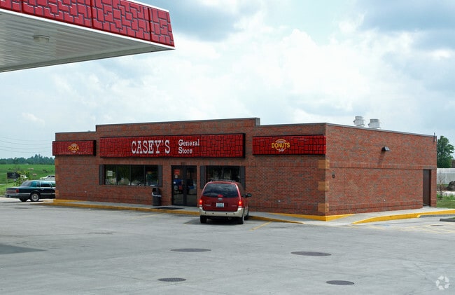

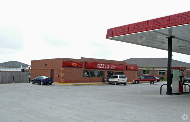
Property Detail
901 E Walnut St
Kansas City, MO-KS
REPLAT OF TRACT 4 BUSH INDUSTRIAL PARK LOT C
2238410
Cass
Supermarket
Missouri
B and X Area of moderate flood hazard, usually the area between the limits of the 100-year and 500-year floods.
c
2024
1.90 AC
2025
Cass County
060308
Kansas City
6,888 SF
NEARBY LISTINGS FOR SALE OR LEASE
DEMOGRAPHICS near 901 E Walnut St
1 mile
3 mile
5 mile
2025 Total Population
3,699
27,384
62,143
2030 Population
3,894
28,726
64,879
Pop Growth 2025-2030
+ 5.27%
+ 4.90%
+ 4.40%
Average Age
41
41
41
2025 Total Households
1,437
10,069
22,856
HH Growth 2025-2030
+ 5.50%
+ 5.02%
+ 4.62%
Median Household Inc
$67,734
$97,583
$97,571
Avg Household Size
2.50
2.70
2.70
2025 Avg HH Vehicles
2.00
2.00
2.00
Median Home Value
$213,693
$330,086
$338,328
Median Year Built
1992
2000
1999
Nearby Places
Map Layers
Map Styles
 Street
 Aerial
Transit
 Traffic
 Biking
Places
Listings with unknown addresses are not visible on the map
- Restaurants
- Banks
- Shops
- Fitness
- Groceries
PUBLIC TRANSPORTATION
AIRPORT
Kansas City International
Drive
Walk
Distance
Kansas City International
63 min
45.3 mi
Nearby Properties
Address
Land Use
TOTAL SIZE
Lot Size
Zoning
Address
Land Use
TOTAL SIZE
Lot Size
Zoning
4,954 SF
23.93 AC
Address
Land Use
TOTAL SIZE
Lot Size
Zoning
15.22 AC
Address
Land Use
TOTAL SIZE
Lot Size
Zoning
3.31 AC
Address
Land Use
TOTAL SIZE
Lot Size
Zoning
2.23 AC
Address
Land Use
TOTAL SIZE
Lot Size
Zoning
50,121 SF
2.98 AC
Address
Land Use
TOTAL SIZE
Lot Size
Zoning
80,456 SF
8.23 AC
Address
Land Use
TOTAL SIZE
Lot Size
Zoning
2.18 AC
Address
Land Use
TOTAL SIZE
Lot Size
Zoning
181,400 SF
12.23 AC
Address
Land Use
TOTAL SIZE
Lot Size
Zoning
1.94 AC
Address
Land Use
TOTAL SIZE
Lot Size
Zoning
1.76 AC
Address
Land Use
TOTAL SIZE
Lot Size
Zoning
5.46 AC
Address
Land Use
TOTAL SIZE
Lot Size
Zoning
594,769 SF
18.43 AC
Address
Land Use
TOTAL SIZE
Lot Size
Zoning
25,484 SF
2.13 AC
Address
Land Use
TOTAL SIZE
Lot Size
Zoning
137,544 SF
11.36 AC
Address
Land Use
TOTAL SIZE
Lot Size
Zoning
137,824 SF
13.62 AC
Address
Land Use
TOTAL SIZE
Lot Size
Zoning
Address
Land Use
TOTAL SIZE
Lot Size
Zoning
19,714 SF
8.40 AC
Address
Land Use
TOTAL SIZE
Lot Size
Zoning
Address
Land Use
TOTAL SIZE
Lot Size
Zoning
20,980 SF
3.06 AC
Address
Land Use
TOTAL SIZE
Lot Size
Zoning
14,466 SF
1.44 AC
Address
Land Use
TOTAL SIZE
Lot Size
Zoning
8,800 SF
1.26 AC
Address
Land Use
TOTAL SIZE
Lot Size
Zoning
15,336 SF
3.06 AC
Address
Land Use
TOTAL SIZE
Lot Size
Zoning
116,250 SF
6.71 AC
Address
Land Use
TOTAL SIZE
Lot Size
Zoning
218,689 SF
10.37 AC
Address
Land Use
TOTAL SIZE
Lot Size
Zoning
18,946 SF
3.90 AC
Address
Land Use
TOTAL SIZE
Lot Size
Zoning
11,304 SF
3.50 AC
Address
Land Use
TOTAL SIZE
Lot Size
Zoning
9,030 SF
3.30 AC
Address
Land Use
TOTAL SIZE
Lot Size
Zoning
40,827 SF
3 AC
Address
Land Use
TOTAL SIZE
Lot Size
Zoning
74,016 SF
6.54 AC
Address
Land Use
TOTAL SIZE
Lot Size
Zoning
8,000 SF
10 AC
The World's #1 Commercial Real Estate Marketplace
Connect with us
© 2026 CoStar Group
The information above has been obtained from sources believed reliable. While we do not doubt its accuracy we have not verified it and make no guarantee, warranty or representation about it. It is your responsibility to independently confirm its accuracy and completeness. Any projections, opinions, assumptions, or estimates used are for example only and do not represent the current or future performance of the property. The value of this transaction to you depends on tax and other factors which should be evaluated by your tax, financial, and legal advisors. You and your advisors should conduct a careful, independent investigation of the property to determine to your satisfaction the suitability of the property for your needs.