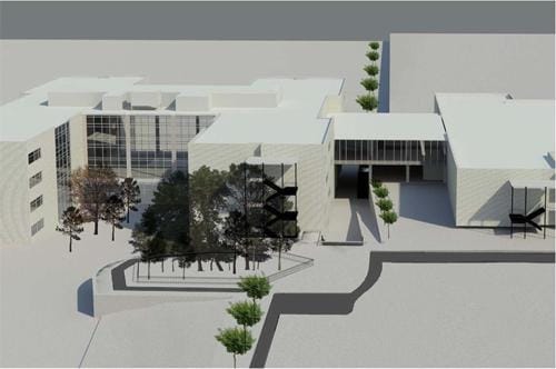
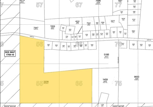
Property Record
901 E Young St, Rolesville, NC 27571

NEARBY LISTINGS FOR SALE OR LEASE
Property Detail
901 E Young St
1768.10-46-4343-000
LOGR PT 1A WAKE COUNTY BOARD OF EDUCATIO
Taxexempt
Wake
X
North Carolina
3720176800K
21.03 AC
0
Northeast Wake County
2025
Raleigh/Durham
054222
Raleigh-Cary, NC
DEMOGRAPHICS near 901 E Young St
1 mile
3 mile
5 mile
2024 Total Population
763
13,158
59,953
2029 Population
821
14,383
65,645
Pop Growth 2024-2029
+ 7.60%
+ 9.31%
+ 9.49%
Average Age
40
39
39
2024 Total Households
262
4,392
20,607
HH Growth 2024-2029
+ 7.63%
+ 9.29%
+ 9.49%
Median Household Inc
$111,590
$117,190
$111,725
Avg Household Size
2.90
3.00
2.90
2024 Avg HH Vehicles
2.00
2.00
2.00
Median Home Value
$410,526
$417,297
$366,760
Median Year Built
2005
2009
2006
Nearby Places
Map Layers
Map Styles
 Street
 Aerial
Transit
 Traffic
 Biking
Places
Listings with unknown addresses are not visible on the map
- Restaurants
- Banks
- Shops
- Fitness
- Groceries
PUBLIC TRANSPORTATION
AIRPORT
Raleigh-Durham International
Drive
Walk
Distance
Raleigh-Durham International
34 min
25.0 mi
Freight Ports
Virginia Port Authority - Richmond
Drive
Walk
Distance
Virginia Port Authority - Richmond
170 min
139.6 mi
Nearby Properties
Address
Land Use
TOTAL SIZE
Lot Size
Zoning
Address
Land Use
TOTAL SIZE
Lot Size
Zoning
340,702 SF
121.26 AC
RM-CZ
Address
Land Use
TOTAL SIZE
Lot Size
Zoning
227,653 SF
10.84 AC
TC
Address
Land Use
TOTAL SIZE
Lot Size
Zoning
196,091 SF
37.21 AC
RL
Address
Land Use
TOTAL SIZE
Lot Size
Zoning
100,625 SF
16.39 AC
RL
Address
Land Use
TOTAL SIZE
Lot Size
Zoning
53,707 SF
17.07 AC
RL
Address
Land Use
TOTAL SIZE
Lot Size
Zoning
45,723 SF
8.96 AC
GC
Address
Land Use
TOTAL SIZE
Lot Size
Zoning
66,801 SF
11.01 AC
RL
Address
Land Use
TOTAL SIZE
Lot Size
Zoning
43,044 SF
6.78 AC
GC-CZ
Address
Land Use
TOTAL SIZE
Lot Size
Zoning
36,295 SF
5.71 AC
GC
Address
Land Use
TOTAL SIZE
Lot Size
Zoning
1,040 SF
292.16 AC
RL
Address
Land Use
TOTAL SIZE
Lot Size
Zoning
46,203 SF
4.68 AC
GC-CZ
Address
Land Use
TOTAL SIZE
Lot Size
Zoning
18,962 SF
52.06 AC
RL
Address
Land Use
TOTAL SIZE
Lot Size
Zoning
65,078 SF
5.74 AC
R&PUD
Address
Land Use
TOTAL SIZE
Lot Size
Zoning
28,670 SF
8.28 AC
GC-CZ
Address
Land Use
TOTAL SIZE
Lot Size
Zoning
32.96 AC
TC
Address
Land Use
TOTAL SIZE
Lot Size
Zoning
21,245 SF
0.45 AC
RL
Address
Land Use
TOTAL SIZE
Lot Size
Zoning
14,652 SF
1.74 AC
GC
Address
Land Use
TOTAL SIZE
Lot Size
Zoning
81,031 SF
6.13 AC
R&PUD
Address
Land Use
TOTAL SIZE
Lot Size
Zoning
20,220 SF
1.62 AC
GC
Address
Land Use
TOTAL SIZE
Lot Size
Zoning
2,724 SF
193.74 AC
R-40W
Address
Land Use
TOTAL SIZE
Lot Size
Zoning
7,748 SF
4.54 AC
GC-CZ
Address
Land Use
TOTAL SIZE
Lot Size
Zoning
25.54 AC
MH
Address
Land Use
TOTAL SIZE
Lot Size
Zoning
19,500 SF
1.98 AC
R&PUD
Address
Land Use
TOTAL SIZE
Lot Size
Zoning
30,600 SF
4 AC
GC-CZ
Address
Land Use
TOTAL SIZE
Lot Size
Zoning
1,128 SF
160.40 AC
R-40W
Address
Land Use
TOTAL SIZE
Lot Size
Zoning
21,000 SF
3.21 AC
CO-SU
Address
Land Use
TOTAL SIZE
Lot Size
Zoning
18,368 SF
2.30 AC
GC-CZ
Address
Land Use
TOTAL SIZE
Lot Size
Zoning
12,518 SF
84.15 AC
RL
Address
Land Use
TOTAL SIZE
Lot Size
Zoning
3,536 SF
190.21 AC
R-30
The World's #1 Commercial Real Estate Marketplace
Connect with us
© 2026 CoStar Group
The information above has been obtained from sources believed reliable. While we do not doubt its accuracy we have not verified it and make no guarantee, warranty or representation about it. It is your responsibility to independently confirm its accuracy and completeness. Any projections, opinions, assumptions, or estimates used are for example only and do not represent the current or future performance of the property. The value of this transaction to you depends on tax and other factors which should be evaluated by your tax, financial, and legal advisors. You and your advisors should conduct a careful, independent investigation of the property to determine to your satisfaction the suitability of the property for your needs.