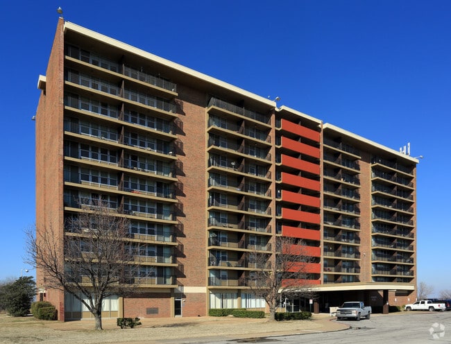
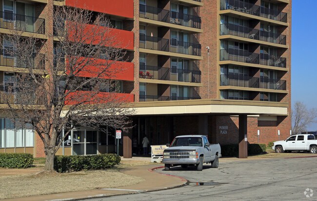
Property Record
901 N Elgin Ave, Tulsa, OK 74106

NEARBY LISTINGS FOR SALE OR LEASE
Property Detail
901 N Elgin Ave
Tulsa, OK
Amended Plat Of Davis-Wilson Heights
10750-02-36-02820
BEG NEC LT 8 TH S476.41 W112.43 S42.80 W16.46 S15.72 W86.55 N43.33 W78.31 CRV RT 44.84 NWLY75.11 N371 E305 POB BLK 1
Multifamilydwelling
Tulsa
X
Oklahoma
40143C0240L
8
0
3.48 AC
2025
University Park
001000
Tulsa
149,204 SF
DEMOGRAPHICS near 901 N Elgin Ave
1 Mile
3 Mile
5 Mile
2024 Total Population
9,619
74,575
148,721
2029 Population
10,098
78,231
155,444
Pop Growth 2024-2029
+ 4.98%
+ 4.90%
+ 4.52%
Average Age
39
38
38
2024 Total Households
3,522
31,335
62,608
HH Growth 2024-2029
+ 5.91%
+ 5.29%
+ 4.68%
Median Household Inc
$45,753
$41,643
$46,604
Avg Household Size
2.00
2.10
2.20
2024 Avg HH Vehicles
1.00
2.00
2.00
Median Home Value
$126,995
$132,046
$141,934
Median Year Built
1967
1957
1955
Nearby Places
Map Layers
Map Styles
 Street
 Aerial
- Restaurants
- Banks
- Shops
- Fitness
- Groceries
PUBLIC TRANSPORTATION
AIRPORT
Tulsa International
DRIVE
WALK
Distance
Tulsa International
16 min
9.1 mi
Freight Ports
DRIVE
WALK
Distance
25 min
18.4 mi
Nearby Properties
Address
Land Use
TOTAL SIZE
Lot Size
Zoning
Address
Land Use
TOTAL SIZE
Lot Size
Zoning
565,000 SF
10.62 AC
CBD
Address
Land Use
TOTAL SIZE
Lot Size
Zoning
1,303,210 SF
7.94 AC
OH
Address
Land Use
TOTAL SIZE
Lot Size
Zoning
1,673,798 SF
90.26 AC
NCU
Address
Land Use
TOTAL SIZE
Lot Size
Zoning
249,092 SF
11.75 AC
CBD
Address
Land Use
TOTAL SIZE
Lot Size
Zoning
692,068 SF
1.03 AC
CBD
Address
Land Use
TOTAL SIZE
Lot Size
Zoning
423,825 SF
23.97 AC
CBD
Address
Land Use
TOTAL SIZE
Lot Size
Zoning
483,697 SF
5.31 AC
CBD
Address
Land Use
TOTAL SIZE
Lot Size
Zoning
247,806 SF
8.40 AC
RS3
Address
Land Use
TOTAL SIZE
Lot Size
Zoning
49,992 SF
33.23 AC
AG
Address
Land Use
TOTAL SIZE
Lot Size
Zoning
528,432 SF
0.01 AC
CBD
Address
Land Use
TOTAL SIZE
Lot Size
Zoning
110,922 SF
1.59 AC
RM2
Address
Land Use
TOTAL SIZE
Lot Size
Zoning
74,284 SF
3.61 AC
IM
Address
Land Use
TOTAL SIZE
Lot Size
Zoning
254,800 SF
2.07 AC
CBD
Address
Land Use
TOTAL SIZE
Lot Size
Zoning
132,305 SF
2.07 AC
CBD
Address
Land Use
TOTAL SIZE
Lot Size
Zoning
87,606 SF
8.25 AC
CBD
Address
Land Use
TOTAL SIZE
Lot Size
Zoning
92,407 SF
6.02 AC
CS
Address
Land Use
TOTAL SIZE
Lot Size
Zoning
175,176 SF
1.57 AC
RM2
Address
Land Use
TOTAL SIZE
Lot Size
Zoning
230,620 SF
16.72 AC
RM2
Address
Land Use
TOTAL SIZE
Lot Size
Zoning
303 SF
33.64 AC
RS2
Address
Land Use
TOTAL SIZE
Lot Size
Zoning
266,944 SF
2.07 AC
CBD
Address
Land Use
TOTAL SIZE
Lot Size
Zoning
144,570 SF
44.59 AC
RM2
Address
Land Use
TOTAL SIZE
Lot Size
Zoning
124,033 SF
4.18 AC
CBD
Address
Land Use
TOTAL SIZE
Lot Size
Zoning
315,434 SF
2.07 AC
CBD
Address
Land Use
TOTAL SIZE
Lot Size
Zoning
355,620 SF
4.78 AC
CBD
Address
Land Use
TOTAL SIZE
Lot Size
Zoning
56,049 SF
1.14 AC
CBD
Address
Land Use
TOTAL SIZE
Lot Size
Zoning
161,670 SF
8.57 AC
IL
Address
Land Use
TOTAL SIZE
Lot Size
Zoning
1,264,325 SF
10.72 AC
CH
Address
Land Use
TOTAL SIZE
Lot Size
Zoning
84,560 SF
1.92 AC
CBD
Address
Land Use
TOTAL SIZE
Lot Size
Zoning
106,579 SF
6.76 AC
RM1
The World's #1 Commercial Real Estate Marketplace
Connect with us
© 2025 CoStar Group
The information above has been obtained from sources believed reliable. While we do not doubt its accuracy we have not verified it and make no guarantee, warranty or representation about it. It is your responsibility to independently confirm its accuracy and completeness. Any projections, opinions, assumptions, or estimates used are for example only and do not represent the current or future performance of the property. The value of this transaction to you depends on tax and other factors which should be evaluated by your tax, financial, and legal advisors. You and your advisors should conduct a careful, independent investigation of the property to determine to your satisfaction the suitability of the property for your needs.