Property Record
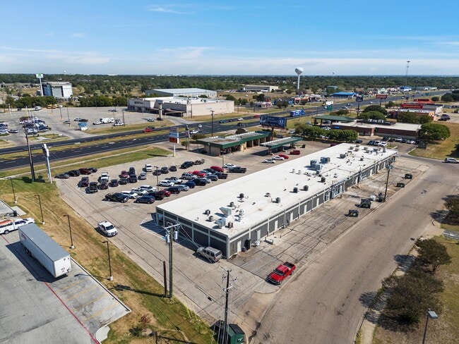
901 N Loop 340, Waco, TX 76705


Current Lease Availabilities
Property Detail
901 N Loop 340
28-057000-017010-9
TOMAS DE LA VEGA ACRES 1.823
Commercialnec
McLennan
B2
Texas
B and X Area of moderate flood hazard, usually the area between the limits of the 100-year and 500-year floods.
1.82 AC
2024
Waco
2025
Other Market Areas
001600
Waco, TX
18,900 SF
NEARBY LISTINGS FOR SALE OR LEASE
DEMOGRAPHICS near 901 N Loop 340
1 mile
3 mile
5 mile
2025 Total Population
6,498
32,674
84,553
2030 Population
6,712
34,061
87,853
Pop Growth 2025-2030
+ 3.29%
+ 4.24%
+ 3.90%
Average Age
36
36
34
2025 Total Households
2,370
11,917
30,397
HH Growth 2025-2030
+ 3.29%
+ 4.39%
+ 4.13%
Median Household Inc
$53,035
$45,740
$39,659
Avg Household Size
2.70
2.60
2.50
2025 Avg HH Vehicles
2.00
2.00
2.00
Median Home Value
$143,210
$164,420
$172,189
Median Year Built
1982
1977
1978
Nearby Places
Map Layers
Map Styles
 Street
 Aerial
Transit
 Traffic
 Biking
Places
Listings with unknown addresses are not visible on the map
- Restaurants
- Banks
- Shops
- Fitness
- Groceries
PUBLIC TRANSPORTATION
AIRPORT
Waco Regional
Drive
Walk
Distance
Waco Regional
20 min
9.3 mi
Nearby Properties
Address
Land Use
TOTAL SIZE
Lot Size
Zoning
Address
Land Use
TOTAL SIZE
Lot Size
Zoning
821,607 SF
48.98 AC
Address
Land Use
TOTAL SIZE
Lot Size
Zoning
215,433 SF
33.17 AC
R
Address
Land Use
TOTAL SIZE
Lot Size
Zoning
193,780 SF
14.12 AC
C
Address
Land Use
TOTAL SIZE
Lot Size
Zoning
Address
Land Use
TOTAL SIZE
Lot Size
Zoning
Address
Land Use
TOTAL SIZE
Lot Size
Zoning
Address
Land Use
TOTAL SIZE
Lot Size
Zoning
30.89 AC
R1
Address
Land Use
TOTAL SIZE
Lot Size
Zoning
33,442 SF
2.80 AC
Address
Land Use
TOTAL SIZE
Lot Size
Zoning
127,979 SF
5.72 AC
R
Address
Land Use
TOTAL SIZE
Lot Size
Zoning
186,588 SF
10.28 AC
C1
Address
Land Use
TOTAL SIZE
Lot Size
Zoning
21.76 AC
R
Address
Land Use
TOTAL SIZE
Lot Size
Zoning
293,368 SF
21.23 AC
M3
Address
Land Use
TOTAL SIZE
Lot Size
Zoning
13.72 AC
R1
Address
Land Use
TOTAL SIZE
Lot Size
Zoning
266,294 SF
23.53 AC
Address
Land Use
TOTAL SIZE
Lot Size
Zoning
8.86 AC
R1
Address
Land Use
TOTAL SIZE
Lot Size
Zoning
1,174,171 SF
44.99 AC
M3
Address
Land Use
TOTAL SIZE
Lot Size
Zoning
87,206 SF
2.80 AC
Address
Land Use
TOTAL SIZE
Lot Size
Zoning
34.95 AC
R1B
Address
Land Use
TOTAL SIZE
Lot Size
Zoning
202,787 SF
22.33 AC
B2
Address
Land Use
TOTAL SIZE
Lot Size
Zoning
Address
Land Use
TOTAL SIZE
Lot Size
Zoning
229,166 SF
14.18 AC
C
Address
Land Use
TOTAL SIZE
Lot Size
Zoning
239,020 SF
38.81 AC
R1B
Address
Land Use
TOTAL SIZE
Lot Size
Zoning
Address
Land Use
TOTAL SIZE
Lot Size
Zoning
132,772 SF
27.36 AC
C
Address
Land Use
TOTAL SIZE
Lot Size
Zoning
125,412 SF
8.37 AC
R
Address
Land Use
TOTAL SIZE
Lot Size
Zoning
102,480 SF
9.36 AC
R4
Address
Land Use
TOTAL SIZE
Lot Size
Zoning
Address
Land Use
TOTAL SIZE
Lot Size
Zoning
75,523 SF
17.78 AC
R1
Address
Land Use
TOTAL SIZE
Lot Size
Zoning
68,942 SF
2.13 AC
C1
Address
Land Use
TOTAL SIZE
Lot Size
Zoning
69,642 SF
27.76 AC
R1B
The World's #1 Commercial Real Estate Marketplace
Connect with us
© 2026 CoStar Group
The information above has been obtained from sources believed reliable. While we do not doubt its accuracy we have not verified it and make no guarantee, warranty or representation about it. It is your responsibility to independently confirm its accuracy and completeness. Any projections, opinions, assumptions, or estimates used are for example only and do not represent the current or future performance of the property. The value of this transaction to you depends on tax and other factors which should be evaluated by your tax, financial, and legal advisors. You and your advisors should conduct a careful, independent investigation of the property to determine to your satisfaction the suitability of the property for your needs.