Property Record
901 Riggins Rd, Tallahassee, FL 32308


NEARBY LISTINGS FOR SALE OR LEASE
Property Detail
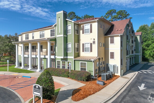
901 Riggins Rd
Tallahassee, FL
Evergreen Commons
11-28-29-00B-001.0
EVERGREEN COMMONS 28 1N 1E 11.738 A LOT 1 BLOCK B OR 2366/11(UT) 3737/1163(RUT)
Multifamilydwelling
Leon
X
Florida
12073C0303F
1
2025
11.74 AC
2025
Governors Square
000907
Tallahassee
203,284 SF
DEMOGRAPHICS near 901 Riggins Rd
1 Mile
3 Mile
5 Mile
2024 Total Population
9,151
62,811
156,150
2029 Population
9,625
66,692
164,141
Pop Growth 2024-2029
+ 5.18%
+ 6.18%
+ 5.12%
Average Age
39
39
36
2024 Total Households
4,259
30,293
68,325
HH Growth 2024-2029
+ 6.08%
+ 6.42%
+ 5.39%
Median Household Inc
$62,482
$60,580
$54,127
Avg Household Size
1.80
2.00
2.10
2024 Avg HH Vehicles
2.00
2.00
2.00
Median Home Value
$222,436
$260,903
$259,301
Median Year Built
1989
1984
1985
Nearby Places
Map Layers
Map Styles
 Street
 Aerial
- Restaurants
- Banks
- Shops
- Fitness
- Groceries
PUBLIC TRANSPORTATION
AIRPORT
Tallahassee International
DRIVE
WALK
Distance
Tallahassee International
21 min
10.6 mi
Freight Ports
Port of Panama City
DRIVE
WALK
Distance
Port of Panama City
149 min
110.6 mi
Nearby Properties
Address
Land Use
TOTAL SIZE
Lot Size
Zoning
Address
Land Use
TOTAL SIZE
Lot Size
Zoning
3,882,850 SF
22.64 AC
CM
Address
Land Use
TOTAL SIZE
Lot Size
Zoning
2,312,757 SF
10.87 AC
CCPD
Address
Land Use
TOTAL SIZE
Lot Size
Zoning
1,906,594 SF
112.75 AC
PUD
Address
Land Use
TOTAL SIZE
Lot Size
Zoning
367,978 SF
2.52 AC
RO
Address
Land Use
TOTAL SIZE
Lot Size
Zoning
361,804 SF
14.17 AC
CM
Address
Land Use
TOTAL SIZE
Lot Size
Zoning
806,710 SF
2.96 AC
CCPD
Address
Land Use
TOTAL SIZE
Lot Size
Zoning
577,345 SF
30.63 AC
Address
Land Use
TOTAL SIZE
Lot Size
Zoning
846,072 SF
166.39 AC
R1
Address
Land Use
TOTAL SIZE
Lot Size
Zoning
545,485 SF
14.01 AC
Address
Land Use
TOTAL SIZE
Lot Size
Zoning
756,595 SF
18.35 AC
Address
Land Use
TOTAL SIZE
Lot Size
Zoning
756,294 SF
20.19 AC
OR3
Address
Land Use
TOTAL SIZE
Lot Size
Zoning
456,149 SF
22.50 AC
OR3
Address
Land Use
TOTAL SIZE
Lot Size
Zoning
775,087 SF
18.34 AC
Address
Land Use
TOTAL SIZE
Lot Size
Zoning
498,616 SF
2.03 AC
CCPD
Address
Land Use
TOTAL SIZE
Lot Size
Zoning
280,000 SF
1.55 AC
CCPD
Address
Land Use
TOTAL SIZE
Lot Size
Zoning
227,485 SF
2.43 AC
Address
Land Use
TOTAL SIZE
Lot Size
Zoning
708,504 SF
50.44 AC
PUD
Address
Land Use
TOTAL SIZE
Lot Size
Zoning
380,000 SF
21.78 AC
PUD
Address
Land Use
TOTAL SIZE
Lot Size
Zoning
169,758 SF
1.71 AC
RO
Address
Land Use
TOTAL SIZE
Lot Size
Zoning
376,746 SF
12.92 AC
OR2
Address
Land Use
TOTAL SIZE
Lot Size
Zoning
473,339 SF
51.93 AC
PUD
Address
Land Use
TOTAL SIZE
Lot Size
Zoning
276,623 SF
20.31 AC
CCPD
Address
Land Use
TOTAL SIZE
Lot Size
Zoning
543,726 SF
13.13 AC
PUD
Address
Land Use
TOTAL SIZE
Lot Size
Zoning
338,790 SF
16 AC
PUD
Address
Land Use
TOTAL SIZE
Lot Size
Zoning
150,000 SF
2.50 AC
CCPD
Address
Land Use
TOTAL SIZE
Lot Size
Zoning
399,815 SF
18.65 AC
Address
Land Use
TOTAL SIZE
Lot Size
Zoning
619,964 SF
6.47 AC
OR3
Address
Land Use
TOTAL SIZE
Lot Size
Zoning
231,616 SF
3.20 AC
CCPD
Address
Land Use
TOTAL SIZE
Lot Size
Zoning
338,619 SF
107.89 AC
GO1
Address
Land Use
TOTAL SIZE
Lot Size
Zoning
606,101 SF
19.01 AC
MR1
The World's #1 Commercial Real Estate Marketplace
Connect with us
© 2026 CoStar Group
The information above has been obtained from sources believed reliable. While we do not doubt its accuracy we have not verified it and make no guarantee, warranty or representation about it. It is your responsibility to independently confirm its accuracy and completeness. Any projections, opinions, assumptions, or estimates used are for example only and do not represent the current or future performance of the property. The value of this transaction to you depends on tax and other factors which should be evaluated by your tax, financial, and legal advisors. You and your advisors should conduct a careful, independent investigation of the property to determine to your satisfaction the suitability of the property for your needs.