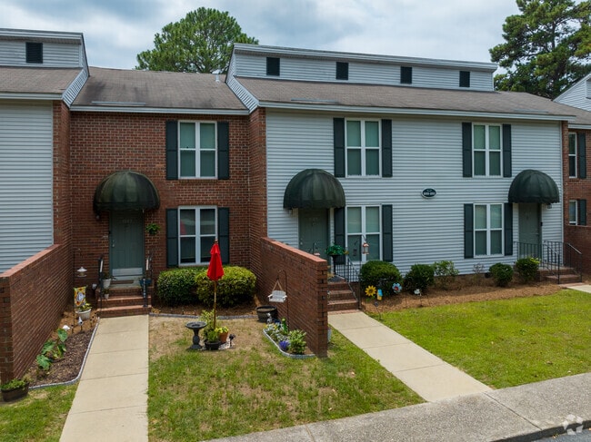
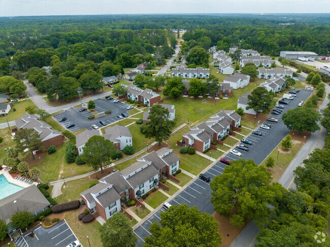
Property Record
901 Rob Roy Ct, West Columbia, SC 29169
NEARBY LISTINGS FOR SALE OR LEASE
-
-
View all West Columbia listings for sale on LoopNet.com
Property Detail
901 Rob Roy Ct
Apartment
Lexington
X
South Carolina
45063C0144J
18.45 AC
2025
West Columbia
2024
Columbia
020512
Columbia, SC
3,825 SF
004596-04-048
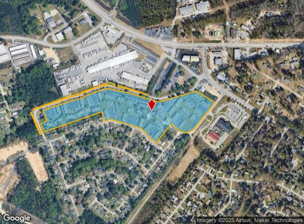
DEMOGRAPHICS near 901 Rob Roy Ct
1 Mile
3 Mile
5 Mile
2024 Total Population
4,299
37,517
126,198
2029 Population
4,664
40,718
134,999
Pop Growth 2024-2029
+ 8.49%
+ 8.53%
+ 6.97%
Average Age
40
40
40
2024 Total Households
1,790
15,500
53,031
HH Growth 2024-2029
+ 8.72%
+ 8.71%
+ 7.21%
Median Household Inc
$68,249
$65,389
$57,695
Avg Household Size
2.40
2.40
2.20
2024 Avg HH Vehicles
2.00
2.00
2.00
Median Home Value
$174,106
$180,788
$169,717
Median Year Built
1989
1985
1982
Nearby Places
Map Layers
Map Styles
 Street
 Aerial
- Restaurants
- Banks
- Shops
- Fitness
- Groceries
PUBLIC TRANSPORTATION
COMMUTER RAIL
Columbia Amtrak Station (Silver Star - Amtrak)
DRIVE
WALK
Distance
Columbia Amtrak Station (Silver Star - Amtrak)
12 min
6.5 mi
AIRPORT
Columbia Metro
DRIVE
WALK
Distance
Columbia Metro
21 min
9.8 mi
Freight Ports
North Charleston Terminal
DRIVE
WALK
Distance
North Charleston Terminal
121 min
106.1 mi
Nearby Properties
Address
Land Use
TOTAL SIZE
Lot Size
Zoning
Address
Land Use
TOTAL SIZE
Lot Size
Zoning
208,016 SF
14.28 AC
GC
Address
Land Use
TOTAL SIZE
Lot Size
Zoning
58,664 SF
6.01 AC
Address
Land Use
TOTAL SIZE
Lot Size
Zoning
31,892 SF
2.23 AC
GC
Address
Land Use
TOTAL SIZE
Lot Size
Zoning
60,085 SF
2.35 AC
GC
Address
Land Use
TOTAL SIZE
Lot Size
Zoning
34,841 SF
2.01 AC
GC
Address
Land Use
TOTAL SIZE
Lot Size
Zoning
8,330 SF
19.10 AC
ID
Address
Land Use
TOTAL SIZE
Lot Size
Zoning
3,080 SF
18.07 AC
R
Address
Land Use
TOTAL SIZE
Lot Size
Zoning
183,776 SF
18.23 AC
C2
Address
Land Use
TOTAL SIZE
Lot Size
Zoning
3,447 SF
10.03 AC
R3
Address
Land Use
TOTAL SIZE
Lot Size
Zoning
6,794 SF
6.17 AC
R1
Address
Land Use
TOTAL SIZE
Lot Size
Zoning
190,570 SF
10.01 AC
C2
Address
Land Use
TOTAL SIZE
Lot Size
Zoning
9,268 SF
15.89 AC
C2
Address
Land Use
TOTAL SIZE
Lot Size
Zoning
99,628 SF
13.09 AC
RD
Address
Land Use
TOTAL SIZE
Lot Size
Zoning
14,309 SF
1.84 AC
GC
Address
Land Use
TOTAL SIZE
Lot Size
Zoning
153,351 SF
13.33 AC
RD
Address
Land Use
TOTAL SIZE
Lot Size
Zoning
85,600 SF
22.08 AC
Address
Land Use
TOTAL SIZE
Lot Size
Zoning
7,383 SF
4.85 AC
ID
Address
Land Use
TOTAL SIZE
Lot Size
Zoning
146,960 SF
9.70 AC
C2
Address
Land Use
TOTAL SIZE
Lot Size
Zoning
34,267 SF
7.53 AC
ID
Address
Land Use
TOTAL SIZE
Lot Size
Zoning
126,000 SF
8.89 AC
Address
Land Use
TOTAL SIZE
Lot Size
Zoning
8,876 SF
15.06 AC
R3
Address
Land Use
TOTAL SIZE
Lot Size
Zoning
10,616 SF
9.63 AC
R3
Address
Land Use
TOTAL SIZE
Lot Size
Zoning
127,329 SF
10.91 AC
Address
Land Use
TOTAL SIZE
Lot Size
Zoning
79,951 SF
3.31 AC
RD
Address
Land Use
TOTAL SIZE
Lot Size
Zoning
39,700 SF
73.29 AC
ID
Address
Land Use
TOTAL SIZE
Lot Size
Zoning
66,043 SF
2.70 AC
ID
Address
Land Use
TOTAL SIZE
Lot Size
Zoning
86,711 SF
3.46 AC
ID
Address
Land Use
TOTAL SIZE
Lot Size
Zoning
54,000 SF
8.60 AC
ID
Address
Land Use
TOTAL SIZE
Lot Size
Zoning
147,166 SF
18.27 AC
ID
The World's #1 Commercial Real Estate Marketplace
Connect with us
© 2026 CoStar Group
The information above has been obtained from sources believed reliable. While we do not doubt its accuracy we have not verified it and make no guarantee, warranty or representation about it. It is your responsibility to independently confirm its accuracy and completeness. Any projections, opinions, assumptions, or estimates used are for example only and do not represent the current or future performance of the property. The value of this transaction to you depends on tax and other factors which should be evaluated by your tax, financial, and legal advisors. You and your advisors should conduct a careful, independent investigation of the property to determine to your satisfaction the suitability of the property for your needs.