Property Record
901 S Highway 77, Noble, OK 73068


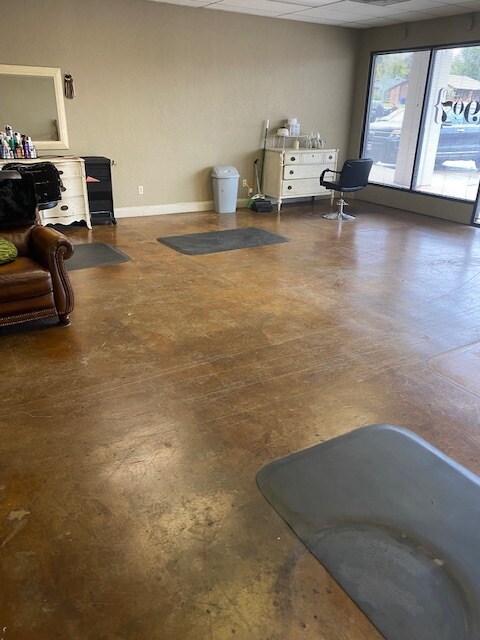
Property Detail
901 S Highway 77
Oklahoma City, OK
NORTHWOOD II ADD LOT 2 BLK 1 & PRT LT 1 BLK 1 AKA BEG S 01D W111.85 W40.49 S 02D E28.94 NE/C OF NORTHWOODS II FOR POB S 02D E60 S 63D W281.46 S 40D W168.11 S 62D W8.05 N 27D W122 N 63D E470.46 POB
R0189523
CLEVELAND
Regionalshoppingcenterormallwithanchorstore
Oklahoma
B and X Area of moderate flood hazard, usually the area between the limits of the 100-year and 500-year floods.
2
2025
3.03 AC
2025
Southeast Outlying
202501
Oklahoma City
NEARBY LISTINGS FOR SALE OR LEASE
-
-
View all Noble listings for lease on LoopNet.com
DEMOGRAPHICS near 901 S Highway 77
1 mile
3 mile
5 mile
2025 Total Population
3,755
19,200
65,531
2030 Population
3,837
19,759
67,316
Pop Growth 2025-2030
+ 2.18%
+ 2.91%
+ 2.72%
Average Age
39
36
35
2025 Total Households
1,405
7,880
24,773
HH Growth 2025-2030
+ 2.21%
+ 2.80%
+ 2.86%
Median Household Inc
$78,036
$63,990
$55,127
Avg Household Size
2.60
2.30
2.30
2025 Avg HH Vehicles
2.00
2.00
2.00
Median Home Value
$226,997
$243,261
$252,576
Median Year Built
1988
1999
1990
Nearby Places
Map Layers
Map Styles
 Street
 Aerial
Transit
 Traffic
 Biking
Places
Listings with unknown addresses are not visible on the map
- Restaurants
- Banks
- Shops
- Fitness
- Groceries
PUBLIC TRANSPORTATION
COMMUTER RAIL
Drive
Walk
Distance
11 min
5.7 mi
AIRPORT
Will Rogers World
Drive
Walk
Distance
Will Rogers World
45 min
28.6 mi
SALE & LEASE HISTORY
LISTING DATE
SALE/LEASE

Jul 19, 2022
For Lease
Aug 25, 2020
For Lease
Nearby Properties
Address
Land Use
TOTAL SIZE
Lot Size
Zoning
Address
Land Use
TOTAL SIZE
Lot Size
Zoning
200,000 SF
40 AC
Address
Land Use
TOTAL SIZE
Lot Size
Zoning
18.60 AC
Address
Land Use
TOTAL SIZE
Lot Size
Zoning
40.63 AC
Address
Land Use
TOTAL SIZE
Lot Size
Zoning
4.36 AC
Address
Land Use
TOTAL SIZE
Lot Size
Zoning
30.44 AC
Address
Land Use
TOTAL SIZE
Lot Size
Zoning
2.76 AC
Address
Land Use
TOTAL SIZE
Lot Size
Zoning
Address
Land Use
TOTAL SIZE
Lot Size
Zoning
3.07 AC
Address
Land Use
TOTAL SIZE
Lot Size
Zoning
21,641 SF
5.11 AC
Address
Land Use
TOTAL SIZE
Lot Size
Zoning
131,387 SF
9.55 AC
Address
Land Use
TOTAL SIZE
Lot Size
Zoning
11.33 AC
Address
Land Use
TOTAL SIZE
Lot Size
Zoning
467,281 SF
33.50 AC
Address
Land Use
TOTAL SIZE
Lot Size
Zoning
54,160 SF
8.26 AC
Address
Land Use
TOTAL SIZE
Lot Size
Zoning
351,466 SF
67.68 AC
I2
Address
Land Use
TOTAL SIZE
Lot Size
Zoning
0.24 AC
Address
Land Use
TOTAL SIZE
Lot Size
Zoning
367,145 SF
22.97 AC
Address
Land Use
TOTAL SIZE
Lot Size
Zoning
2.76 AC
Address
Land Use
TOTAL SIZE
Lot Size
Zoning
9.33 AC
Address
Land Use
TOTAL SIZE
Lot Size
Zoning
42,094 SF
18.75 AC
Address
Land Use
TOTAL SIZE
Lot Size
Zoning
107,526 SF
18.77 AC
Address
Land Use
TOTAL SIZE
Lot Size
Zoning
189,901 SF
5.76 AC
Address
Land Use
TOTAL SIZE
Lot Size
Zoning
46,824 SF
1 AC
Address
Land Use
TOTAL SIZE
Lot Size
Zoning
384 SF
26.92 AC
PU
Address
Land Use
TOTAL SIZE
Lot Size
Zoning
234,051 SF
80.33 AC
Address
Land Use
TOTAL SIZE
Lot Size
Zoning
1,170 SF
11.36 AC
R1
Address
Land Use
TOTAL SIZE
Lot Size
Zoning
147,692 SF
16.19 AC
Address
Land Use
TOTAL SIZE
Lot Size
Zoning
187,632 SF
11.25 AC
Address
Land Use
TOTAL SIZE
Lot Size
Zoning
198,416 SF
13.16 AC
Address
Land Use
TOTAL SIZE
Lot Size
Zoning
15,072 SF
0.60 AC
Address
Land Use
TOTAL SIZE
Lot Size
Zoning
4,706 SF
11.03 AC
RM
The World's #1 Commercial Real Estate Marketplace
Connect with us
© 2026 CoStar Group
The information above has been obtained from sources believed reliable. While we do not doubt its accuracy we have not verified it and make no guarantee, warranty or representation about it. It is your responsibility to independently confirm its accuracy and completeness. Any projections, opinions, assumptions, or estimates used are for example only and do not represent the current or future performance of the property. The value of this transaction to you depends on tax and other factors which should be evaluated by your tax, financial, and legal advisors. You and your advisors should conduct a careful, independent investigation of the property to determine to your satisfaction the suitability of the property for your needs.