Property Record
901 Spinks Rd, Flower Mound, TX 75028
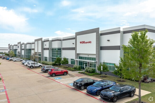

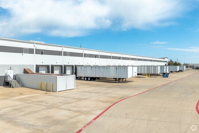
Property Detail
901 Spinks Rd
Dallas-Fort Worth-Arlington, TX
CORNERSTONE 1 BLK A LOT 2R
R529133
Denton
Commercialnec
Texas
B and X Area of moderate flood hazard, usually the area between the limits of the 100-year and 500-year floods.
2r
2024
20.35 AC
2025
Lewisville
021727
Dallas/Ft Worth
310,224 SF
NEARBY LISTINGS FOR SALE OR LEASE
DEMOGRAPHICS near 901 Spinks Rd
1 mile
3 mile
5 mile
2025 Total Population
5,025
78,121
235,806
2030 Population
5,670
86,086
257,792
Pop Growth 2025-2030
+ 12.84%
+ 10.20%
+ 9.32%
Average Age
39
39
39
2025 Total Households
1,727
28,764
88,788
HH Growth 2025-2030
+ 12.85%
+ 10.29%
+ 9.54%
Median Household Inc
$155,410
$120,818
$108,094
Avg Household Size
2.90
2.70
2.60
2025 Avg HH Vehicles
2.00
2.00
2.00
Median Home Value
$748,079
$471,495
$468,488
Median Year Built
2002
1996
1994
Nearby Places
Map Layers
Map Styles
 Street
 Aerial
Layers
 Traffic
 Biking
Places
Listings with unknown addresses are not visible on the map
- Restaurants
- Banks
- Shops
- Fitness
- Groceries
PUBLIC TRANSPORTATION
COMMUTER RAIL
Hebron Station (A-train - Denton County Transportation Authority)
Drive
Walk
Distance
Hebron Station (A-train - Denton County Transportation Authority)
12 min
5.7 mi
Old Town Station (A-train - Denton County Transportation Authority)
Drive
Walk
Distance
Old Town Station (A-train - Denton County Transportation Authority)
12 min
6.7 mi
AIRPORT
Dallas-Fort Worth International
Drive
Walk
Distance
Dallas-Fort Worth International
13 min
7.9 mi
Dallas Love Field
Drive
Walk
Distance
Dallas Love Field
32 min
21.4 mi
Freight Ports
Port of Shreveport
Drive
Walk
Distance
Port of Shreveport
238 min
219.6 mi
SALE & LEASE HISTORY
LISTING DATE
SALE/LEASE

Sep 25, 2016
For Lease
Jan 18, 2018
For Lease
Feb 28, 2024
For Lease
Nearby Properties
Address
Land Use
TOTAL SIZE
Lot Size
Zoning
Address
Land Use
TOTAL SIZE
Lot Size
Zoning
1,325,709 SF
124.50 AC
Address
Land Use
TOTAL SIZE
Lot Size
Zoning
563,145 SF
Address
Land Use
TOTAL SIZE
Lot Size
Zoning
444,824 SF
19.08 AC
Address
Land Use
TOTAL SIZE
Lot Size
Zoning
527,463 SF
42.25 AC
Address
Land Use
TOTAL SIZE
Lot Size
Zoning
432,986 SF
10.57 AC
Address
Land Use
TOTAL SIZE
Lot Size
Zoning
768,494 SF
10.42 AC
Address
Land Use
TOTAL SIZE
Lot Size
Zoning
531,979 SF
4.54 AC
Address
Land Use
TOTAL SIZE
Lot Size
Zoning
481,511 SF
34.76 AC
Z172
Address
Land Use
TOTAL SIZE
Lot Size
Zoning
835,344 SF
143.50 AC
Address
Land Use
TOTAL SIZE
Lot Size
Zoning
457,738 SF
28.49 AC
Address
Land Use
TOTAL SIZE
Lot Size
Zoning
313,369 SF
55.25 AC
Address
Land Use
TOTAL SIZE
Lot Size
Zoning
389,286 SF
21.86 AC
Address
Land Use
TOTAL SIZE
Lot Size
Zoning
394,048 SF
16.36 AC
Address
Land Use
TOTAL SIZE
Lot Size
Zoning
284,952 SF
26.18 AC
Address
Land Use
TOTAL SIZE
Lot Size
Zoning
184,186 SF
34.74 AC
Z31
Address
Land Use
TOTAL SIZE
Lot Size
Zoning
397,935 SF
10.65 AC
Address
Land Use
TOTAL SIZE
Lot Size
Zoning
329,666 SF
19.76 AC
Address
Land Use
TOTAL SIZE
Lot Size
Zoning
295,408 SF
10.33 AC
Address
Land Use
TOTAL SIZE
Lot Size
Zoning
269,300 SF
60.39 AC
Address
Land Use
TOTAL SIZE
Lot Size
Zoning
947,236 SF
52.19 AC
Address
Land Use
TOTAL SIZE
Lot Size
Zoning
263,119 SF
11.01 AC
Address
Land Use
TOTAL SIZE
Lot Size
Zoning
411,223 SF
24.07 AC
3B
Address
Land Use
TOTAL SIZE
Lot Size
Zoning
1,030,000 SF
53.43 AC
Address
Land Use
TOTAL SIZE
Lot Size
Zoning
329,353 SF
7.90 AC
Address
Land Use
TOTAL SIZE
Lot Size
Zoning
714,010 SF
36.33 AC
Z31
Address
Land Use
TOTAL SIZE
Lot Size
Zoning
748,710 SF
37.91 AC
Address
Land Use
TOTAL SIZE
Lot Size
Zoning
371,268 SF
7.45 AC
Address
Land Use
TOTAL SIZE
Lot Size
Zoning
310,788 SF
15.05 AC
Address
Land Use
TOTAL SIZE
Lot Size
Zoning
295,668 SF
13.03 AC
Address
Land Use
TOTAL SIZE
Lot Size
Zoning
650,000 SF
32.01 AC
The World's #1 Commercial Real Estate Marketplace
Connect with us
© 2026 CoStar Group
The information above has been obtained from sources believed reliable. While we do not doubt its accuracy we have not verified it and make no guarantee, warranty or representation about it. It is your responsibility to independently confirm its accuracy and completeness. Any projections, opinions, assumptions, or estimates used are for example only and do not represent the current or future performance of the property. The value of this transaction to you depends on tax and other factors which should be evaluated by your tax, financial, and legal advisors. You and your advisors should conduct a careful, independent investigation of the property to determine to your satisfaction the suitability of the property for your needs.