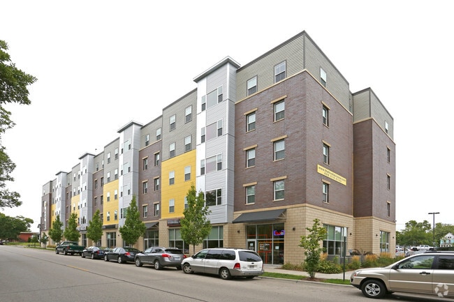
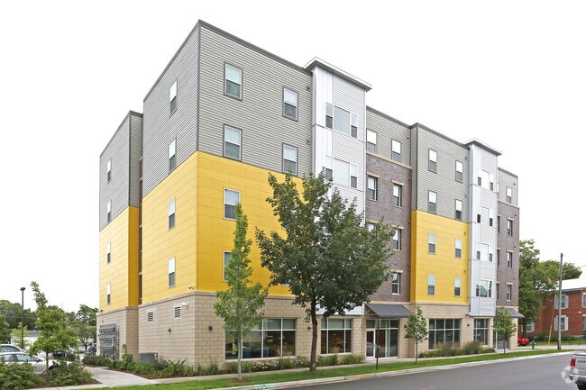
Property Record
901 State St N, La Crosse, WI 54601
NEARBY LISTINGS FOR SALE OR LEASE
Property Detail
901 State St N
La Crosse-Onalaska, WI-MN
CERTIFIED SURVEY MAP NO. 131 VOL 17 LOT 1 DOC NO. 1717914 SUBJ TO ESMT IN DOC NO. 1774030
017020202121
La Crosse
Commercialnec
Wisconsin
X
1
27055C0125E
1.64 AC
2023
Downtown La Crosse
2023
Other Market Areas
000402
DEMOGRAPHICS near 901 State St N
1 Mile
3 Mile
5 Mile
2024 Total Population
18,841
52,288
77,155
2029 Population
19,089
53,309
78,209
Pop Growth 2024-2029
+ 1.32%
+ 1.95%
+ 1.37%
Average Age
31
37
39
2024 Total Households
7,052
22,439
33,555
HH Growth 2024-2029
+ 1.83%
+ 2.15%
+ 1.42%
Median Household Inc
$31,572
$46,392
$52,670
Avg Household Size
2.00
2.00
2.10
2024 Avg HH Vehicles
2.00
2.00
2.00
Median Home Value
$198,602
$171,126
$188,437
Median Year Built
1971
1964
1971
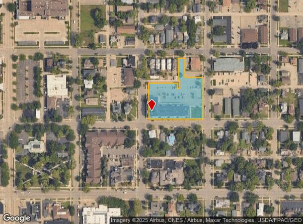
Nearby Places
Map Layers
Map Styles
 Street
 Aerial
- Restaurants
- Banks
- Shops
- Fitness
- Groceries
PUBLIC TRANSPORTATION
COMMUTER RAIL
La Crosse (Empire Builder - Amtrak)
DRIVE
WALK
Distance
La Crosse (Empire Builder - Amtrak)
6 min
2.0 mi
AIRPORT
La Crosse Regional
DRIVE
WALK
Distance
La Crosse Regional
17 min
6.5 mi
Freight Ports
Port Milwaukee
DRIVE
WALK
Distance
Port Milwaukee
237 min
211.4 mi
SALE & LEASE HISTORY
LISTING DATE
SALE/LEASE

Sep 25, 2016
For Lease
Nearby Properties
Address
Land Use
TOTAL SIZE
Lot Size
Zoning
Address
Land Use
TOTAL SIZE
Lot Size
Zoning
4.65 AC
Address
Land Use
TOTAL SIZE
Lot Size
Zoning
42.20 AC
MZA
Address
Land Use
TOTAL SIZE
Lot Size
Zoning
38,407 SF
3.12 AC
MZA
Address
Land Use
TOTAL SIZE
Lot Size
Zoning
12.60 AC
MZA
Address
Land Use
TOTAL SIZE
Lot Size
Zoning
0.75 AC
MZA
Address
Land Use
TOTAL SIZE
Lot Size
Zoning
54.26 AC
MZA
Address
Land Use
TOTAL SIZE
Lot Size
Zoning
131,552 SF
0.89 AC
Address
Land Use
TOTAL SIZE
Lot Size
Zoning
11.40 AC
MZA
Address
Land Use
TOTAL SIZE
Lot Size
Zoning
3.91 AC
Address
Land Use
TOTAL SIZE
Lot Size
Zoning
73,056 SF
0.62 AC
Address
Land Use
TOTAL SIZE
Lot Size
Zoning
4.81 AC
Address
Land Use
TOTAL SIZE
Lot Size
Zoning
64,480 SF
0.69 AC
MZA
Address
Land Use
TOTAL SIZE
Lot Size
Zoning
5.29 AC
MZA
Address
Land Use
TOTAL SIZE
Lot Size
Zoning
0.12 AC
Address
Land Use
TOTAL SIZE
Lot Size
Zoning
11.56 AC
Address
Land Use
TOTAL SIZE
Lot Size
Zoning
54,884 SF
1.09 AC
MZA
Address
Land Use
TOTAL SIZE
Lot Size
Zoning
10.21 AC
MZA
Address
Land Use
TOTAL SIZE
Lot Size
Zoning
2.10 AC
MZA
Address
Land Use
TOTAL SIZE
Lot Size
Zoning
2.12 AC
MZA
Address
Land Use
TOTAL SIZE
Lot Size
Zoning
5.79 AC
MZA
Address
Land Use
TOTAL SIZE
Lot Size
Zoning
162,355 SF
13.90 AC
MZA
Address
Land Use
TOTAL SIZE
Lot Size
Zoning
2.43 AC
Address
Land Use
TOTAL SIZE
Lot Size
Zoning
0.56 AC
MZA
Address
Land Use
TOTAL SIZE
Lot Size
Zoning
8.98 AC
MZA
Address
Land Use
TOTAL SIZE
Lot Size
Zoning
27,000 SF
0.22 AC
MZA
Address
Land Use
TOTAL SIZE
Lot Size
Zoning
81,664 SF
1.06 AC
MZA
Address
Land Use
TOTAL SIZE
Lot Size
Zoning
32,153 SF
3.16 AC
MZA
Address
Land Use
TOTAL SIZE
Lot Size
Zoning
1.70 AC
MZA
Address
Land Use
TOTAL SIZE
Lot Size
Zoning
15.48 AC
MZA
Address
Land Use
TOTAL SIZE
Lot Size
Zoning
1.19 AC
The World's #1 Commercial Real Estate Marketplace
Connect with us
© 2026 CoStar Group
The information above has been obtained from sources believed reliable. While we do not doubt its accuracy we have not verified it and make no guarantee, warranty or representation about it. It is your responsibility to independently confirm its accuracy and completeness. Any projections, opinions, assumptions, or estimates used are for example only and do not represent the current or future performance of the property. The value of this transaction to you depends on tax and other factors which should be evaluated by your tax, financial, and legal advisors. You and your advisors should conduct a careful, independent investigation of the property to determine to your satisfaction the suitability of the property for your needs.