Property Record
9010 Brodie Ln, Austin, TX 78748
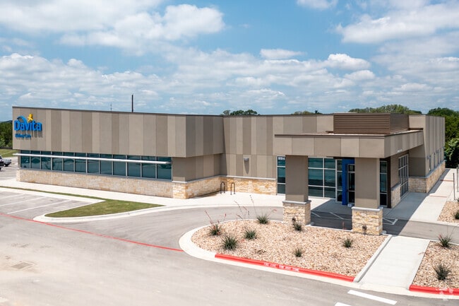

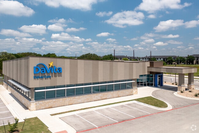
Property Detail
9010 Brodie Ln
Austin-Round Rock-San Marcos, TX
UNT A 31 DEERFIELD CONDOMINIUMS PLUS 24.63 % INT IN COM AREA
893400
TRAVIS
Commercialcondominium
Texas
B and X Area of moderate flood hazard, usually the area between the limits of the 100-year and 500-year floods.
a
2025
2.14 AC
2025
South
031300
Austin
10,235 SF
NEARBY LISTINGS FOR SALE OR LEASE
DEMOGRAPHICS near 9010 Brodie Ln
1 mile
3 mile
5 mile
2025 Total Population
12,532
100,247
231,959
2030 Population
12,917
103,460
241,377
Pop Growth 2025-2030
+ 3.07%
+ 3.21%
+ 4.06%
Average Age
40
40
39
2025 Total Households
5,441
41,758
99,630
HH Growth 2025-2030
+ 3.66%
+ 3.92%
+ 4.79%
Median Household Inc
$103,756
$114,466
$102,630
Avg Household Size
2.20
2.30
2.20
2025 Avg HH Vehicles
2.00
2.00
2.00
Median Home Value
$537,199
$586,492
$604,499
Median Year Built
1994
1995
1999
Nearby Places
Map Layers
Map Styles
 Street
 Aerial
Layers
 Traffic
 Biking
Places
Listings with unknown addresses are not visible on the map
- Restaurants
- Banks
- Shops
- Fitness
- Groceries
PUBLIC TRANSPORTATION
COMMUTER RAIL
Drive
Walk
Distance
15 min
9.2 mi
AIRPORT
Austin-Bergstrom International
Drive
Walk
Distance
Austin-Bergstrom International
30 min
15.4 mi
SALE & LEASE HISTORY
LISTING DATE
SALE/LEASE

Nov 16, 2020
For Sale
Feb 25, 2019
For Sale
Feb 22, 2019
For Sale
Nearby Properties
Address
Land Use
TOTAL SIZE
Lot Size
Zoning
Address
Land Use
TOTAL SIZE
Lot Size
Zoning
881,940 SF
80.11 AC
Address
Land Use
TOTAL SIZE
Lot Size
Zoning
474,907 SF
36.94 AC
Address
Land Use
TOTAL SIZE
Lot Size
Zoning
441,209 SF
64.41 AC
Address
Land Use
TOTAL SIZE
Lot Size
Zoning
432,404 SF
37.29 AC
Address
Land Use
TOTAL SIZE
Lot Size
Zoning
267,224 SF
56.90 AC
Address
Land Use
TOTAL SIZE
Lot Size
Zoning
401,771 SF
59.77 AC
Address
Land Use
TOTAL SIZE
Lot Size
Zoning
450,836 SF
29.58 AC
Address
Land Use
TOTAL SIZE
Lot Size
Zoning
324,860 SF
8.36 AC
Address
Land Use
TOTAL SIZE
Lot Size
Zoning
400,301 SF
22.65 AC
Address
Land Use
TOTAL SIZE
Lot Size
Zoning
425,720 SF
28.49 AC
Address
Land Use
TOTAL SIZE
Lot Size
Zoning
404,812 SF
31.32 AC
Address
Land Use
TOTAL SIZE
Lot Size
Zoning
257,400 SF
10.70 AC
Address
Land Use
TOTAL SIZE
Lot Size
Zoning
399,828 SF
50.10 AC
Address
Land Use
TOTAL SIZE
Lot Size
Zoning
320,000 SF
7.44 AC
Address
Land Use
TOTAL SIZE
Lot Size
Zoning
233,943 SF
39.66 AC
Address
Land Use
TOTAL SIZE
Lot Size
Zoning
327,886 SF
23.91 AC
Address
Land Use
TOTAL SIZE
Lot Size
Zoning
316,572 SF
22.67 AC
Address
Land Use
TOTAL SIZE
Lot Size
Zoning
345,632 SF
25.21 AC
Address
Land Use
TOTAL SIZE
Lot Size
Zoning
255,144 SF
6.62 AC
Address
Land Use
TOTAL SIZE
Lot Size
Zoning
246,854 SF
19.40 AC
Address
Land Use
TOTAL SIZE
Lot Size
Zoning
244,365 SF
11.87 AC
Address
Land Use
TOTAL SIZE
Lot Size
Zoning
226,301 SF
13.26 AC
Address
Land Use
TOTAL SIZE
Lot Size
Zoning
307,584 SF
39.67 AC
Address
Land Use
TOTAL SIZE
Lot Size
Zoning
126.95 AC
Address
Land Use
TOTAL SIZE
Lot Size
Zoning
183,198 SF
23 AC
Address
Land Use
TOTAL SIZE
Lot Size
Zoning
194,490 SF
21.53 AC
Address
Land Use
TOTAL SIZE
Lot Size
Zoning
223,921 SF
22.22 AC
Address
Land Use
TOTAL SIZE
Lot Size
Zoning
189,756 SF
28.77 AC
Address
Land Use
TOTAL SIZE
Lot Size
Zoning
145,816 SF
22.71 AC
Address
Land Use
TOTAL SIZE
Lot Size
Zoning
253,404 SF
12.54 AC
The World's #1 Commercial Real Estate Marketplace
Connect with us
© 2026 CoStar Group
The information above has been obtained from sources believed reliable. While we do not doubt its accuracy we have not verified it and make no guarantee, warranty or representation about it. It is your responsibility to independently confirm its accuracy and completeness. Any projections, opinions, assumptions, or estimates used are for example only and do not represent the current or future performance of the property. The value of this transaction to you depends on tax and other factors which should be evaluated by your tax, financial, and legal advisors. You and your advisors should conduct a careful, independent investigation of the property to determine to your satisfaction the suitability of the property for your needs.