Property Record
9012 N Us Hy 183 S, Austin, TX 78747


Current Lease Availabilities
NEARBY LISTINGS FOR SALE OR LEASE
Property Detail
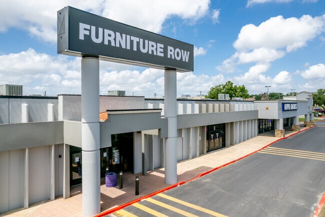
9012 N Us Hy 183 S
Austin-Round Rock-San Marcos, TX
Schnip I
251492
LOT A * LESS .51A SCHNIP I LOT 2 * SCHNIP 1-A & ACR .255 DAVIS G W
Regionalshoppingcenterormallwithanchorstore
Travis
X
Texas
48453C0455J
a,2
2024
8.73 AC
2025
Central
002440
Austin
115,124 SF
DEMOGRAPHICS near 9012 N Us Hy 183 S
1 Mile
3 Mile
5 Mile
2024 Total Population
14,920
145,835
318,758
2029 Population
16,047
157,772
345,145
Pop Growth 2024-2029
+ 7.55%
+ 8.19%
+ 8.28%
Average Age
36
37
38
2024 Total Households
6,308
66,331
143,727
HH Growth 2024-2029
+ 8.31%
+ 9.03%
+ 9.04%
Median Household Inc
$46,804
$67,116
$74,610
Avg Household Size
2.30
2.10
2.10
2024 Avg HH Vehicles
1.00
2.00
2.00
Median Home Value
$434,706
$531,991
$511,558
Median Year Built
1976
1982
1986
Nearby Places
Map Layers
Map Styles
 Street
 Aerial
- Restaurants
- Banks
- Shops
- Fitness
- Groceries
PUBLIC TRANSPORTATION
COMMUTER RAIL
Austin (Texas Eagle - Amtrak)
DRIVE
WALK
Distance
Austin (Texas Eagle - Amtrak)
15 min
10.0 mi
AIRPORT
Austin-Bergstrom International
DRIVE
WALK
Distance
Austin-Bergstrom International
28 min
18.8 mi
Freight Ports
Calhoun Port
DRIVE
WALK
Distance
Calhoun Port
194 min
162.3 mi
Nearby Properties
Address
Land Use
TOTAL SIZE
Lot Size
Zoning
Address
Land Use
TOTAL SIZE
Lot Size
Zoning
230.30 AC
Address
Land Use
TOTAL SIZE
Lot Size
Zoning
702,590 SF
48.64 AC
Address
Land Use
TOTAL SIZE
Lot Size
Zoning
1,145,461 SF
34.05 AC
Address
Land Use
TOTAL SIZE
Lot Size
Zoning
371,269 SF
27.63 AC
Address
Land Use
TOTAL SIZE
Lot Size
Zoning
326,626 SF
2.54 AC
Address
Land Use
TOTAL SIZE
Lot Size
Zoning
750,565 SF
65.25 AC
Address
Land Use
TOTAL SIZE
Lot Size
Zoning
666,331 SF
36.37 AC
Address
Land Use
TOTAL SIZE
Lot Size
Zoning
320,104 SF
3.27 AC
Address
Land Use
TOTAL SIZE
Lot Size
Zoning
295,320 SF
2.99 AC
Address
Land Use
TOTAL SIZE
Lot Size
Zoning
323,406 SF
2.36 AC
Address
Land Use
TOTAL SIZE
Lot Size
Zoning
571,738 SF
36.06 AC
Address
Land Use
TOTAL SIZE
Lot Size
Zoning
456,682 SF
7.34 AC
Address
Land Use
TOTAL SIZE
Lot Size
Zoning
293,224 SF
4.45 AC
Address
Land Use
TOTAL SIZE
Lot Size
Zoning
316,888 SF
3.79 AC
Address
Land Use
TOTAL SIZE
Lot Size
Zoning
352,386 SF
33.65 AC
Address
Land Use
TOTAL SIZE
Lot Size
Zoning
354,008 SF
39.99 AC
Address
Land Use
TOTAL SIZE
Lot Size
Zoning
340,785 SF
1.89 AC
Address
Land Use
TOTAL SIZE
Lot Size
Zoning
340,000 SF
1.54 AC
Address
Land Use
TOTAL SIZE
Lot Size
Zoning
300,616 SF
3.95 AC
Address
Land Use
TOTAL SIZE
Lot Size
Zoning
172,307 SF
11.95 AC
Address
Land Use
TOTAL SIZE
Lot Size
Zoning
311,025 SF
4.99 AC
Address
Land Use
TOTAL SIZE
Lot Size
Zoning
233,091 SF
5.61 AC
Address
Land Use
TOTAL SIZE
Lot Size
Zoning
351,012 SF
16.40 AC
Address
Land Use
TOTAL SIZE
Lot Size
Zoning
364,130 SF
42.45 AC
Address
Land Use
TOTAL SIZE
Lot Size
Zoning
314,319 SF
5.97 AC
Address
Land Use
TOTAL SIZE
Lot Size
Zoning
377,769 SF
20.97 AC
Address
Land Use
TOTAL SIZE
Lot Size
Zoning
45.78 AC
Address
Land Use
TOTAL SIZE
Lot Size
Zoning
451,564 SF
25 AC
Address
Land Use
TOTAL SIZE
Lot Size
Zoning
409,082 SF
14.42 AC
Address
Land Use
TOTAL SIZE
Lot Size
Zoning
293,217 SF
22.34 AC
The World's #1 Commercial Real Estate Marketplace
Connect with us
© 2026 CoStar Group
The information above has been obtained from sources believed reliable. While we do not doubt its accuracy we have not verified it and make no guarantee, warranty or representation about it. It is your responsibility to independently confirm its accuracy and completeness. Any projections, opinions, assumptions, or estimates used are for example only and do not represent the current or future performance of the property. The value of this transaction to you depends on tax and other factors which should be evaluated by your tax, financial, and legal advisors. You and your advisors should conduct a careful, independent investigation of the property to determine to your satisfaction the suitability of the property for your needs.