Property Record
902 Se Shurfine Dr, Ankeny, IA 50021


NEARBY LISTINGS FOR SALE OR LEASE
Property Detail
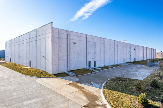
902 Se Shurfine Dr
Des Moines-West Des Moines, IA
Ankeny Industrial Park
181/00161-001-018
E 6.90A LOTS 3, 4 & 5 LESS S 40F SE SHURFINE DR ANKENY INDUSTRIAL PARK
Warehouse
Polk
X
Iowa
19153C0205F
3,4,5
2024
6.37 AC
2025
Ankeny
010212
Des Moines
90,900 SF
DEMOGRAPHICS near 902 Se Shurfine Dr
1 Mile
3 Mile
5 Mile
2024 Total Population
6,385
48,001
85,692
2029 Population
6,571
50,437
89,984
Pop Growth 2024-2029
+ 2.91%
+ 5.07%
+ 5.01%
Average Age
41
37
37
2024 Total Households
2,733
19,287
32,992
HH Growth 2024-2029
+ 3.26%
+ 5.22%
+ 5.18%
Median Household Inc
$78,974
$87,131
$92,683
Avg Household Size
2.30
2.40
2.50
2024 Avg HH Vehicles
2.00
2.00
2.00
Median Home Value
$204,316
$259,371
$282,172
Median Year Built
1991
2000
2004
Nearby Places
Map Layers
Map Styles
 Street
 Aerial
- Restaurants
- Banks
- Shops
- Fitness
- Groceries
PUBLIC TRANSPORTATION
AIRPORT
Des Moines International
DRIVE
WALK
Distance
Des Moines International
28 min
16.1 mi
Freight Ports
Port Milwaukee
DRIVE
WALK
Distance
Port Milwaukee
415 min
372.9 mi
SALE & LEASE HISTORY
LISTING DATE
SALE/LEASE

Jul 16, 2018
For Lease
Nearby Properties
Address
Land Use
TOTAL SIZE
Lot Size
Zoning
Address
Land Use
TOTAL SIZE
Lot Size
Zoning
2,732,552 SF
443.35 AC
Address
Land Use
TOTAL SIZE
Lot Size
Zoning
723,056 SF
83.96 AC
M1
Address
Land Use
TOTAL SIZE
Lot Size
Zoning
857,109 SF
73.97 AC
LI
Address
Land Use
TOTAL SIZE
Lot Size
Zoning
644,568 SF
29.90 AC
M-1
Address
Land Use
TOTAL SIZE
Lot Size
Zoning
463,530 SF
35.91 AC
M-1
Address
Land Use
TOTAL SIZE
Lot Size
Zoning
272,072 SF
11.70 AC
Address
Land Use
TOTAL SIZE
Lot Size
Zoning
350,150 SF
35.34 AC
Address
Land Use
TOTAL SIZE
Lot Size
Zoning
296,500 SF
24.36 AC
Address
Land Use
TOTAL SIZE
Lot Size
Zoning
274,300 SF
24.85 AC
Address
Land Use
TOTAL SIZE
Lot Size
Zoning
644,942 SF
60.73 AC
M-1
Address
Land Use
TOTAL SIZE
Lot Size
Zoning
100,751 SF
12.67 AC
C-2
Address
Land Use
TOTAL SIZE
Lot Size
Zoning
263,250 SF
30.10 AC
M-1
Address
Land Use
TOTAL SIZE
Lot Size
Zoning
198,454 SF
12.04 AC
Address
Land Use
TOTAL SIZE
Lot Size
Zoning
254,801 SF
20.05 AC
Address
Land Use
TOTAL SIZE
Lot Size
Zoning
300,000 SF
18.98 AC
Address
Land Use
TOTAL SIZE
Lot Size
Zoning
140,045 SF
9.29 AC
Address
Land Use
TOTAL SIZE
Lot Size
Zoning
200,860 SF
11.25 AC
Address
Land Use
TOTAL SIZE
Lot Size
Zoning
143,249 SF
7.19 AC
Address
Land Use
TOTAL SIZE
Lot Size
Zoning
200,220 SF
15.61 AC
Address
Land Use
TOTAL SIZE
Lot Size
Zoning
200,688 SF
20.26 AC
Address
Land Use
TOTAL SIZE
Lot Size
Zoning
206,000 SF
19.12 AC
Address
Land Use
TOTAL SIZE
Lot Size
Zoning
90,381 SF
19.28 AC
R-3
Address
Land Use
TOTAL SIZE
Lot Size
Zoning
143,012 SF
1.75 AC
Address
Land Use
TOTAL SIZE
Lot Size
Zoning
170,692 SF
6.54 AC
Address
Land Use
TOTAL SIZE
Lot Size
Zoning
96,344 SF
13.39 AC
PUD
Address
Land Use
TOTAL SIZE
Lot Size
Zoning
180,000 SF
11.72 AC
Address
Land Use
TOTAL SIZE
Lot Size
Zoning
175,424 SF
8.01 AC
Address
Land Use
TOTAL SIZE
Lot Size
Zoning
162,384 SF
11.16 AC
R-3
Address
Land Use
TOTAL SIZE
Lot Size
Zoning
157,500 SF
13.71 AC
Address
Land Use
TOTAL SIZE
Lot Size
Zoning
211,986 SF
20.98 AC
The World's #1 Commercial Real Estate Marketplace
Connect with us
© 2025 CoStar Group
The information above has been obtained from sources believed reliable. While we do not doubt its accuracy we have not verified it and make no guarantee, warranty or representation about it. It is your responsibility to independently confirm its accuracy and completeness. Any projections, opinions, assumptions, or estimates used are for example only and do not represent the current or future performance of the property. The value of this transaction to you depends on tax and other factors which should be evaluated by your tax, financial, and legal advisors. You and your advisors should conduct a careful, independent investigation of the property to determine to your satisfaction the suitability of the property for your needs.