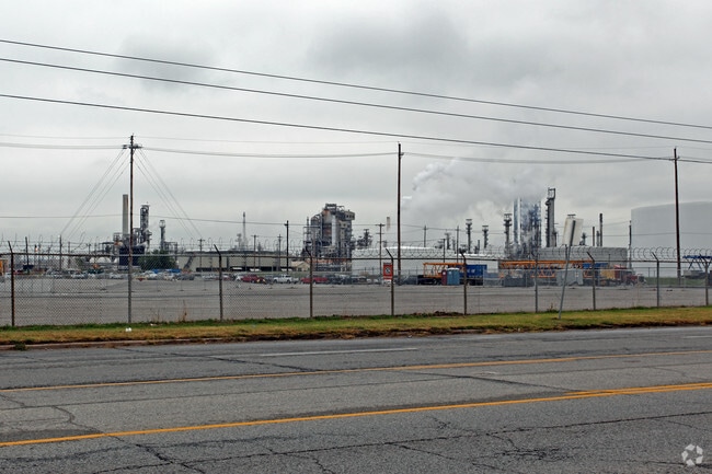
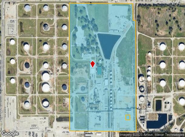
Property Record
902 W 25Th St, Tulsa, OK 74107
NEARBY LISTINGS FOR SALE OR LEASE
Property Detail
902 W 25Th St
99214-92-14-22980
Unplatted
Officebuilding
W/2 SE & W50 S2240 E/2 SE LESS BEG 240.4N & 78W SECR W/2 SE TH W87 N93 E87 S93 POB SEC 14 19 12 82.385ACS
X
Tulsa
40143C0332L
Oklahoma
2025
82.39 AC
2025
West
004900
Tulsa
107,989 SF
Tulsa, OK
DEMOGRAPHICS near 902 W 25Th St
1 mile
3 mile
5 mile
2024 Total Population
2,837
57,943
176,778
2029 Population
2,898
60,483
184,183
Pop Growth 2024-2029
+ 2.15%
+ 4.38%
+ 4.19%
Average Age
37
41
39
2024 Total Households
1,296
27,370
78,917
HH Growth 2024-2029
+ 2.93%
+ 4.69%
+ 4.31%
Median Household Inc
$37,395
$56,860
$50,865
Avg Household Size
2.10
2.00
2.10
2024 Avg HH Vehicles
1.00
2.00
2.00
Median Home Value
$317,460
$257,130
$176,223
Median Year Built
1971
1957
1962
Nearby Places
Map Layers
Map Styles
 Street
 Aerial
Transit
 Traffic
 Biking
Places
Listings with unknown addresses are not visible on the map
- Restaurants
- Banks
- Shops
- Fitness
- Groceries
PUBLIC TRANSPORTATION
AIRPORT
Tulsa International
Drive
Walk
Distance
Tulsa International
21 min
12.2 mi
Freight Ports
Tulsa Port Of Catoosa
Drive
Walk
Distance
Tulsa Port Of Catoosa
31 min
21.5 mi
Nearby Properties
Address
Land Use
TOTAL SIZE
Lot Size
Zoning
Address
Land Use
TOTAL SIZE
Lot Size
Zoning
565,000 SF
10.62 AC
CBD
Address
Land Use
TOTAL SIZE
Lot Size
Zoning
1,303,210 SF
7.94 AC
OH
Address
Land Use
TOTAL SIZE
Lot Size
Zoning
249,092 SF
11.75 AC
CBD
Address
Land Use
TOTAL SIZE
Lot Size
Zoning
692,068 SF
1.03 AC
CBD
Address
Land Use
TOTAL SIZE
Lot Size
Zoning
423,825 SF
23.97 AC
CBD
Address
Land Use
TOTAL SIZE
Lot Size
Zoning
483,697 SF
5.31 AC
CBD
Address
Land Use
TOTAL SIZE
Lot Size
Zoning
247,806 SF
8.40 AC
RS3
Address
Land Use
TOTAL SIZE
Lot Size
Zoning
49,992 SF
33.23 AC
AG
Address
Land Use
TOTAL SIZE
Lot Size
Zoning
528,432 SF
0.01 AC
CBD
Address
Land Use
TOTAL SIZE
Lot Size
Zoning
110,922 SF
1.59 AC
RM2
Address
Land Use
TOTAL SIZE
Lot Size
Zoning
74,284 SF
3.61 AC
IM
Address
Land Use
TOTAL SIZE
Lot Size
Zoning
254,800 SF
2.07 AC
CBD
Address
Land Use
TOTAL SIZE
Lot Size
Zoning
132,305 SF
2.07 AC
CBD
Address
Land Use
TOTAL SIZE
Lot Size
Zoning
114,791 SF
23.40 AC
RE
Address
Land Use
TOTAL SIZE
Lot Size
Zoning
87,606 SF
8.25 AC
CBD
Address
Land Use
TOTAL SIZE
Lot Size
Zoning
238,884 SF
38.79 AC
RS2
Address
Land Use
TOTAL SIZE
Lot Size
Zoning
303 SF
33.64 AC
RS2
Address
Land Use
TOTAL SIZE
Lot Size
Zoning
266,944 SF
2.07 AC
CBD
Address
Land Use
TOTAL SIZE
Lot Size
Zoning
124,033 SF
4.18 AC
CBD
Address
Land Use
TOTAL SIZE
Lot Size
Zoning
315,434 SF
2.07 AC
CBD
Address
Land Use
TOTAL SIZE
Lot Size
Zoning
355,620 SF
4.78 AC
CBD
Address
Land Use
TOTAL SIZE
Lot Size
Zoning
56,049 SF
1.14 AC
CBD
Address
Land Use
TOTAL SIZE
Lot Size
Zoning
1,264,325 SF
10.72 AC
CH
Address
Land Use
TOTAL SIZE
Lot Size
Zoning
84,560 SF
1.92 AC
CBD
Address
Land Use
TOTAL SIZE
Lot Size
Zoning
53,337 SF
3.34 AC
FBC
Address
Land Use
TOTAL SIZE
Lot Size
Zoning
60,320 SF
5.23 AC
NCU
Address
Land Use
TOTAL SIZE
Lot Size
Zoning
410,400 SF
1.76 AC
CBD
Address
Land Use
TOTAL SIZE
Lot Size
Zoning
1,298,531 SF
2.49 AC
CBD
Address
Land Use
TOTAL SIZE
Lot Size
Zoning
137,215 SF
5.08 AC
RM3
Address
Land Use
TOTAL SIZE
Lot Size
Zoning
236,413 SF
2.07 AC
CBD
The World's #1 Commercial Real Estate Marketplace
Connect with us
© 2026 CoStar Group
The information above has been obtained from sources believed reliable. While we do not doubt its accuracy we have not verified it and make no guarantee, warranty or representation about it. It is your responsibility to independently confirm its accuracy and completeness. Any projections, opinions, assumptions, or estimates used are for example only and do not represent the current or future performance of the property. The value of this transaction to you depends on tax and other factors which should be evaluated by your tax, financial, and legal advisors. You and your advisors should conduct a careful, independent investigation of the property to determine to your satisfaction the suitability of the property for your needs.