Property Record
9020 Beach Blvd, Jacksonville, FL 32216


NEARBY LISTINGS FOR SALE OR LEASE
Property Detail
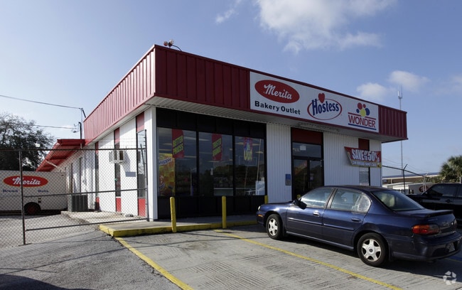
9020 Beach Blvd
Jacksonville, FL
Southside Estates Unit 03
123273-0000
18-74 35-2S-27E .99 SOUTHSIDE ESTATES UNIT NO 3 S/D LOT 2(EX STATE RD),LOT 3 BLK 17
Parkinglot
Duval
X
Florida
12031C0391H
2,3
2025
1.01 AC
2026
Butler Corridor
015927
Jacksonville (Florida)
4,960 SF
DEMOGRAPHICS near 9020 Beach Blvd
1 mile
3 mile
5 mile
2024 Total Population
6,832
87,064
229,252
2029 Population
7,096
91,033
240,907
Pop Growth 2024-2029
+ 3.86%
+ 4.56%
+ 5.08%
Average Age
39
38
37
2024 Total Households
2,715
36,228
95,028
HH Growth 2024-2029
+ 3.98%
+ 4.63%
+ 5.28%
Median Household Inc
$52,927
$56,275
$56,767
Avg Household Size
2.40
2.30
2.30
2024 Avg HH Vehicles
2.00
2.00
2.00
Median Home Value
$155,414
$188,162
$216,415
Median Year Built
1972
1986
1985
Nearby Places
Map Layers
Map Styles
 Street
 Aerial
Transit
 Traffic
 Biking
Places
Listings with unknown addresses are not visible on the map
- Restaurants
- Banks
- Shops
- Fitness
- Groceries
PUBLIC TRANSPORTATION
AIRPORT
Jacksonville International
Drive
Walk
Distance
Jacksonville International
31 min
20.2 mi
Freight Ports
Jacksonville Port
Drive
Walk
Distance
Jacksonville Port
16 min
8.6 mi
Nearby Properties
Address
Land Use
TOTAL SIZE
Lot Size
Zoning
Address
Land Use
TOTAL SIZE
Lot Size
Zoning
387,908 SF
32.59 AC
PUD
Address
Land Use
TOTAL SIZE
Lot Size
Zoning
1,037,304 SF
103.91 AC
PUD
Address
Land Use
TOTAL SIZE
Lot Size
Zoning
875,866 SF
22.33 AC
PBF-3
Address
Land Use
TOTAL SIZE
Lot Size
Zoning
251,691 SF
17.51 AC
PUD
Address
Land Use
TOTAL SIZE
Lot Size
Zoning
478,012 SF
29.87 AC
PUD
Address
Land Use
TOTAL SIZE
Lot Size
Zoning
419,299 SF
40.24 AC
PUD
Address
Land Use
TOTAL SIZE
Lot Size
Zoning
283,724 SF
28.50 AC
PUD
Address
Land Use
TOTAL SIZE
Lot Size
Zoning
371,466 SF
49.16 AC
PBF-2
Address
Land Use
TOTAL SIZE
Lot Size
Zoning
293,072 SF
16.52 AC
PUD
Address
Land Use
TOTAL SIZE
Lot Size
Zoning
186,482 SF
33.57 AC
PUD
Address
Land Use
TOTAL SIZE
Lot Size
Zoning
209,436 SF
14.38 AC
PUD
Address
Land Use
TOTAL SIZE
Lot Size
Zoning
565,202 SF
33.92 AC
RMD-D
Address
Land Use
TOTAL SIZE
Lot Size
Zoning
475,463 SF
37.20 AC
PUD
Address
Land Use
TOTAL SIZE
Lot Size
Zoning
255,951 SF
5.58 AC
PUD
Address
Land Use
TOTAL SIZE
Lot Size
Zoning
273,196 SF
16.57 AC
PUD
Address
Land Use
TOTAL SIZE
Lot Size
Zoning
306,416 SF
12.27 AC
PUD
Address
Land Use
TOTAL SIZE
Lot Size
Zoning
341,849 SF
15 AC
PUD
Address
Land Use
TOTAL SIZE
Lot Size
Zoning
217,557 SF
14.72 AC
PUD
Address
Land Use
TOTAL SIZE
Lot Size
Zoning
329,810 SF
33.39 AC
PUD
Address
Land Use
TOTAL SIZE
Lot Size
Zoning
171,972 SF
9 AC
PUD
Address
Land Use
TOTAL SIZE
Lot Size
Zoning
304,922 SF
26.28 AC
PUD
Address
Land Use
TOTAL SIZE
Lot Size
Zoning
426,575 SF
32.98 AC
PUD
Address
Land Use
TOTAL SIZE
Lot Size
Zoning
316,705 SF
15.44 AC
PUD
Address
Land Use
TOTAL SIZE
Lot Size
Zoning
408,283 SF
25.16 AC
RMD-D
Address
Land Use
TOTAL SIZE
Lot Size
Zoning
380,690 SF
6.68 AC
PUD
Address
Land Use
TOTAL SIZE
Lot Size
Zoning
281,793 SF
17.43 AC
PUD
Address
Land Use
TOTAL SIZE
Lot Size
Zoning
282,193 SF
18.68 AC
RMD-D
Address
Land Use
TOTAL SIZE
Lot Size
Zoning
430,668 SF
27.20 AC
RMD-D
Address
Land Use
TOTAL SIZE
Lot Size
Zoning
256,875 SF
32.76 AC
PUD
Address
Land Use
TOTAL SIZE
Lot Size
Zoning
62,183 SF
106.45 AC
RMD-MH
The World's #1 Commercial Real Estate Marketplace
Connect with us
© 2026 CoStar Group
The information above has been obtained from sources believed reliable. While we do not doubt its accuracy we have not verified it and make no guarantee, warranty or representation about it. It is your responsibility to independently confirm its accuracy and completeness. Any projections, opinions, assumptions, or estimates used are for example only and do not represent the current or future performance of the property. The value of this transaction to you depends on tax and other factors which should be evaluated by your tax, financial, and legal advisors. You and your advisors should conduct a careful, independent investigation of the property to determine to your satisfaction the suitability of the property for your needs.