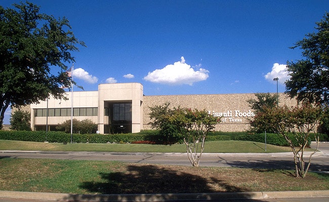
Property Record
9020 Sterling St, Irving, TX 75063

NEARBY LISTINGS FOR SALE OR LEASE
Property Detail
9020 Sterling St
Dallas-Fort Worth-Arlington, TX
Freeport Commerce Center
321280900A0020000
FREEPORT COMMERCE CENTER BLK A LT 2 ACS 6.838 INT201600314400 DD11042016 CO-DC 1280900A00200 1CI1280900A
Warehouse
Dallas
X
Texas
48113C0145K
2
2024
6.84 AC
2025
E DFW Air/Las Colinas
014124
Dallas/Ft Worth
56,376 SF
DEMOGRAPHICS near 9020 Sterling St
1 Mile
3 Mile
5 Mile
2024 Total Population
0
30,356
156,844
2029 Population
0
30,854
160,587
Pop Growth 2024-2029
0.00%
+ 1.64%
+ 2.39%
Average Age
0
36
36
2024 Total Households
0
11,028
62,611
HH Growth 2024-2029
0.00%
(0.18%)
+ 2.35%
Median Household Inc
$0
$117,698
$95,736
Avg Household Size
.00
2.70
2.50
2024 Avg HH Vehicles
.00
2.00
2.00
Median Home Value
$0
$461,659
$421,975
Median Year Built
0
2003
1994
Nearby Places
Map Layers
Map Styles
 Street
 Aerial
- Restaurants
- Banks
- Shops
- Fitness
- Groceries
PUBLIC TRANSPORTATION
COMMUTER RAIL
DRIVE
WALK
Distance
17 min
9.4 mi
AIRPORT
Dallas-Fort Worth International
DRIVE
WALK
Distance
Dallas-Fort Worth International
10 min
4.9 mi
Dallas Love Field
DRIVE
WALK
Distance
Dallas Love Field
25 min
15.9 mi
Nearby Properties
Address
Land Use
TOTAL SIZE
Lot Size
Zoning
Address
Land Use
TOTAL SIZE
Lot Size
Zoning
7,321,782 SF
0.01 AC
Z392
Address
Land Use
TOTAL SIZE
Lot Size
Zoning
3,604,594 SF
490.43 AC
Address
Land Use
TOTAL SIZE
Lot Size
Zoning
2,545,604 SF
123.01 AC
Z402
Address
Land Use
TOTAL SIZE
Lot Size
Zoning
1,325,709 SF
124.50 AC
Address
Land Use
TOTAL SIZE
Lot Size
Zoning
680,063 SF
36.51 AC
Address
Land Use
TOTAL SIZE
Lot Size
Zoning
432,986 SF
10.57 AC
Address
Land Use
TOTAL SIZE
Lot Size
Zoning
500,000 SF
99.10 AC
Address
Land Use
TOTAL SIZE
Lot Size
Zoning
768,494 SF
10.42 AC
Address
Land Use
TOTAL SIZE
Lot Size
Zoning
1,581,742 SF
53.48 AC
Z123
Address
Land Use
TOTAL SIZE
Lot Size
Zoning
190,223 SF
0.03 AC
Z392
Address
Land Use
TOTAL SIZE
Lot Size
Zoning
464,996 SF
18.43 AC
SP2
Address
Land Use
TOTAL SIZE
Lot Size
Zoning
808,352 SF
7.87 AC
Address
Land Use
TOTAL SIZE
Lot Size
Zoning
1,065,080 SF
49.57 AC
Z123
Address
Land Use
TOTAL SIZE
Lot Size
Zoning
1,076,400 SF
48.83 AC
Z01
Address
Land Use
TOTAL SIZE
Lot Size
Zoning
204,167 SF
68 AC
Z239
Address
Land Use
TOTAL SIZE
Lot Size
Zoning
389,286 SF
21.86 AC
Address
Land Use
TOTAL SIZE
Lot Size
Zoning
950,000 SF
45.32 AC
Z123
Address
Land Use
TOTAL SIZE
Lot Size
Zoning
426,365 SF
14.77 AC
Z239
Address
Land Use
TOTAL SIZE
Lot Size
Zoning
634,939 SF
52.29 AC
Z84
Address
Land Use
TOTAL SIZE
Lot Size
Zoning
184,186 SF
34.74 AC
Z31
Address
Land Use
TOTAL SIZE
Lot Size
Zoning
397,935 SF
10.65 AC
Address
Land Use
TOTAL SIZE
Lot Size
Zoning
779,551 SF
6.50 AC
Address
Land Use
TOTAL SIZE
Lot Size
Zoning
581,211 SF
9 AC
Z239
Address
Land Use
TOTAL SIZE
Lot Size
Zoning
367,000 SF
11.58 AC
Z84
Address
Land Use
TOTAL SIZE
Lot Size
Zoning
555,170 SF
3.32 AC
Z239
Address
Land Use
TOTAL SIZE
Lot Size
Zoning
263,119 SF
11.01 AC
Address
Land Use
TOTAL SIZE
Lot Size
Zoning
543,591 SF
5.08 AC
Z239
Address
Land Use
TOTAL SIZE
Lot Size
Zoning
329,353 SF
7.90 AC
Address
Land Use
TOTAL SIZE
Lot Size
Zoning
234,200 SF
274.75 AC
Address
Land Use
TOTAL SIZE
Lot Size
Zoning
714,010 SF
36.33 AC
Z31
The World's #1 Commercial Real Estate Marketplace
Connect with us
© 2026 CoStar Group
The information above has been obtained from sources believed reliable. While we do not doubt its accuracy we have not verified it and make no guarantee, warranty or representation about it. It is your responsibility to independently confirm its accuracy and completeness. Any projections, opinions, assumptions, or estimates used are for example only and do not represent the current or future performance of the property. The value of this transaction to you depends on tax and other factors which should be evaluated by your tax, financial, and legal advisors. You and your advisors should conduct a careful, independent investigation of the property to determine to your satisfaction the suitability of the property for your needs.