Property Record
9025 Us Highway 1 S, Bunnell, FL 32110

NEARBY LISTINGS FOR SALE OR LEASE
-
-
View all Bunnell listings for sale on LoopNet.com
Property Detail
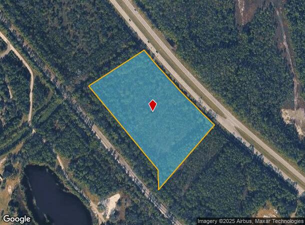
9025 Us Highway 1 S
Deltona-Daytona Beach-Ormond Beach, FL
Coastal Park Of Bunnell
21-13-31-0650-000A0-0020
8.13 ACRES BEING (4.29 ACRES LYING E OF FEC, W OF US-1 & WITHIN THE NE 1/4 OF SEC POR BEING THE NW CRNR SEC 22 THENCE SE APPROX 1329 TO WLY ROW US-1 & POB THENCE ALONG WLY ROW US-1 ALONG A CURVE GOING NW 110, LEAVING US-1 S571700W - 449.36 TO ELY ROW
Commercialacreage
Flagler
X
Florida
12035C0335E
2
2024
8.13 AC
2025
Daytona Area
060206
Other Market Areas
DEMOGRAPHICS near 9025 Us Highway 1 S
1 Mile
3 Mile
5 Mile
2024 Total Population
548
6,788
17,538
2029 Population
674
7,861
20,640
Pop Growth 2024-2029
+ 22.99%
+ 15.81%
+ 17.69%
Average Age
60
62
52
2024 Total Households
277
3,498
7,765
HH Growth 2024-2029
+ 22.02%
+ 15.58%
+ 16.93%
Median Household Inc
$83,928
$77,256
$73,415
Avg Household Size
2.00
1.90
2.20
2024 Avg HH Vehicles
2.00
2.00
2.00
Median Home Value
$411,309
$362,410
$317,408
Median Year Built
2003
2003
2003
Nearby Places
Map Layers
Map Styles
 Street
 Aerial
- Restaurants
- Banks
- Shops
- Fitness
- Groceries
PUBLIC TRANSPORTATION
AIRPORT
Daytona Beach International
DRIVE
WALK
Distance
Daytona Beach International
24 min
17.3 mi
Freight Ports
Jacksonville Port
DRIVE
WALK
Distance
Jacksonville Port
97 min
79.4 mi
SALE & LEASE HISTORY
LISTING DATE
SALE/LEASE

Jun 16, 2017
For Sale
Nearby Properties
Address
Land Use
TOTAL SIZE
Lot Size
Zoning
Address
Land Use
TOTAL SIZE
Lot Size
Zoning
196,932 SF
12.44 AC
BPUD
Address
Land Use
TOTAL SIZE
Lot Size
Zoning
209,984 SF
24.14 AC
I1
Address
Land Use
TOTAL SIZE
Lot Size
Zoning
106,488 SF
27.60 AC
MPUD
Address
Land Use
TOTAL SIZE
Lot Size
Zoning
229,050 SF
8.37 AC
I-C
Address
Land Use
TOTAL SIZE
Lot Size
Zoning
141,982 SF
8.09 AC
C-2
Address
Land Use
TOTAL SIZE
Lot Size
Zoning
13,724 SF
219.03 AC
RPUD
Address
Land Use
TOTAL SIZE
Lot Size
Zoning
44,123 SF
139.81 AC
PUD
Address
Land Use
TOTAL SIZE
Lot Size
Zoning
17,631 SF
5.47 AC
A2
Address
Land Use
TOTAL SIZE
Lot Size
Zoning
400 SF
24.11 AC
PUD
Address
Land Use
TOTAL SIZE
Lot Size
Zoning
31,277 SF
5.45 AC
BPUD
Address
Land Use
TOTAL SIZE
Lot Size
Zoning
54,596 SF
7.47 AC
PUD
Address
Land Use
TOTAL SIZE
Lot Size
Zoning
3,200 SF
824.39 AC
PUD
Address
Land Use
TOTAL SIZE
Lot Size
Zoning
57,230 SF
6.85 AC
01B6
Address
Land Use
TOTAL SIZE
Lot Size
Zoning
151,185 SF
28.90 AC
01I1
Address
Land Use
TOTAL SIZE
Lot Size
Zoning
130.59 AC
RPUD
Address
Land Use
TOTAL SIZE
Lot Size
Zoning
18,255 SF
14 AC
01I1
Address
Land Use
TOTAL SIZE
Lot Size
Zoning
28,686 SF
3.24 AC
BPUD
Address
Land Use
TOTAL SIZE
Lot Size
Zoning
51.60 AC
Address
Land Use
TOTAL SIZE
Lot Size
Zoning
68,280 SF
4.02 AC
Address
Land Use
TOTAL SIZE
Lot Size
Zoning
38.93 AC
PUD
Address
Land Use
TOTAL SIZE
Lot Size
Zoning
8,936 SF
9.07 AC
BPUD
Address
Land Use
TOTAL SIZE
Lot Size
Zoning
21,423 SF
4.46 AC
01B6
Address
Land Use
TOTAL SIZE
Lot Size
Zoning
36.68 AC
PUD
Address
Land Use
TOTAL SIZE
Lot Size
Zoning
29,729 SF
19.27 AC
AC
Address
Land Use
TOTAL SIZE
Lot Size
Zoning
37,575 SF
11.71 AC
PUD
Address
Land Use
TOTAL SIZE
Lot Size
Zoning
10,220 SF
1.69 AC
BPUD
Address
Land Use
TOTAL SIZE
Lot Size
Zoning
9,580 SF
13.25 AC
PUD
Address
Land Use
TOTAL SIZE
Lot Size
Zoning
391 SF
19.69 AC
PUD
Address
Land Use
TOTAL SIZE
Lot Size
Zoning
13,056 SF
98.01 AC
PUD
Address
Land Use
TOTAL SIZE
Lot Size
Zoning
14,098 SF
5.32 AC
01I1
The World's #1 Commercial Real Estate Marketplace
Connect with us
© 2025 CoStar Group
The information above has been obtained from sources believed reliable. While we do not doubt its accuracy we have not verified it and make no guarantee, warranty or representation about it. It is your responsibility to independently confirm its accuracy and completeness. Any projections, opinions, assumptions, or estimates used are for example only and do not represent the current or future performance of the property. The value of this transaction to you depends on tax and other factors which should be evaluated by your tax, financial, and legal advisors. You and your advisors should conduct a careful, independent investigation of the property to determine to your satisfaction the suitability of the property for your needs.