Property Record
903 W Parker Rd, Plano, TX 75023
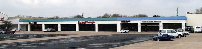

Property Detail
903 W Parker Rd
R-1441-01A-002R-1
VILLAGE SQUARE ADDITION NO 3, BLK 1A, LOT 2R
Commercialnec
COLLIN
R
Texas
B and X Area of moderate flood hazard, usually the area between the limits of the 100-year and 500-year floods.
2r
2025
1.79 AC
2025
Central Plano
031611
Dallas/Ft Worth
25,720 SF
Dallas-Fort Worth-Arlington, TX
NEARBY LISTINGS FOR SALE OR LEASE
DEMOGRAPHICS near 903 W Parker Rd
1 mile
3 mile
5 mile
2025 Total Population
13,910
129,152
348,382
2030 Population
15,686
146,262
392,804
Pop Growth 2025-2030
+ 12.77%
+ 13.25%
+ 12.75%
Average Age
41
40
40
2025 Total Households
5,133
50,208
133,543
HH Growth 2025-2030
+ 12.94%
+ 13.58%
+ 13.19%
Median Household Inc
$107,072
$98,166
$106,505
Avg Household Size
2.60
2.50
2.50
2025 Avg HH Vehicles
2.00
2.00
2.00
Median Home Value
$362,985
$418,043
$476,154
Median Year Built
1981
1985
1992
Nearby Places
Map Layers
Map Styles
 Street
 Aerial
Transit
 Traffic
 Biking
Places
Listings with unknown addresses are not visible on the map
- Restaurants
- Banks
- Shops
- Fitness
- Groceries
PUBLIC TRANSPORTATION
AIRPORT
Dallas Love Field
Drive
Walk
Distance
Dallas Love Field
31 min
22.0 mi
Dallas-Fort Worth International
Drive
Walk
Distance
Dallas-Fort Worth International
38 min
30.0 mi
Nearby Properties
Address
Land Use
TOTAL SIZE
Lot Size
Zoning
Address
Land Use
TOTAL SIZE
Lot Size
Zoning
1,049,441 SF
Address
Land Use
TOTAL SIZE
Lot Size
Zoning
1,283,376 SF
11.62 AC
Address
Land Use
TOTAL SIZE
Lot Size
Zoning
567,715 SF
4.75 AC
LC/PD-A
Address
Land Use
TOTAL SIZE
Lot Size
Zoning
1,105,509 SF
92.46 AC
A
Address
Land Use
TOTAL SIZE
Lot Size
Zoning
606,071 SF
64.75 AC
SFR
Address
Land Use
TOTAL SIZE
Lot Size
Zoning
384,538 SF
2.63 AC
LI-1
Address
Land Use
TOTAL SIZE
Lot Size
Zoning
341,492 SF
25.20 AC
SFR
Address
Land Use
TOTAL SIZE
Lot Size
Zoning
528,996 SF
26.35 AC
R
Address
Land Use
TOTAL SIZE
Lot Size
Zoning
442,484 SF
APTS
Address
Land Use
TOTAL SIZE
Lot Size
Zoning
377,152 SF
3.91 AC
O-S
Address
Land Use
TOTAL SIZE
Lot Size
Zoning
509,566 SF
34.05 AC
PD
Address
Land Use
TOTAL SIZE
Lot Size
Zoning
289,093 SF
8.87 AC
R/O-2
Address
Land Use
TOTAL SIZE
Lot Size
Zoning
284,830 SF
2.98 AC
Address
Land Use
TOTAL SIZE
Lot Size
Zoning
617,776 SF
97.53 AC
A
Address
Land Use
TOTAL SIZE
Lot Size
Zoning
421,532 SF
4.29 AC
Address
Land Use
TOTAL SIZE
Lot Size
Zoning
308,854 SF
16.62 AC
Address
Land Use
TOTAL SIZE
Lot Size
Zoning
445,959 SF
4.55 AC
MF-E
Address
Land Use
TOTAL SIZE
Lot Size
Zoning
64.94 AC
Address
Land Use
TOTAL SIZE
Lot Size
Zoning
460,233 SF
10.31 AC
CC
Address
Land Use
TOTAL SIZE
Lot Size
Zoning
408,256 SF
27.66 AC
MF-M
Address
Land Use
TOTAL SIZE
Lot Size
Zoning
417,173 SF
4.48 AC
O-S
Address
Land Use
TOTAL SIZE
Lot Size
Zoning
400,049 SF
34.67 AC
MF-L
Address
Land Use
TOTAL SIZE
Lot Size
Zoning
457,656 SF
23.19 AC
MF-H
Address
Land Use
TOTAL SIZE
Lot Size
Zoning
297,331 SF
3.77 AC
Address
Land Use
TOTAL SIZE
Lot Size
Zoning
216,665 SF
12.17 AC
Address
Land Use
TOTAL SIZE
Lot Size
Zoning
253,268 SF
4.54 AC
LC
Address
Land Use
TOTAL SIZE
Lot Size
Zoning
213,415 SF
16.94 AC
Address
Land Use
TOTAL SIZE
Lot Size
Zoning
381,372 SF
18.72 AC
MF-3
Address
Land Use
TOTAL SIZE
Lot Size
Zoning
326,481 SF
2.94 AC
BG
Address
Land Use
TOTAL SIZE
Lot Size
Zoning
291,184 SF
21.03 AC
MF-M
The World's #1 Commercial Real Estate Marketplace
Connect with us
© 2026 CoStar Group
The information above has been obtained from sources believed reliable. While we do not doubt its accuracy we have not verified it and make no guarantee, warranty or representation about it. It is your responsibility to independently confirm its accuracy and completeness. Any projections, opinions, assumptions, or estimates used are for example only and do not represent the current or future performance of the property. The value of this transaction to you depends on tax and other factors which should be evaluated by your tax, financial, and legal advisors. You and your advisors should conduct a careful, independent investigation of the property to determine to your satisfaction the suitability of the property for your needs.