Property Record
9030 Moore Rd, Littleton, CO 80125


Property Detail
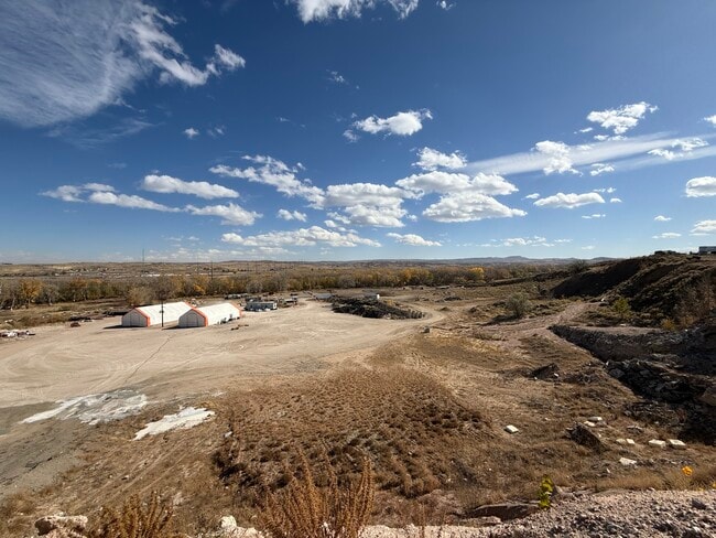
9030 Moore Rd
Denver-Aurora-Centennial, CO
LOT 3 LAWRENCE DEV 49.08 AM/L
2229-290-04-001
DOUGLAS
Industrialacreage
Colorado
A1
3
AE The base floodplain where base flood elevations are provided. AE Zones are now used on new format FIRMs instead of A1-A30 Zones.
49.08 AC
2024
Outlying Douglas County
2025
Denver
014205
NEARBY LISTINGS FOR SALE OR LEASE
DEMOGRAPHICS near 9030 Moore Rd
1 mile
3 mile
5 mile
2025 Total Population
2,164
21,731
81,755
2030 Population
2,496
23,667
88,006
Pop Growth 2025-2030
+ 15.34%
+ 8.91%
+ 7.65%
Average Age
44
40
41
2025 Total Households
808
7,372
29,621
HH Growth 2025-2030
+ 15.84%
+ 9.44%
+ 8.21%
Median Household Inc
$168,601
$163,835
$162,006
Avg Household Size
2.70
2.90
2.70
2025 Avg HH Vehicles
2.00
2.00
2.00
Median Home Value
$886,075
$837,505
$785,441
Median Year Built
2011
2002
1999
Nearby Places
Map Layers
Map Styles
 Street
 Aerial
Layers
 Traffic
 Biking
Places
Listings with unknown addresses are not visible on the map
- Restaurants
- Banks
- Shops
- Fitness
- Groceries
SALE & LEASE HISTORY
LISTING DATE
SALE/LEASE

Oct 30, 2024
For Sale
Dec 09, 2024
For Sale
Nearby Properties
Address
Land Use
TOTAL SIZE
Lot Size
Zoning
Address
Land Use
TOTAL SIZE
Lot Size
Zoning
206,000 SF
70 AC
PDU
Address
Land Use
TOTAL SIZE
Lot Size
Zoning
355,500 SF
12.30 AC
Address
Land Use
TOTAL SIZE
Lot Size
Zoning
68,751 SF
9.42 AC
PDU
Address
Land Use
TOTAL SIZE
Lot Size
Zoning
73,146 SF
10.15 AC
PDU
Address
Land Use
TOTAL SIZE
Lot Size
Zoning
2,414.50 AC
A1
Address
Land Use
TOTAL SIZE
Lot Size
Zoning
51,020 SF
10.19 AC
PDU
Address
Land Use
TOTAL SIZE
Lot Size
Zoning
53,448 SF
7.30 AC
PDU
Address
Land Use
TOTAL SIZE
Lot Size
Zoning
41,351 SF
3.41 AC
PDU
Address
Land Use
TOTAL SIZE
Lot Size
Zoning
30,296 SF
2.50 AC
Address
Land Use
TOTAL SIZE
Lot Size
Zoning
41,888 SF
154.73 AC
PDNU
Address
Land Use
TOTAL SIZE
Lot Size
Zoning
35,297 SF
7.14 AC
GI
Address
Land Use
TOTAL SIZE
Lot Size
Zoning
34,424 SF
22.47 AC
Address
Land Use
TOTAL SIZE
Lot Size
Zoning
12.51 AC
Address
Land Use
TOTAL SIZE
Lot Size
Zoning
10,800 SF
0.92 AC
PDU
Address
Land Use
TOTAL SIZE
Lot Size
Zoning
2,338 SF
320 AC
A1
Address
Land Use
TOTAL SIZE
Lot Size
Zoning
44,203 SF
4.76 AC
PDU
Address
Land Use
TOTAL SIZE
Lot Size
Zoning
5,000 SF
36.99 AC
PDU
Address
Land Use
TOTAL SIZE
Lot Size
Zoning
57,879 SF
2.83 AC
PDU
Address
Land Use
TOTAL SIZE
Lot Size
Zoning
8,770 SF
40.75 AC
Address
Land Use
TOTAL SIZE
Lot Size
Zoning
30,357 SF
1.90 AC
GI
Address
Land Use
TOTAL SIZE
Lot Size
Zoning
22,595 SF
2.21 AC
GI
Address
Land Use
TOTAL SIZE
Lot Size
Zoning
31,428 SF
2.62 AC
GI
Address
Land Use
TOTAL SIZE
Lot Size
Zoning
14,364 SF
1.83 AC
PDU
Address
Land Use
TOTAL SIZE
Lot Size
Zoning
33,218 SF
2.73 AC
GI
Address
Land Use
TOTAL SIZE
Lot Size
Zoning
20,732 SF
2.97 AC
GI
Address
Land Use
TOTAL SIZE
Lot Size
Zoning
20,000 SF
2.79 AC
GI
Address
Land Use
TOTAL SIZE
Lot Size
Zoning
29,949 SF
79.43 AC
GI
Address
Land Use
TOTAL SIZE
Lot Size
Zoning
14,446 SF
0.93 AC
Address
Land Use
TOTAL SIZE
Lot Size
Zoning
15,764 SF
2.20 AC
GI
The World's #1 Commercial Real Estate Marketplace
Connect with us
© 2026 CoStar Group
The information above has been obtained from sources believed reliable. While we do not doubt its accuracy we have not verified it and make no guarantee, warranty or representation about it. It is your responsibility to independently confirm its accuracy and completeness. Any projections, opinions, assumptions, or estimates used are for example only and do not represent the current or future performance of the property. The value of this transaction to you depends on tax and other factors which should be evaluated by your tax, financial, and legal advisors. You and your advisors should conduct a careful, independent investigation of the property to determine to your satisfaction the suitability of the property for your needs.