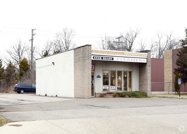
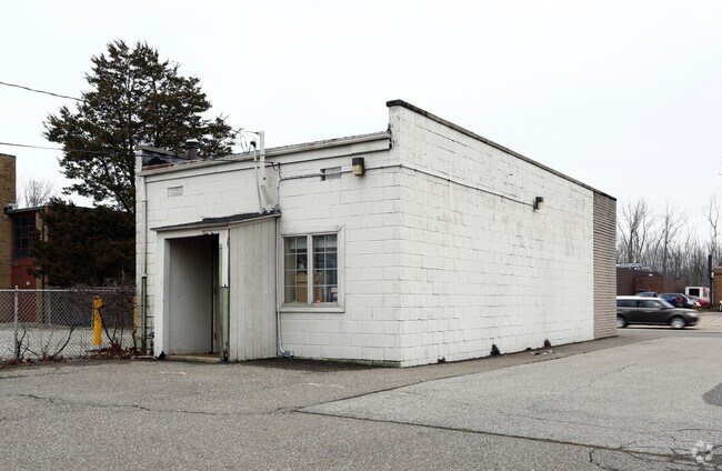
Property Record
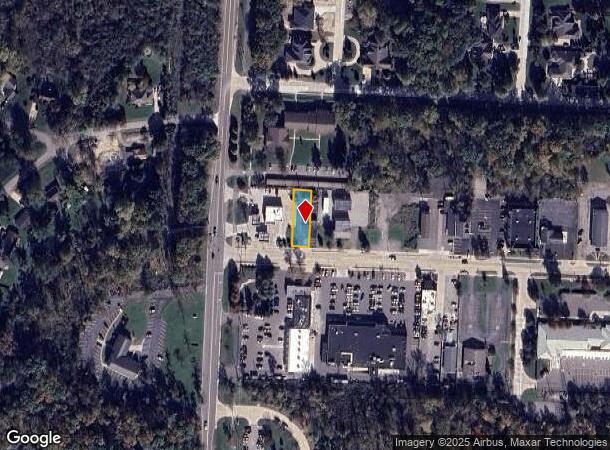
9036 Macomb St, Grosse Ile, MI 48138
NEARBY LISTINGS FOR SALE OR LEASE
Property Detail
9036 Macomb St
Detroit-Warren-Dearborn, MI
Gray Woods
73-029-01-0050-000
552E50 LOT 50 GRAY WOODS SUB PC 552 L55 P63 WCR
Drycleanerlaundryservice
Wayne
X
Michigan
26163C0418F
50
2025
0.19 AC
2025
Downriver South
596200
Detroit
880 SF
DEMOGRAPHICS near 9036 Macomb St
1 Mile
3 Mile
5 Mile
2024 Total Population
3,331
27,209
71,595
2029 Population
3,205
26,119
68,562
Pop Growth 2024-2029
(3.78%)
(4.01%)
(4.24%)
Average Age
46
45
44
2024 Total Households
1,368
11,734
30,580
HH Growth 2024-2029
(3.80%)
(4.06%)
(4.26%)
Median Household Inc
$119,938
$90,502
$76,809
Avg Household Size
2.40
2.30
2.30
2024 Avg HH Vehicles
2.00
2.00
2.00
Median Home Value
$363,898
$238,186
$198,369
Median Year Built
1975
1966
1969
Nearby Places
Map Layers
Map Styles
 Street
 Aerial
- Restaurants
- Banks
- Shops
- Fitness
- Groceries
PUBLIC TRANSPORTATION
AIRPORT
Detroit Metro Wayne County
DRIVE
WALK
Distance
Detroit Metro Wayne County
29 min
17.4 mi
Windsor International
DRIVE
WALK
Distance
Windsor International
54 min
32.9 mi
Freight Ports
Port of Toledo
DRIVE
WALK
Distance
Port of Toledo
60 min
44.3 mi
Nearby Properties
Address
Land Use
TOTAL SIZE
Lot Size
Zoning
Address
Land Use
TOTAL SIZE
Lot Size
Zoning
2,651,867 SF
137.23 AC
I-3
Address
Land Use
TOTAL SIZE
Lot Size
Zoning
155,600 SF
83.84 AC
R1
Address
Land Use
TOTAL SIZE
Lot Size
Zoning
150,224 SF
15.45 AC
RM-1
Address
Land Use
TOTAL SIZE
Lot Size
Zoning
2,160 SF
334.88 AC
I1
Address
Land Use
TOTAL SIZE
Lot Size
Zoning
143,496 SF
3.73 AC
RM-2
Address
Land Use
TOTAL SIZE
Lot Size
Zoning
169,192 SF
11.90 AC
R1
Address
Land Use
TOTAL SIZE
Lot Size
Zoning
18,678 SF
3.10 AC
R1-ONE
Address
Land Use
TOTAL SIZE
Lot Size
Zoning
58,149 SF
11.40 AC
B2-COM
Address
Land Use
TOTAL SIZE
Lot Size
Zoning
62,039 SF
Address
Land Use
TOTAL SIZE
Lot Size
Zoning
131,935 SF
6.71 AC
RM1-MUL
Address
Land Use
TOTAL SIZE
Lot Size
Zoning
144,188 SF
8.56 AC
RM1-MUL
Address
Land Use
TOTAL SIZE
Lot Size
Zoning
60 SF
3.83 AC
PCA
Address
Land Use
TOTAL SIZE
Lot Size
Zoning
551,184 SF
RESIDE
Address
Land Use
TOTAL SIZE
Lot Size
Zoning
551,184 SF
42.34 AC
RESIDE
Address
Land Use
TOTAL SIZE
Lot Size
Zoning
137,982 SF
7.33 AC
RM1-MUL
Address
Land Use
TOTAL SIZE
Lot Size
Zoning
16.38 AC
OR-1
Address
Land Use
TOTAL SIZE
Lot Size
Zoning
40,136 SF
42.97 AC
R-1-D
Address
Land Use
TOTAL SIZE
Lot Size
Zoning
112,520 SF
4.90 AC
RM1-MUL
Address
Land Use
TOTAL SIZE
Lot Size
Zoning
92.87 AC
Address
Land Use
TOTAL SIZE
Lot Size
Zoning
65,435 SF
24.77 AC
RESIDE
Address
Land Use
TOTAL SIZE
Lot Size
Zoning
19,177 SF
R1-SING
Address
Land Use
TOTAL SIZE
Lot Size
Zoning
74,095 SF
5.94 AC
Address
Land Use
TOTAL SIZE
Lot Size
Zoning
53,214 SF
4.92 AC
B2
Address
Land Use
TOTAL SIZE
Lot Size
Zoning
47,056 SF
8.71 AC
M2-GENE
Address
Land Use
TOTAL SIZE
Lot Size
Zoning
133.65 AC
MU REDEV
Address
Land Use
TOTAL SIZE
Lot Size
Zoning
354,969 SF
23.78 AC
I2
Address
Land Use
TOTAL SIZE
Lot Size
Zoning
77.50 AC
Address
Land Use
TOTAL SIZE
Lot Size
Zoning
35,518 SF
1.21 AC
B2
Address
Land Use
TOTAL SIZE
Lot Size
Zoning
13.66 AC
Address
Land Use
TOTAL SIZE
Lot Size
Zoning
3,500 SF
106.18 AC
R-1-D
The World's #1 Commercial Real Estate Marketplace
Connect with us
© 2026 CoStar Group
The information above has been obtained from sources believed reliable. While we do not doubt its accuracy we have not verified it and make no guarantee, warranty or representation about it. It is your responsibility to independently confirm its accuracy and completeness. Any projections, opinions, assumptions, or estimates used are for example only and do not represent the current or future performance of the property. The value of this transaction to you depends on tax and other factors which should be evaluated by your tax, financial, and legal advisors. You and your advisors should conduct a careful, independent investigation of the property to determine to your satisfaction the suitability of the property for your needs.