Property Record
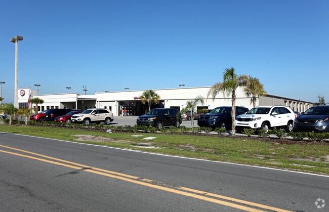
9039 Us Highway 441, Leesburg, FL 34788


NEARBY LISTINGS FOR SALE OR LEASE
Property Detail
9039 Us Highway 441
Orlando-Kissimmee-Sanford, FL
Silver Lake Estates
15-19-25-0105-000-01401
LEESBURG COUNTRY CLUB GATEWAY PB 14 PG 71 LOTS 14 15 16 17 18 AND SILVER LAKE ESTATES PB 10 PG 66-69 THAT PART OF LOT 3 BLK 52 DESCRIBED AS: FROM THE SOUTHWEST CORNER OF SECTION 15 TOWNSHIP 19 SOUTH RANGE 25 EAST RUN SOUTH 89-44-30 EAST 452.40 FEET T
Vehiclerentalsvehiclesales
Lake
X
Florida
12069C0333E
14
0
4.20 AC
2026
Lake County
030302
Orlando
19,656 SF
DEMOGRAPHICS near 9039 Us Highway 441
1 Mile
3 Mile
5 Mile
2024 Total Population
1,891
19,565
47,804
2029 Population
2,202
22,917
56,305
Pop Growth 2024-2029
+ 16.45%
+ 17.13%
+ 17.78%
Average Age
41
47
47
2024 Total Households
776
8,556
21,167
HH Growth 2024-2029
+ 16.37%
+ 16.97%
+ 17.81%
Median Household Inc
$59,619
$53,740
$50,572
Avg Household Size
2.40
2.30
2.20
2024 Avg HH Vehicles
2.00
2.00
2.00
Median Home Value
$276,829
$166,556
$169,122
Median Year Built
1991
1987
1986
Nearby Places
Map Layers
Map Styles
 Street
 Aerial
- Restaurants
- Banks
- Shops
- Fitness
- Groceries
Nearby Properties
Address
Land Use
TOTAL SIZE
Lot Size
Zoning
Address
Land Use
TOTAL SIZE
Lot Size
Zoning
137,651 SF
17.35 AC
RMRP
Address
Land Use
TOTAL SIZE
Lot Size
Zoning
131,655 SF
9.98 AC
RP
Address
Land Use
TOTAL SIZE
Lot Size
Zoning
5,760 SF
110.52 AC
R1
Address
Land Use
TOTAL SIZE
Lot Size
Zoning
546,456 SF
56.22 AC
RP
Address
Land Use
TOTAL SIZE
Lot Size
Zoning
972 SF
565.39 AC
A
Address
Land Use
TOTAL SIZE
Lot Size
Zoning
183,700 SF
11.66 AC
R2
Address
Land Use
TOTAL SIZE
Lot Size
Zoning
60,700 SF
784.12 AC
P
Address
Land Use
TOTAL SIZE
Lot Size
Zoning
137,622 SF
18.33 AC
C3
Address
Land Use
TOTAL SIZE
Lot Size
Zoning
39,164 SF
7.25 AC
Address
Land Use
TOTAL SIZE
Lot Size
Zoning
162,928 SF
9.52 AC
R3
Address
Land Use
TOTAL SIZE
Lot Size
Zoning
35,040 SF
5.36 AC
C3
Address
Land Use
TOTAL SIZE
Lot Size
Zoning
81,821 SF
12.30 AC
Address
Land Use
TOTAL SIZE
Lot Size
Zoning
40,776 SF
2.28 AC
C1
Address
Land Use
TOTAL SIZE
Lot Size
Zoning
48,478 SF
1.61 AC
CIP
Address
Land Use
TOTAL SIZE
Lot Size
Zoning
77,075 SF
4.66 AC
CP
Address
Land Use
TOTAL SIZE
Lot Size
Zoning
109,792 SF
11.83 AC
RMRP
Address
Land Use
TOTAL SIZE
Lot Size
Zoning
37,310 SF
4.39 AC
Address
Land Use
TOTAL SIZE
Lot Size
Zoning
37,983 SF
5.54 AC
C3
Address
Land Use
TOTAL SIZE
Lot Size
Zoning
124,495 SF
6.49 AC
R3
Address
Land Use
TOTAL SIZE
Lot Size
Zoning
69,172 SF
5.91 AC
C2
Address
Land Use
TOTAL SIZE
Lot Size
Zoning
32,704 SF
6.12 AC
R1
Address
Land Use
TOTAL SIZE
Lot Size
Zoning
20,559 SF
5.21 AC
Address
Land Use
TOTAL SIZE
Lot Size
Zoning
33,675 SF
2.74 AC
Address
Land Use
TOTAL SIZE
Lot Size
Zoning
53,312 SF
3.86 AC
RP
Address
Land Use
TOTAL SIZE
Lot Size
Zoning
32,823 SF
1.93 AC
C3
Address
Land Use
TOTAL SIZE
Lot Size
Zoning
55.05 AC
R1
Address
Land Use
TOTAL SIZE
Lot Size
Zoning
70,465 SF
3.86 AC
M1
Address
Land Use
TOTAL SIZE
Lot Size
Zoning
17,948 SF
3.10 AC
C3
Address
Land Use
TOTAL SIZE
Lot Size
Zoning
19,622 SF
4.56 AC
C3
Address
Land Use
TOTAL SIZE
Lot Size
Zoning
40,368 SF
5.52 AC
RP
The World's #1 Commercial Real Estate Marketplace
Connect with us
© 2026 CoStar Group
The information above has been obtained from sources believed reliable. While we do not doubt its accuracy we have not verified it and make no guarantee, warranty or representation about it. It is your responsibility to independently confirm its accuracy and completeness. Any projections, opinions, assumptions, or estimates used are for example only and do not represent the current or future performance of the property. The value of this transaction to you depends on tax and other factors which should be evaluated by your tax, financial, and legal advisors. You and your advisors should conduct a careful, independent investigation of the property to determine to your satisfaction the suitability of the property for your needs.