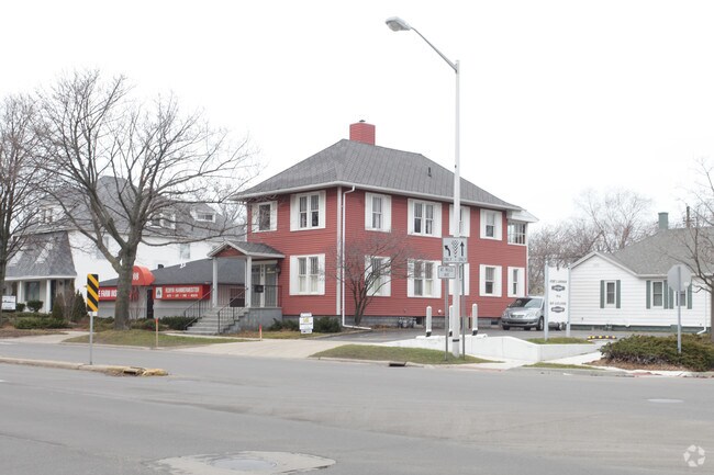
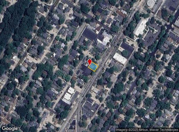
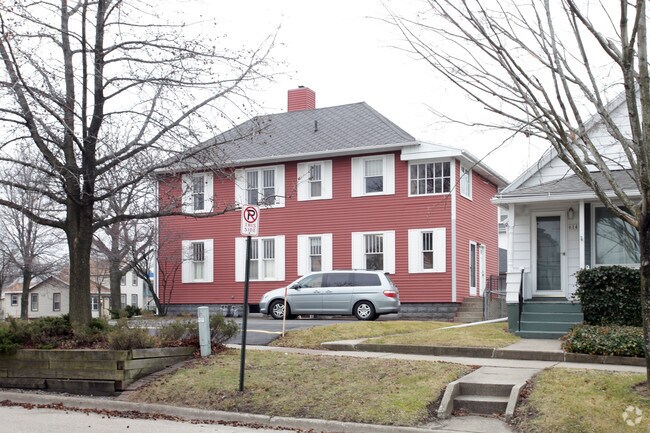
Property Record
904 Main St, Saint Joseph, MI 49085
NEARBY LISTINGS FOR SALE OR LEASE
Property Detail
904 Main St
11-76-3160-0104-00-5
Hoyts Add
Officebuilding
THE ELY 95'OF LOT 1 BLK 42 HOYT'S ADD TO CITY OF ST JOSEPH EXC COM ON NELY LN SD LOT 1, 60.6'NWLY FROM INT OF SD NELY LOT LN WITH SELY LN SD LOT 1 TH NWLY ON LOT LN 34.4'TH SWLY 64.3'TO A POINT 94.3'NWLY FROM SELY LN AS MEAS ON A LN PAR TO & 64.3' FR
X
Berrien
26021C0101D
Michigan
2024
1,6,60
2025
0.09 AC
000801
Other Market Areas
1,903 SF
Niles-Benton Harbor, MI
DEMOGRAPHICS near 904 Main St
1 Mile
3 Mile
5 Mile
2024 Total Population
4,969
28,684
45,088
2029 Population
4,889
28,367
44,438
Pop Growth 2024-2029
(1.61%)
(1.11%)
(1.44%)
Average Age
43
40
40
2024 Total Households
2,517
12,261
18,925
HH Growth 2024-2029
(1.83%)
(1.49%)
(1.75%)
Median Household Inc
$86,691
$44,815
$48,798
Avg Household Size
2.00
2.30
2.30
2024 Avg HH Vehicles
2.00
2.00
2.00
Median Home Value
$242,901
$178,962
$196,547
Median Year Built
1948
1958
1963
Nearby Places
Map Layers
Map Styles
 Street
 Aerial
- Restaurants
- Banks
- Shops
- Fitness
- Groceries
PUBLIC TRANSPORTATION
COMMUTER RAIL
St. Joseph-Benton Harbor Amtrak Station (Pere Marquette - Amtrak)
DRIVE
WALK
Distance
St. Joseph-Benton Harbor Amtrak Station (Pere Marquette - Amtrak)
3 min
9 min
0.5 mi
AIRPORT
South Bend International
DRIVE
WALK
Distance
South Bend International
52 min
34.1 mi
Freight Ports
Port Milwaukee
DRIVE
WALK
Distance
Port Milwaukee
218 min
180.7 mi
Nearby Properties
Address
Land Use
TOTAL SIZE
Lot Size
Zoning
Address
Land Use
TOTAL SIZE
Lot Size
Zoning
313,588 SF
11.48 AC
DISTRICT A
Address
Land Use
TOTAL SIZE
Lot Size
Zoning
216,232 SF
Address
Land Use
TOTAL SIZE
Lot Size
Zoning
Address
Land Use
TOTAL SIZE
Lot Size
Zoning
125,408 SF
4.66 AC
R-3
Address
Land Use
TOTAL SIZE
Lot Size
Zoning
89,062 SF
1.60 AC
W
Address
Land Use
TOTAL SIZE
Lot Size
Zoning
99,468 SF
10.07 AC
DISTRICT G
Address
Land Use
TOTAL SIZE
Lot Size
Zoning
87,978 SF
4.36 AC
R2 MDR
Address
Land Use
TOTAL SIZE
Lot Size
Zoning
73,680 SF
CO-A
Address
Land Use
TOTAL SIZE
Lot Size
Zoning
202,713 SF
14.23 AC
CO-A
Address
Land Use
TOTAL SIZE
Lot Size
Zoning
30,889 SF
2.83 AC
CO-A
Address
Land Use
TOTAL SIZE
Lot Size
Zoning
258,549 SF
17.20 AC
C MULTI
Address
Land Use
TOTAL SIZE
Lot Size
Zoning
53,504 SF
Address
Land Use
TOTAL SIZE
Lot Size
Zoning
69,750 SF
0.47 AC
D
Address
Land Use
TOTAL SIZE
Lot Size
Zoning
330,000 SF
20.56 AC
I1
Address
Land Use
TOTAL SIZE
Lot Size
Zoning
28,312 SF
4.30 AC
C
Address
Land Use
TOTAL SIZE
Lot Size
Zoning
93,032 SF
0.51 AC
D
Address
Land Use
TOTAL SIZE
Lot Size
Zoning
75,050 SF
5.33 AC
NONE
Address
Land Use
TOTAL SIZE
Lot Size
Zoning
82,567 SF
1.74 AC
D
Address
Land Use
TOTAL SIZE
Lot Size
Zoning
90,000 SF
7.62 AC
W
Address
Land Use
TOTAL SIZE
Lot Size
Zoning
519,203 SF
25.57 AC
C
Address
Land Use
TOTAL SIZE
Lot Size
Zoning
65,584 SF
6.52 AC
CO-A
Address
Land Use
TOTAL SIZE
Lot Size
Zoning
40,063 SF
9.78 AC
DISTRICT G
Address
Land Use
TOTAL SIZE
Lot Size
Zoning
25,080 SF
I-1
Address
Land Use
TOTAL SIZE
Lot Size
Zoning
70,617 SF
12 AC
E RESTRICT
Address
Land Use
TOTAL SIZE
Lot Size
Zoning
69,484 SF
8.08 AC
C MULTI
Address
Land Use
TOTAL SIZE
Lot Size
Zoning
18.05 AC
D1 COMM
Address
Land Use
TOTAL SIZE
Lot Size
Zoning
151,462 SF
9.96 AC
DISTRICT F
Address
Land Use
TOTAL SIZE
Lot Size
Zoning
55,753 SF
6 AC
DISTRICT D
Address
Land Use
TOTAL SIZE
Lot Size
Zoning
34,384 SF
2.76 AC
DISTRICT D
Address
Land Use
TOTAL SIZE
Lot Size
Zoning
70,321 SF
14.71 AC
C MULTI
The World's #1 Commercial Real Estate Marketplace
Connect with us
© 2025 CoStar Group
The information above has been obtained from sources believed reliable. While we do not doubt its accuracy we have not verified it and make no guarantee, warranty or representation about it. It is your responsibility to independently confirm its accuracy and completeness. Any projections, opinions, assumptions, or estimates used are for example only and do not represent the current or future performance of the property. The value of this transaction to you depends on tax and other factors which should be evaluated by your tax, financial, and legal advisors. You and your advisors should conduct a careful, independent investigation of the property to determine to your satisfaction the suitability of the property for your needs.