Property Record
9043 State Route 250 Se, Dennison, OH 44621
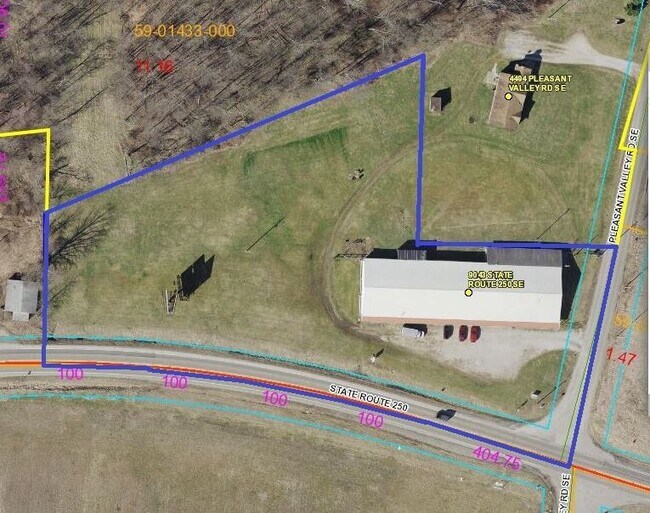


Property Detail
9043 State Route 250 Se
5901433000
7 14 20 PR SE 11.165A EXCEPT OIL,GAS, & MINERALS
Commercialnec
Tuscarawas
B and X Area of moderate flood hazard, usually the area between the limits of the 100-year and 500-year floods.
Ohio
2025
11.17 AC
2025
Ohio North Area
021600
Other Market Areas
15,802 SF
New Philadelphia-Dover, OH
NEARBY LISTINGS FOR SALE OR LEASE
DEMOGRAPHICS near 9043 State Route 250 Se
1 mile
3 mile
5 mile
2025 Total Population
164
4,656
13,072
2030 Population
161
4,651
13,110
Pop Growth 2025-2030
(1.83%)
(0.11%)
+ 0.29%
Average Age
42
39
40
2025 Total Households
67
1,816
5,233
HH Growth 2025-2030
(1.49%)
(0.22%)
+ 0.21%
Median Household Inc
$55,000
$54,806
$52,063
Avg Household Size
2.40
2.50
2.40
2025 Avg HH Vehicles
2.00
2.00
2.00
Median Home Value
$181,249
$104,244
$112,311
Median Year Built
1974
1955
1960
Nearby Places
Map Layers
Map Styles
 Street
 Aerial
Layers
 Traffic
 Biking
Places
Listings with unknown addresses are not visible on the map
- Restaurants
- Banks
- Shops
- Fitness
- Groceries
PUBLIC TRANSPORTATION
AIRPORT
Akron-Canton Regional
Drive
Walk
Distance
Akron-Canton Regional
55 min
47.4 mi
SALE & LEASE HISTORY
LISTING DATE
SALE/LEASE

Feb 02, 2022
For Sale
Nearby Properties
Address
Land Use
TOTAL SIZE
Lot Size
Zoning
Address
Land Use
TOTAL SIZE
Lot Size
Zoning
53,801 SF
10.76 AC
Address
Land Use
TOTAL SIZE
Lot Size
Zoning
Address
Land Use
TOTAL SIZE
Lot Size
Zoning
8,944 SF
76.79 AC
Address
Land Use
TOTAL SIZE
Lot Size
Zoning
12,856 SF
3.55 AC
Address
Land Use
TOTAL SIZE
Lot Size
Zoning
8,444 SF
3.30 AC
Address
Land Use
TOTAL SIZE
Lot Size
Zoning
7,542 SF
53.21 AC
Address
Land Use
TOTAL SIZE
Lot Size
Zoning
162.64 AC
Address
Land Use
TOTAL SIZE
Lot Size
Zoning
22,572 SF
5.34 AC
Address
Land Use
TOTAL SIZE
Lot Size
Zoning
6,676 SF
5.98 AC
Address
Land Use
TOTAL SIZE
Lot Size
Zoning
3,072 SF
20.24 AC
Address
Land Use
TOTAL SIZE
Lot Size
Zoning
174.97 AC
Address
Land Use
TOTAL SIZE
Lot Size
Zoning
3,760 SF
155.76 AC
Address
Land Use
TOTAL SIZE
Lot Size
Zoning
5,644 SF
12.34 AC
Address
Land Use
TOTAL SIZE
Lot Size
Zoning
5,376 SF
0.34 AC
Address
Land Use
TOTAL SIZE
Lot Size
Zoning
6,542 SF
93.99 AC
Address
Land Use
TOTAL SIZE
Lot Size
Zoning
4,774 SF
60.50 AC
Address
Land Use
TOTAL SIZE
Lot Size
Zoning
4,704 SF
83.97 AC
Address
Land Use
TOTAL SIZE
Lot Size
Zoning
2,994 SF
125.10 AC
Address
Land Use
TOTAL SIZE
Lot Size
Zoning
7,720 SF
13 AC
Address
Land Use
TOTAL SIZE
Lot Size
Zoning
600 SF
136.13 AC
Address
Land Use
TOTAL SIZE
Lot Size
Zoning
5,552 SF
31.79 AC
Address
Land Use
TOTAL SIZE
Lot Size
Zoning
3,728 SF
80.55 AC
Address
Land Use
TOTAL SIZE
Lot Size
Zoning
3,600 SF
22.16 AC
Address
Land Use
TOTAL SIZE
Lot Size
Zoning
4,586 SF
58.39 AC
Address
Land Use
TOTAL SIZE
Lot Size
Zoning
5,864 SF
30 AC
Address
Land Use
TOTAL SIZE
Lot Size
Zoning
5,840 SF
11.72 AC
Address
Land Use
TOTAL SIZE
Lot Size
Zoning
5,462 SF
15.94 AC
Address
Land Use
TOTAL SIZE
Lot Size
Zoning
3,204 SF
81.02 AC
Address
Land Use
TOTAL SIZE
Lot Size
Zoning
4,318 SF
54.90 AC
The World's #1 Commercial Real Estate Marketplace
Connect with us
© 2026 CoStar Group
The information above has been obtained from sources believed reliable. While we do not doubt its accuracy we have not verified it and make no guarantee, warranty or representation about it. It is your responsibility to independently confirm its accuracy and completeness. Any projections, opinions, assumptions, or estimates used are for example only and do not represent the current or future performance of the property. The value of this transaction to you depends on tax and other factors which should be evaluated by your tax, financial, and legal advisors. You and your advisors should conduct a careful, independent investigation of the property to determine to your satisfaction the suitability of the property for your needs.