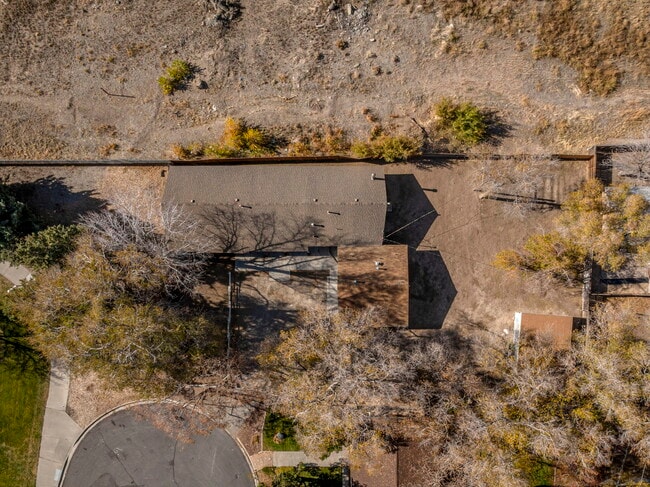
Property Record
905 Mauldin Ln, Reno, NV 89502
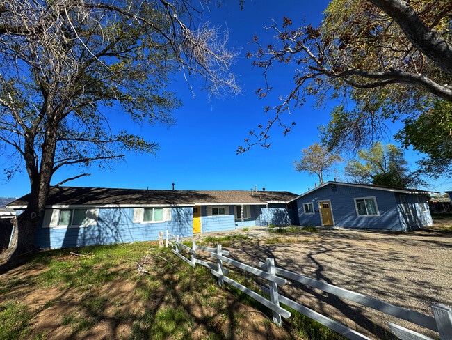
This Property Is For Sale
NEARBY LISTINGS FOR SALE OR LEASE
Property Detail
905 Mauldin Ln
Reno, NV
_Unspecified
020-313-19
Washoe
Duplex
Nevada
X
0.33 AC
32031C3231G
Convention Center
2,727 SF
Reno/Sparks
DEMOGRAPHICS near 905 Mauldin Ln
1 Mile
3 Mile
5 Mile
2024 Total Population
16,846
85,834
223,469
2029 Population
17,850
91,254
238,020
Pop Growth 2024-2029
+ 5.96%
+ 6.31%
+ 6.51%
Average Age
35
41
40
2024 Total Households
6,335
37,803
94,852
HH Growth 2024-2029
+ 6.17%
+ 6.51%
+ 6.72%
Median Household Inc
$57,960
$67,535
$70,353
Avg Household Size
2.60
2.20
2.20
2024 Avg HH Vehicles
1.00
2.00
2.00
Median Home Value
$145,289
$525,705
$538,805
Median Year Built
1976
1977
1981
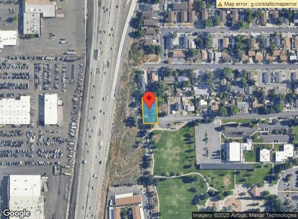
Nearby Places
Map Layers
Map Styles
 Street
 Aerial
- Restaurants
- Banks
- Shops
- Fitness
- Groceries
PUBLIC TRANSPORTATION
COMMUTER RAIL
DRIVE
WALK
Distance
10 min
4.5 mi
AIRPORT
Reno/Tahoe International
DRIVE
WALK
Distance
Reno/Tahoe International
9 min
4.6 mi
Nearby Properties
Address
Land Use
TOTAL SIZE
Lot Size
Zoning
Address
Land Use
TOTAL SIZE
Lot Size
Zoning
2,041,608 SF
28.47 AC
MU
Address
Land Use
TOTAL SIZE
Lot Size
Zoning
1,638,272 SF
17.11 AC
MU
Address
Land Use
TOTAL SIZE
Lot Size
Zoning
762,384 SF
1,131.28 AC
MA
Address
Land Use
TOTAL SIZE
Lot Size
Zoning
1,103,124 SF
138.61 AC
MU
Address
Land Use
TOTAL SIZE
Lot Size
Zoning
799,762 SF
13.30 AC
MU
Address
Land Use
TOTAL SIZE
Lot Size
Zoning
390,743 SF
22.20 AC
IC
Address
Land Use
TOTAL SIZE
Lot Size
Zoning
1,048,514 SF
1.30 AC
MU
Address
Land Use
TOTAL SIZE
Lot Size
Zoning
1,051,043 SF
78.81 AC
PD
Address
Land Use
TOTAL SIZE
Lot Size
Zoning
425,118 SF
30.37 AC
IC
Address
Land Use
TOTAL SIZE
Lot Size
Zoning
759,161 SF
37.37 AC
MU
Address
Land Use
TOTAL SIZE
Lot Size
Zoning
991,800 SF
51.03 AC
PD
Address
Land Use
TOTAL SIZE
Lot Size
Zoning
893,055 SF
52.71 AC
MA
Address
Land Use
TOTAL SIZE
Lot Size
Zoning
451,635 SF
15 AC
PD
Address
Land Use
TOTAL SIZE
Lot Size
Zoning
497,928 SF
3.52 AC
MU
Address
Land Use
TOTAL SIZE
Lot Size
Zoning
645,699 SF
4.53 AC
MU
Address
Land Use
TOTAL SIZE
Lot Size
Zoning
421,744 SF
12.07 AC
MS
Address
Land Use
TOTAL SIZE
Lot Size
Zoning
296,048 SF
93.65 AC
PF
Address
Land Use
TOTAL SIZE
Lot Size
Zoning
500,079 SF
45.66 AC
SPD
Address
Land Use
TOTAL SIZE
Lot Size
Zoning
342,019 SF
23.32 AC
MF14
Address
Land Use
TOTAL SIZE
Lot Size
Zoning
109,936 SF
1.80 AC
MD-RD
Address
Land Use
TOTAL SIZE
Lot Size
Zoning
366,641 SF
37.91 AC
MA
Address
Land Use
TOTAL SIZE
Lot Size
Zoning
209,748 SF
3.88 AC
MD-RD
Address
Land Use
TOTAL SIZE
Lot Size
Zoning
231,329 SF
8.37 AC
GC
Address
Land Use
TOTAL SIZE
Lot Size
Zoning
591,000 SF
5.46 AC
MU
Address
Land Use
TOTAL SIZE
Lot Size
Zoning
34,503 SF
30.82 AC
PF
Address
Land Use
TOTAL SIZE
Lot Size
Zoning
322,180 SF
2.87 AC
MU
Address
Land Use
TOTAL SIZE
Lot Size
Zoning
149,324 SF
4.34 AC
PD
Address
Land Use
TOTAL SIZE
Lot Size
Zoning
159,803 SF
0.60 AC
MD-RD
Address
Land Use
TOTAL SIZE
Lot Size
Zoning
519,840 SF
1.08 AC
MD-RD
Address
Land Use
TOTAL SIZE
Lot Size
Zoning
253,751 SF
1.02 AC
MD-RD
The World's #1 Commercial Real Estate Marketplace
Connect with us
© 2026 CoStar Group
The information above has been obtained from sources believed reliable. While we do not doubt its accuracy we have not verified it and make no guarantee, warranty or representation about it. It is your responsibility to independently confirm its accuracy and completeness. Any projections, opinions, assumptions, or estimates used are for example only and do not represent the current or future performance of the property. The value of this transaction to you depends on tax and other factors which should be evaluated by your tax, financial, and legal advisors. You and your advisors should conduct a careful, independent investigation of the property to determine to your satisfaction the suitability of the property for your needs.