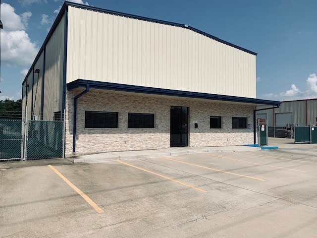
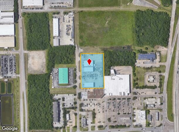
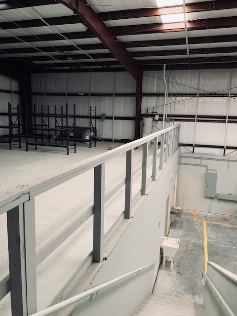
Property Record
905 S 14Th St, La Porte, TX 77571
NEARBY LISTINGS FOR SALE OR LEASE
Property Detail
905 S 14Th St
Houston-The Woodlands-Sugar Land, TX
La Porte
0241140660001
LTS 1 THRU 32 & TR A BLK 866 LA PORTE
Lightindustrial
Harris
X
Texas
48201C0945M
1-32
2024
2.44 AC
2025
East-Southeast Far
343700
Houston
16,500 SF
DEMOGRAPHICS near 905 S 14Th St
1 Mile
3 Mile
5 Mile
2024 Total Population
3,076
25,671
51,926
2029 Population
3,105
26,217
52,996
Pop Growth 2024-2029
+ 0.94%
+ 2.13%
+ 2.06%
Average Age
37
39
39
2024 Total Households
1,215
9,332
18,434
HH Growth 2024-2029
+ 0.16%
+ 1.97%
+ 2.00%
Median Household Inc
$61,170
$85,435
$89,384
Avg Household Size
2.50
2.70
2.80
2024 Avg HH Vehicles
2.00
2.00
2.00
Median Home Value
$177,480
$205,315
$224,837
Median Year Built
1983
1984
1985
Nearby Places
Map Layers
Map Styles
 Street
 Aerial
- Restaurants
- Banks
- Shops
- Fitness
- Groceries
PUBLIC TRANSPORTATION
AIRPORT
William P Hobby
DRIVE
WALK
Distance
William P Hobby
33 min
16.8 mi
George Bush Intcntl/Houston
DRIVE
WALK
Distance
George Bush Intcntl/Houston
48 min
37.5 mi
Freight Ports
Port of Houston
DRIVE
WALK
Distance
Port of Houston
30 min
20.4 mi
SALE & LEASE HISTORY
LISTING DATE
SALE/LEASE

Sep 26, 2016
For Lease
Feb 22, 2019
For Lease
Nearby Properties
Address
Land Use
TOTAL SIZE
Lot Size
Zoning
Address
Land Use
TOTAL SIZE
Lot Size
Zoning
45.75 AC
Address
Land Use
TOTAL SIZE
Lot Size
Zoning
45.78 AC
Address
Land Use
TOTAL SIZE
Lot Size
Zoning
179.52 AC
Address
Land Use
TOTAL SIZE
Lot Size
Zoning
38.27 AC
Address
Land Use
TOTAL SIZE
Lot Size
Zoning
Address
Land Use
TOTAL SIZE
Lot Size
Zoning
20.83 AC
Address
Land Use
TOTAL SIZE
Lot Size
Zoning
47.21 AC
Address
Land Use
TOTAL SIZE
Lot Size
Zoning
Address
Land Use
TOTAL SIZE
Lot Size
Zoning
156.07 AC
Address
Land Use
TOTAL SIZE
Lot Size
Zoning
Address
Land Use
TOTAL SIZE
Lot Size
Zoning
61.40 AC
Address
Land Use
TOTAL SIZE
Lot Size
Zoning
748,500 SF
42.13 AC
Address
Land Use
TOTAL SIZE
Lot Size
Zoning
610,402 SF
34.69 AC
Address
Land Use
TOTAL SIZE
Lot Size
Zoning
602,060 SF
34.15 AC
Address
Land Use
TOTAL SIZE
Lot Size
Zoning
30.58 AC
Address
Land Use
TOTAL SIZE
Lot Size
Zoning
348,294 SF
18.02 AC
Address
Land Use
TOTAL SIZE
Lot Size
Zoning
102.68 AC
Address
Land Use
TOTAL SIZE
Lot Size
Zoning
287,729 SF
20 AC
Address
Land Use
TOTAL SIZE
Lot Size
Zoning
40.14 AC
Address
Land Use
TOTAL SIZE
Lot Size
Zoning
416,005 SF
21.47 AC
Address
Land Use
TOTAL SIZE
Lot Size
Zoning
415,662 SF
21.49 AC
Address
Land Use
TOTAL SIZE
Lot Size
Zoning
371,072 SF
19.71 AC
Address
Land Use
TOTAL SIZE
Lot Size
Zoning
45.18 AC
Address
Land Use
TOTAL SIZE
Lot Size
Zoning
369,855 SF
21.68 AC
Address
Land Use
TOTAL SIZE
Lot Size
Zoning
306,482 SF
22.96 AC
Address
Land Use
TOTAL SIZE
Lot Size
Zoning
46.57 AC
Address
Land Use
TOTAL SIZE
Lot Size
Zoning
43.89 AC
Address
Land Use
TOTAL SIZE
Lot Size
Zoning
297,698 SF
19.14 AC
Address
Land Use
TOTAL SIZE
Lot Size
Zoning
289,475 SF
14.83 AC
Address
Land Use
TOTAL SIZE
Lot Size
Zoning
275,853 SF
14.42 AC
The World's #1 Commercial Real Estate Marketplace
Connect with us
© 2025 CoStar Group
The information above has been obtained from sources believed reliable. While we do not doubt its accuracy we have not verified it and make no guarantee, warranty or representation about it. It is your responsibility to independently confirm its accuracy and completeness. Any projections, opinions, assumptions, or estimates used are for example only and do not represent the current or future performance of the property. The value of this transaction to you depends on tax and other factors which should be evaluated by your tax, financial, and legal advisors. You and your advisors should conduct a careful, independent investigation of the property to determine to your satisfaction the suitability of the property for your needs.