Property Record
905 W Campbell Rd, Garland, TX 75044


NEARBY LISTINGS FOR SALE OR LEASE
-
-
NEQ President George Bush Turnpike & N Garland Ave
Garland, TX 75044
Rent Upon Request
1.22 AC Lots
Land
-
-
-
-
-
-
View all Garland listings for sale on LoopNet.com
Property Detail
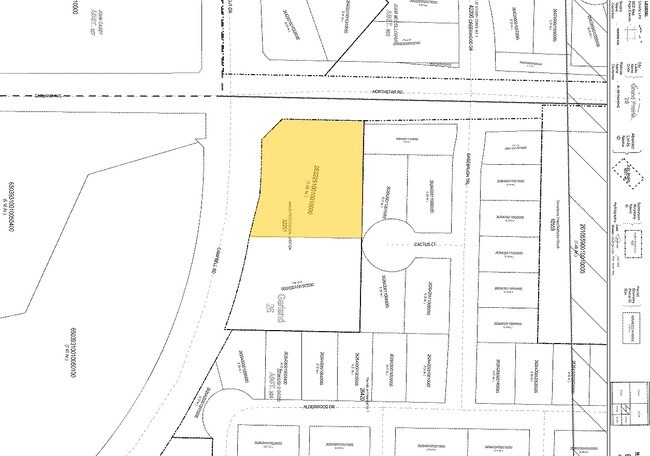
905 W Campbell Rd
Dallas-Fort Worth-Arlington, TX
Mason Professional
26322510010010000
MASON PROFESSIONAL BLK 1 LT 1 1.0597 ACS INT20080331703 DD10102008 CO-DC 3225100100100 2CG32251001
Animalhospitalvet
Dallas
X
Texas
48113C0210L
1
2024
1.06 AC
2025
Richardson
019042
Dallas/Ft Worth
6,705 SF
DEMOGRAPHICS near 905 W Campbell Rd
1 Mile
3 Mile
5 Mile
2024 Total Population
8,800
99,053
282,443
2029 Population
9,938
108,577
309,580
Pop Growth 2024-2029
+ 12.93%
+ 9.62%
+ 9.61%
Average Age
39
39
38
2024 Total Households
3,264
35,241
99,519
HH Growth 2024-2029
+ 11.95%
+ 9.21%
+ 9.81%
Median Household Inc
$132,387
$92,374
$85,572
Avg Household Size
2.60
2.70
2.80
2024 Avg HH Vehicles
2.00
2.00
2.00
Median Home Value
$455,935
$329,691
$295,629
Median Year Built
2009
1994
1991
Nearby Places
Map Layers
Map Styles
 Street
 Aerial
- Restaurants
- Banks
- Shops
- Fitness
- Groceries
PUBLIC TRANSPORTATION
AIRPORT
Dallas Love Field
DRIVE
WALK
Distance
Dallas Love Field
33 min
23.9 mi
Dallas-Fort Worth International
DRIVE
WALK
Distance
Dallas-Fort Worth International
38 min
31.9 mi
Freight Ports
Port of Shreveport
DRIVE
WALK
Distance
Port of Shreveport
221 min
198.8 mi
Nearby Properties
Address
Land Use
TOTAL SIZE
Lot Size
Zoning
Address
Land Use
TOTAL SIZE
Lot Size
Zoning
479,209 SF
19.97 AC
Address
Land Use
TOTAL SIZE
Lot Size
Zoning
453,635 SF
19.04 AC
RT
Address
Land Use
TOTAL SIZE
Lot Size
Zoning
630,247 SF
42 AC
Z239
Address
Land Use
TOTAL SIZE
Lot Size
Zoning
766,245 SF
49.94 AC
COMM
Address
Land Use
TOTAL SIZE
Lot Size
Zoning
164,843 SF
24.94 AC
Address
Land Use
TOTAL SIZE
Lot Size
Zoning
242,201 SF
14.54 AC
RT
Address
Land Use
TOTAL SIZE
Lot Size
Zoning
768,061 SF
42.03 AC
Z02
Address
Land Use
TOTAL SIZE
Lot Size
Zoning
650,164 SF
66.57 AC
Z02
Address
Land Use
TOTAL SIZE
Lot Size
Zoning
279,693 SF
19.86 AC
Z239
Address
Land Use
TOTAL SIZE
Lot Size
Zoning
548,300 SF
17.29 AC
Z239
Address
Land Use
TOTAL SIZE
Lot Size
Zoning
374,266 SF
19.42 AC
Z239
Address
Land Use
TOTAL SIZE
Lot Size
Zoning
360,673 SF
7.89 AC
PD-207 R
Address
Land Use
TOTAL SIZE
Lot Size
Zoning
502,554 SF
31.06 AC
MF-M
Address
Land Use
TOTAL SIZE
Lot Size
Zoning
353,347 SF
17 AC
Z02
Address
Land Use
TOTAL SIZE
Lot Size
Zoning
433,745 SF
15.18 AC
Z02
Address
Land Use
TOTAL SIZE
Lot Size
Zoning
450,481 SF
10.73 AC
PD-207 R
Address
Land Use
TOTAL SIZE
Lot Size
Zoning
137,772 SF
11.79 AC
LC/PD-A
Address
Land Use
TOTAL SIZE
Lot Size
Zoning
829,390 SF
66.56 AC
1-M-1
Address
Land Use
TOTAL SIZE
Lot Size
Zoning
310,382 SF
11.78 AC
Z148
Address
Land Use
TOTAL SIZE
Lot Size
Zoning
287,833 SF
9.81 AC
PD-207 R
Address
Land Use
TOTAL SIZE
Lot Size
Zoning
181,200 SF
15.11 AC
Address
Land Use
TOTAL SIZE
Lot Size
Zoning
388,059 SF
21.80 AC
Z239
Address
Land Use
TOTAL SIZE
Lot Size
Zoning
310,860 SF
21.88 AC
MF-M
Address
Land Use
TOTAL SIZE
Lot Size
Zoning
365,761 SF
22.88 AC
COMM
Address
Land Use
TOTAL SIZE
Lot Size
Zoning
342,658 SF
4.94 AC
Z239
Address
Land Use
TOTAL SIZE
Lot Size
Zoning
241,478 SF
7.86 AC
PD-207 R
Address
Land Use
TOTAL SIZE
Lot Size
Zoning
244,025 SF
17.80 AC
Z02
Address
Land Use
TOTAL SIZE
Lot Size
Zoning
331,684 SF
9.80 AC
Z148
Address
Land Use
TOTAL SIZE
Lot Size
Zoning
303,169 SF
19.67 AC
Z239
Address
Land Use
TOTAL SIZE
Lot Size
Zoning
403,206 SF
4 AC
Z239
The World's #1 Commercial Real Estate Marketplace
Connect with us
© 2026 CoStar Group
The information above has been obtained from sources believed reliable. While we do not doubt its accuracy we have not verified it and make no guarantee, warranty or representation about it. It is your responsibility to independently confirm its accuracy and completeness. Any projections, opinions, assumptions, or estimates used are for example only and do not represent the current or future performance of the property. The value of this transaction to you depends on tax and other factors which should be evaluated by your tax, financial, and legal advisors. You and your advisors should conduct a careful, independent investigation of the property to determine to your satisfaction the suitability of the property for your needs.