Property Record
9050 W Spring Cove Rd, Homosassa, FL 34448
NEARBY LISTINGS FOR SALE OR LEASE
Property Detail
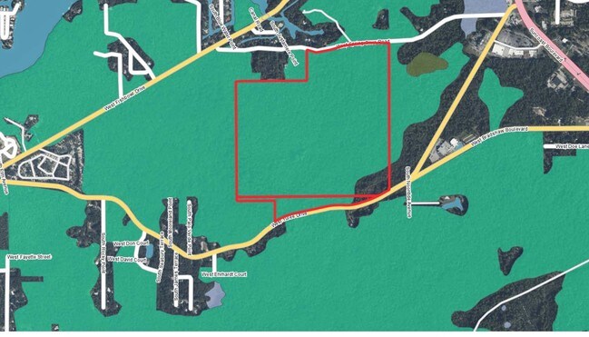
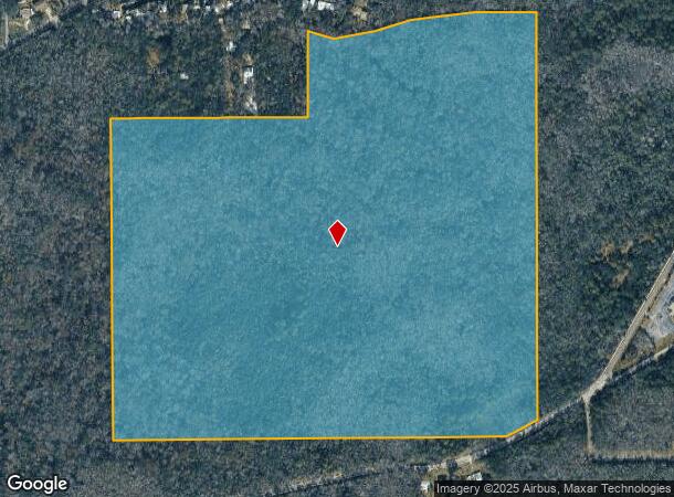
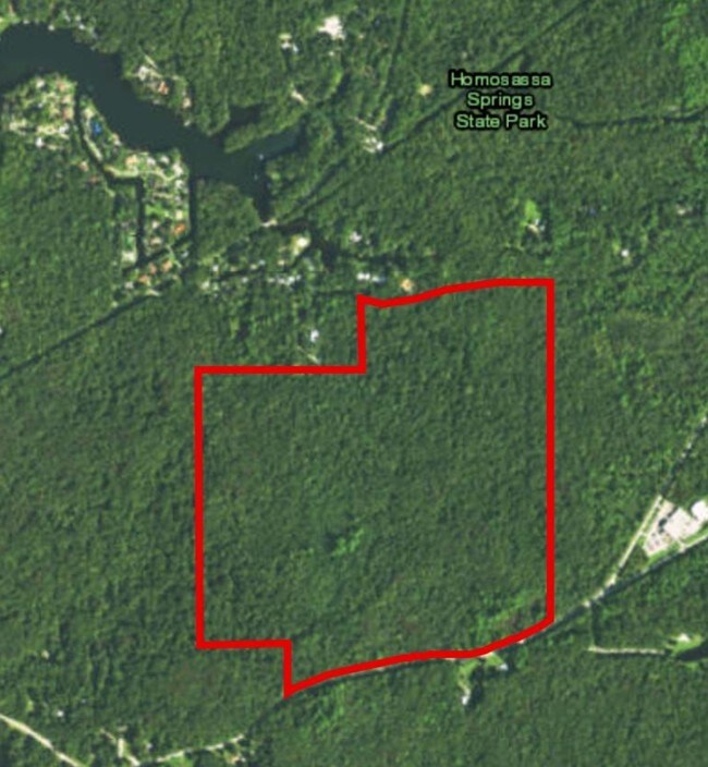
9050 W Spring Cove Rd
Homosassa Springs, FL
Homosassa Company
17E-19S-28-0040-00330-0010
HOMOSASSA COMPANYS SUBD OF SEC 28-19-17 BLKS 33 34 35 & 36 S OF CR R/W --&-- BLKS 45 46 47 48 49 50 51 52 61 62 & 63 & PT OF BLK 64 N OF SR 490 R/W -- LESS: BEG AT INT OF S R/W OF 50 FT WIDE CO RD & W LN OF SE1/4 SEC 28-19-17 TH S 0 DEG 6M 58S W AL W
Vacantlandnec
Citrus
AE
Florida
12017C0312E
10
2024
139.56 AC
2025
Florida Central North Area
451502
Other Market Areas
DEMOGRAPHICS near 9050 W Spring Cove Rd
1 Mile
3 Mile
5 Mile
2024 Total Population
848
9,496
22,122
2029 Population
958
10,896
25,216
Pop Growth 2024-2029
+ 12.97%
+ 14.74%
+ 13.99%
Average Age
60
52
51
2024 Total Households
469
4,517
10,246
HH Growth 2024-2029
+ 12.58%
+ 14.48%
+ 13.71%
Median Household Inc
$43,771
$42,174
$43,313
Avg Household Size
1.80
2.10
2.10
2024 Avg HH Vehicles
2.00
2.00
2.00
Median Home Value
$153,488
$181,228
$162,160
Median Year Built
1984
1984
1985
Nearby Places
Map Layers
Map Styles
 Street
 Aerial
- Restaurants
- Banks
- Shops
- Fitness
- Groceries
SALE & LEASE HISTORY
LISTING DATE
SALE/LEASE

Sep 04, 2017
For Sale
Jan 04, 2018
For Sale
Nearby Properties
Address
Land Use
TOTAL SIZE
Lot Size
Zoning
Address
Land Use
TOTAL SIZE
Lot Size
Zoning
1,600,009 SF
8.85 AC
LDR
Address
Land Use
TOTAL SIZE
Lot Size
Zoning
317,558 SF
88.56 AC
CON
Address
Land Use
TOTAL SIZE
Lot Size
Zoning
7,497 SF
50.78 AC
LDR
Address
Land Use
TOTAL SIZE
Lot Size
Zoning
1,358,539 SF
10.42 AC
GNC
Address
Land Use
TOTAL SIZE
Lot Size
Zoning
32,888 SF
96.24 AC
RVP
Address
Land Use
TOTAL SIZE
Lot Size
Zoning
58,876 SF
9.88 AC
CLR
Address
Land Use
TOTAL SIZE
Lot Size
Zoning
133,204 SF
16.34 AC
GNC
Address
Land Use
TOTAL SIZE
Lot Size
Zoning
134,352 SF
5.62 AC
GNC
Address
Land Use
TOTAL SIZE
Lot Size
Zoning
460,000 SF
9.28 AC
GNC
Address
Land Use
TOTAL SIZE
Lot Size
Zoning
11,714 SF
19.75 AC
RVP
Address
Land Use
TOTAL SIZE
Lot Size
Zoning
619.86 AC
CON
Address
Land Use
TOTAL SIZE
Lot Size
Zoning
3,247.21 AC
CON
Address
Land Use
TOTAL SIZE
Lot Size
Zoning
140,194 SF
7.94 AC
CLRMH
Address
Land Use
TOTAL SIZE
Lot Size
Zoning
9,227 SF
164.58 AC
LDRMH
Address
Land Use
TOTAL SIZE
Lot Size
Zoning
37,689 SF
52.51 AC
CON
Address
Land Use
TOTAL SIZE
Lot Size
Zoning
17,812 SF
2.47 AC
GNC
Address
Land Use
TOTAL SIZE
Lot Size
Zoning
162,168 SF
6.94 AC
GNC
Address
Land Use
TOTAL SIZE
Lot Size
Zoning
101,200 SF
12.19 AC
GNC
Address
Land Use
TOTAL SIZE
Lot Size
Zoning
63,225 SF
9.53 AC
GNC
Address
Land Use
TOTAL SIZE
Lot Size
Zoning
15,628 SF
1.62 AC
GNC
Address
Land Use
TOTAL SIZE
Lot Size
Zoning
132,710 SF
6.14 AC
GNC
Address
Land Use
TOTAL SIZE
Lot Size
Zoning
2,340 SF
14.82 AC
MHP
Address
Land Use
TOTAL SIZE
Lot Size
Zoning
69,568 SF
4.62 AC
GNC
Address
Land Use
TOTAL SIZE
Lot Size
Zoning
197,350 SF
7.50 AC
CLC
Address
Land Use
TOTAL SIZE
Lot Size
Zoning
34,632 SF
2.66 AC
CLR
Address
Land Use
TOTAL SIZE
Lot Size
Zoning
453.14 AC
CON
Address
Land Use
TOTAL SIZE
Lot Size
Zoning
2,060.98 AC
CON
Address
Land Use
TOTAL SIZE
Lot Size
Zoning
49,773 SF
4.01 AC
Address
Land Use
TOTAL SIZE
Lot Size
Zoning
32,330 SF
6.94 AC
GNC
Address
Land Use
TOTAL SIZE
Lot Size
Zoning
23,691 SF
39.88 AC
GNC
The World's #1 Commercial Real Estate Marketplace
Connect with us
© 2025 CoStar Group
The information above has been obtained from sources believed reliable. While we do not doubt its accuracy we have not verified it and make no guarantee, warranty or representation about it. It is your responsibility to independently confirm its accuracy and completeness. Any projections, opinions, assumptions, or estimates used are for example only and do not represent the current or future performance of the property. The value of this transaction to you depends on tax and other factors which should be evaluated by your tax, financial, and legal advisors. You and your advisors should conduct a careful, independent investigation of the property to determine to your satisfaction the suitability of the property for your needs.