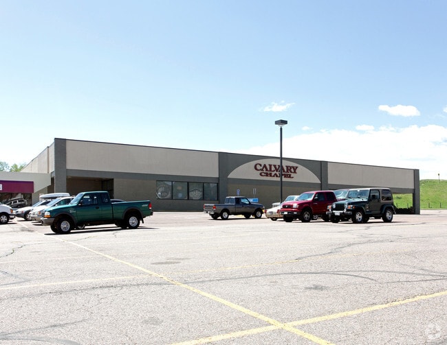
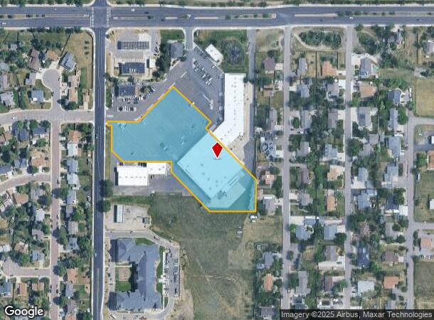
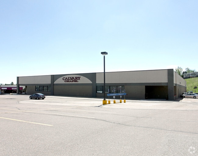
Property Record
9052 W Ken Caryl Ave, Littleton, CO 80128

NEARBY LISTINGS FOR SALE OR LEASE
Property Detail
9052 W Ken Caryl Ave
Denver-Aurora-Lakewood, CO
Fairview Heights Blk 24 & Pt 23 & 25 Ex
59-341-06-020
SECTION 34 TOWNSHIP 05 RANGE 69 SUBDIVISIONCD 238400 SUBDIVISIONNAME FAIRVIEW HEIGHTS BLK 24 & PT 23 & 25 EX SUR #2 BLOCK LOT 000E SIZE: 167584 TRACT VALUE: 3.847
Commercialnec
Jefferson
X
Colorado
08059C0403F
e
0
3.85 AC
2024
Southwest
012059
Denver
42,271 SF
DEMOGRAPHICS near 9052 W Ken Caryl Ave
1 Mile
3 Mile
5 Mile
2024 Total Population
14,774
79,635
160,854
2029 Population
14,490
78,383
161,046
Pop Growth 2024-2029
(1.92%)
(1.57%)
+ 0.12%
Average Age
41
42
43
2024 Total Households
5,718
30,960
63,797
HH Growth 2024-2029
(2.08%)
(1.65%)
+ 0.26%
Median Household Inc
$101,685
$112,424
$108,213
Avg Household Size
2.50
2.50
2.40
2024 Avg HH Vehicles
2.00
2.00
2.00
Median Home Value
$502,612
$574,259
$591,824
Median Year Built
1984
1986
1987
Nearby Places
Map Layers
Map Styles
 Street
 Aerial
- Restaurants
- Banks
- Shops
- Fitness
- Groceries
SALE & LEASE HISTORY
LISTING DATE
SALE/LEASE

Jun 12, 2020
For Lease
Nearby Properties
Address
Land Use
TOTAL SIZE
Lot Size
Zoning
Address
Land Use
TOTAL SIZE
Lot Size
Zoning
272,246 SF
31.76 AC
PD
Address
Land Use
TOTAL SIZE
Lot Size
Zoning
381,135 SF
35.02 AC
Address
Land Use
TOTAL SIZE
Lot Size
Zoning
2,884.97 AC
A1
Address
Land Use
TOTAL SIZE
Lot Size
Zoning
600,847 SF
32.41 AC
PD
Address
Land Use
TOTAL SIZE
Lot Size
Zoning
600,847 SF
35.87 AC
PD
Address
Land Use
TOTAL SIZE
Lot Size
Zoning
214,066 SF
82.60 AC
PD
Address
Land Use
TOTAL SIZE
Lot Size
Zoning
391,595 SF
27.94 AC
Address
Land Use
TOTAL SIZE
Lot Size
Zoning
392,710 SF
21.23 AC
PD
Address
Land Use
TOTAL SIZE
Lot Size
Zoning
178,421 SF
12.31 AC
PD
Address
Land Use
TOTAL SIZE
Lot Size
Zoning
304,475 SF
22.32 AC
Address
Land Use
TOTAL SIZE
Lot Size
Zoning
123,843 SF
6.03 AC
Address
Land Use
TOTAL SIZE
Lot Size
Zoning
329,538 SF
14.64 AC
B-4
Address
Land Use
TOTAL SIZE
Lot Size
Zoning
189,672 SF
16.74 AC
PD
Address
Land Use
TOTAL SIZE
Lot Size
Zoning
101,699 SF
10.34 AC
Address
Land Use
TOTAL SIZE
Lot Size
Zoning
221,819 SF
33.64 AC
A1
Address
Land Use
TOTAL SIZE
Lot Size
Zoning
101,795 SF
12.61 AC
PD
Address
Land Use
TOTAL SIZE
Lot Size
Zoning
308,134 SF
14.56 AC
LPD-C
Address
Land Use
TOTAL SIZE
Lot Size
Zoning
279,023 SF
13.15 AC
LPD-R
Address
Land Use
TOTAL SIZE
Lot Size
Zoning
297,003 SF
26.77 AC
PD
Address
Land Use
TOTAL SIZE
Lot Size
Zoning
221,123 SF
14.82 AC
PD
Address
Land Use
TOTAL SIZE
Lot Size
Zoning
119,540 SF
10.67 AC
C1
Address
Land Use
TOTAL SIZE
Lot Size
Zoning
218,391 SF
9.73 AC
PD
Address
Land Use
TOTAL SIZE
Lot Size
Zoning
120,766 SF
20.56 AC
PD
Address
Land Use
TOTAL SIZE
Lot Size
Zoning
100,550 SF
7.72 AC
PD
Address
Land Use
TOTAL SIZE
Lot Size
Zoning
94,577 SF
5.76 AC
B-4
Address
Land Use
TOTAL SIZE
Lot Size
Zoning
107,693 SF
9.17 AC
PD
Address
Land Use
TOTAL SIZE
Lot Size
Zoning
187,987 SF
10.07 AC
PD
Address
Land Use
TOTAL SIZE
Lot Size
Zoning
177,688 SF
8.45 AC
Address
Land Use
TOTAL SIZE
Lot Size
Zoning
188,435 SF
8.40 AC
LPD-C
Address
Land Use
TOTAL SIZE
Lot Size
Zoning
109,559 SF
13.37 AC
B-4
The World's #1 Commercial Real Estate Marketplace
Connect with us
© 2026 CoStar Group
The information above has been obtained from sources believed reliable. While we do not doubt its accuracy we have not verified it and make no guarantee, warranty or representation about it. It is your responsibility to independently confirm its accuracy and completeness. Any projections, opinions, assumptions, or estimates used are for example only and do not represent the current or future performance of the property. The value of this transaction to you depends on tax and other factors which should be evaluated by your tax, financial, and legal advisors. You and your advisors should conduct a careful, independent investigation of the property to determine to your satisfaction the suitability of the property for your needs.