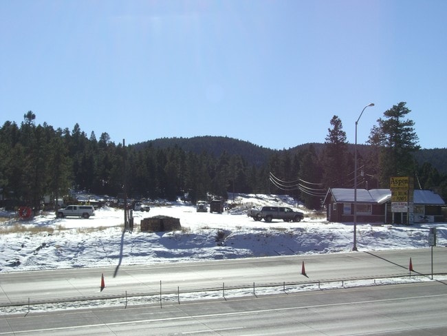
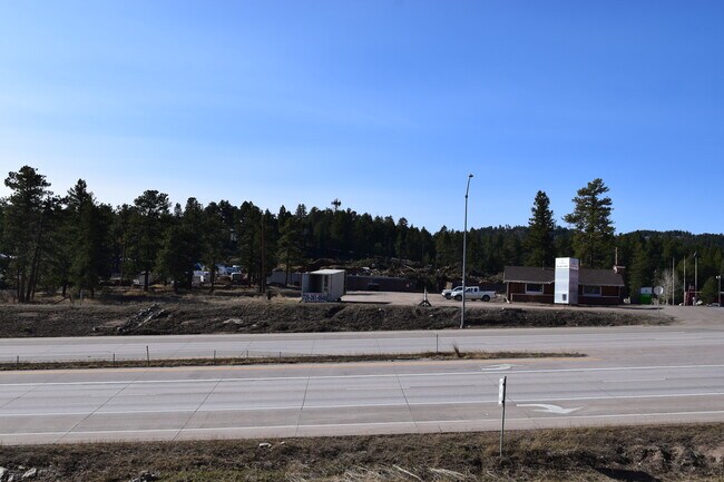
Property Record
9054 Us Highway 285, Morrison, CO 80465

Current Lease Availabilities
Property Detail
9054 Us Highway 285
60-081-00-003
SECTION 08 TOWNSHIP 06 RANGE 70 QTR NE SIZE: 43560 VALUE: 1.000 KEY=058
Commercialnec
Jefferson
PD
Colorado
B and X Area of moderate flood hazard, usually the area between the limits of the 100-year and 500-year floods.
0.79 AC
2023
West Denver
2024
Denver
012033
Denver-Aurora-Centennial, CO
800 SF
NEARBY LISTINGS FOR SALE OR LEASE
DEMOGRAPHICS near 9054 Us Highway 285
1 mile
3 mile
5 mile
2025 Total Population
757
4,601
15,269
2030 Population
756
4,593
15,148
Pop Growth 2025-2030
(0.13%)
(0.17%)
(0.79%)
Average Age
47
46
46
2025 Total Households
305
1,839
5,899
HH Growth 2025-2030
(0.33%)
(0.27%)
(0.85%)
Median Household Inc
$161,111
$152,279
$159,927
Avg Household Size
2.50
2.50
2.50
2025 Avg HH Vehicles
3.00
3.00
3.00
Median Home Value
$854,037
$898,542
$922,959
Median Year Built
1977
1979
1983
Nearby Places
Map Layers
Map Styles
 Street
 Aerial
Transit
 Traffic
 Biking
Places
Listings with unknown addresses are not visible on the map
- Restaurants
- Banks
- Shops
- Fitness
- Groceries
Nearby Properties
Address
Land Use
TOTAL SIZE
Lot Size
Zoning
Address
Land Use
TOTAL SIZE
Lot Size
Zoning
99,925 SF
40 AC
A2
Address
Land Use
TOTAL SIZE
Lot Size
Zoning
62,164 SF
6.07 AC
Address
Land Use
TOTAL SIZE
Lot Size
Zoning
68,855 SF
6.65 AC
PD
Address
Land Use
TOTAL SIZE
Lot Size
Zoning
55,831 SF
3.35 AC
C1
Address
Land Use
TOTAL SIZE
Lot Size
Zoning
262.19 AC
CO
Address
Land Use
TOTAL SIZE
Lot Size
Zoning
35,890 SF
3.04 AC
Address
Land Use
TOTAL SIZE
Lot Size
Zoning
50,801 SF
19.26 AC
R1
Address
Land Use
TOTAL SIZE
Lot Size
Zoning
19,979 SF
15.09 AC
PD
Address
Land Use
TOTAL SIZE
Lot Size
Zoning
389.03 AC
A2
Address
Land Use
TOTAL SIZE
Lot Size
Zoning
26,752 SF
1.67 AC
Address
Land Use
TOTAL SIZE
Lot Size
Zoning
14,000 SF
2.40 AC
PD
Address
Land Use
TOTAL SIZE
Lot Size
Zoning
120 AC
CO
Address
Land Use
TOTAL SIZE
Lot Size
Zoning
4,345 SF
0.76 AC
PD
Address
Land Use
TOTAL SIZE
Lot Size
Zoning
18,275 SF
2 AC
PD
Address
Land Use
TOTAL SIZE
Lot Size
Zoning
7,200 SF
1.28 AC
C1
Address
Land Use
TOTAL SIZE
Lot Size
Zoning
14,400 SF
3.18 AC
C1
Address
Land Use
TOTAL SIZE
Lot Size
Zoning
3,232 SF
1.05 AC
PD
Address
Land Use
TOTAL SIZE
Lot Size
Zoning
7,917 SF
2 AC
PD
Address
Land Use
TOTAL SIZE
Lot Size
Zoning
9,200 SF
1 AC
C1
Address
Land Use
TOTAL SIZE
Lot Size
Zoning
85.44 AC
A2
Address
Land Use
TOTAL SIZE
Lot Size
Zoning
13,500 SF
4 AC
PD
Address
Land Use
TOTAL SIZE
Lot Size
Zoning
80 AC
CO
Address
Land Use
TOTAL SIZE
Lot Size
Zoning
80 AC
CO
Address
Land Use
TOTAL SIZE
Lot Size
Zoning
4,728 SF
0.67 AC
C1
Address
Land Use
TOTAL SIZE
Lot Size
Zoning
5,052 SF
1.01 AC
C1
Address
Land Use
TOTAL SIZE
Lot Size
Zoning
4,092 SF
0.98 AC
C1
Address
Land Use
TOTAL SIZE
Lot Size
Zoning
13,725 SF
52 AC
PD
Address
Land Use
TOTAL SIZE
Lot Size
Zoning
5,153 SF
1.03 AC
C1
Address
Land Use
TOTAL SIZE
Lot Size
Zoning
8,671 SF
1.24 AC
C1
Address
Land Use
TOTAL SIZE
Lot Size
Zoning
3,795 SF
1.52 AC
C1
The World's #1 Commercial Real Estate Marketplace
Connect with us
© 2026 CoStar Group
The information above has been obtained from sources believed reliable. While we do not doubt its accuracy we have not verified it and make no guarantee, warranty or representation about it. It is your responsibility to independently confirm its accuracy and completeness. Any projections, opinions, assumptions, or estimates used are for example only and do not represent the current or future performance of the property. The value of this transaction to you depends on tax and other factors which should be evaluated by your tax, financial, and legal advisors. You and your advisors should conduct a careful, independent investigation of the property to determine to your satisfaction the suitability of the property for your needs.