Property Record
9055 New Kings Rd, Jacksonville, FL 32219


NEARBY LISTINGS FOR SALE OR LEASE
Property Detail
9055 New Kings Rd
002792-0050
Section Land
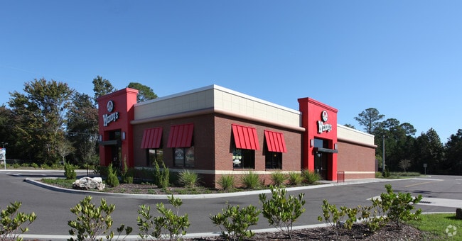
Restaurantbuilding
13-1S-25E 1.019 PT NE1/4 OF SE1/4 RECD O/R 18132-2124
X
Duval
12031C0186J
Florida
2025
1.15 AC
2026
Northwest Jacksonville
010502
Jacksonville (Florida)
3,240 SF
Jacksonville, FL
DEMOGRAPHICS near 9055 New Kings Rd
1 Mile
3 Mile
5 Mile
2024 Total Population
2,103
33,369
83,450
2029 Population
2,252
35,258
88,278
Pop Growth 2024-2029
+ 7.09%
+ 5.66%
+ 5.79%
Average Age
40
40
39
2024 Total Households
786
12,464
31,226
HH Growth 2024-2029
+ 7.38%
+ 5.76%
+ 5.89%
Median Household Inc
$69,862
$52,376
$48,358
Avg Household Size
2.60
2.60
2.60
2024 Avg HH Vehicles
2.00
2.00
2.00
Median Home Value
$177,748
$170,893
$158,111
Median Year Built
1987
1978
1974
Nearby Places
Map Layers
Map Styles
 Street
 Aerial
- Restaurants
- Banks
- Shops
- Fitness
- Groceries
PUBLIC TRANSPORTATION
COMMUTER RAIL
Jacksonville (Silver Meteor - Amtrak, Silver Star - Amtrak)
DRIVE
WALK
Distance
Jacksonville (Silver Meteor - Amtrak, Silver Star - Amtrak)
8 min
4.0 mi
AIRPORT
Jacksonville International
DRIVE
WALK
Distance
Jacksonville International
18 min
10.4 mi
Freight Ports
Jacksonville Port
DRIVE
WALK
Distance
Jacksonville Port
19 min
10.2 mi
SALE & LEASE HISTORY
LISTING DATE
SALE/LEASE

May 15, 2017
For Sale
Jan 17, 2017
For Sale
Aug 02, 2017
For Sale
Nearby Properties
Address
Land Use
TOTAL SIZE
Lot Size
Zoning
Address
Land Use
TOTAL SIZE
Lot Size
Zoning
647,378 SF
27.72 AC
IBP
Address
Land Use
TOTAL SIZE
Lot Size
Zoning
449,967 SF
23.08 AC
IL
Address
Land Use
TOTAL SIZE
Lot Size
Zoning
375,130 SF
25.22 AC
IBP
Address
Land Use
TOTAL SIZE
Lot Size
Zoning
302,066 SF
15.70 AC
IL
Address
Land Use
TOTAL SIZE
Lot Size
Zoning
6,300 SF
744.81 AC
PUD
Address
Land Use
TOTAL SIZE
Lot Size
Zoning
277,582 SF
16.49 AC
IL
Address
Land Use
TOTAL SIZE
Lot Size
Zoning
262,792 SF
15.23 AC
PUD
Address
Land Use
TOTAL SIZE
Lot Size
Zoning
249,082 SF
31.28 AC
PUD
Address
Land Use
TOTAL SIZE
Lot Size
Zoning
189,832 SF
13.08 AC
PUD
Address
Land Use
TOTAL SIZE
Lot Size
Zoning
171,572 SF
10.47 AC
PUD
Address
Land Use
TOTAL SIZE
Lot Size
Zoning
225,829 SF
140.47 AC
PBF-1
Address
Land Use
TOTAL SIZE
Lot Size
Zoning
39,251 SF
55.24 AC
PUD
Address
Land Use
TOTAL SIZE
Lot Size
Zoning
296,575 SF
16.24 AC
PUD
Address
Land Use
TOTAL SIZE
Lot Size
Zoning
176,798 SF
14.77 AC
PUD
Address
Land Use
TOTAL SIZE
Lot Size
Zoning
178,080 SF
9.34 AC
IL
Address
Land Use
TOTAL SIZE
Lot Size
Zoning
157,948 SF
9.22 AC
PUD
Address
Land Use
TOTAL SIZE
Lot Size
Zoning
190,264 SF
14.62 AC
RMD-D
Address
Land Use
TOTAL SIZE
Lot Size
Zoning
80,622 SF
78.47 AC
PUD
Address
Land Use
TOTAL SIZE
Lot Size
Zoning
95,080 SF
9.35 AC
CRO
Address
Land Use
TOTAL SIZE
Lot Size
Zoning
142,998 SF
7.07 AC
PUD
Address
Land Use
TOTAL SIZE
Lot Size
Zoning
79,407 SF
14.93 AC
PUD
Address
Land Use
TOTAL SIZE
Lot Size
Zoning
49,120 SF
89.32 AC
CCG-2
Address
Land Use
TOTAL SIZE
Lot Size
Zoning
1,688 SF
99.78 AC
IH
Address
Land Use
TOTAL SIZE
Lot Size
Zoning
64,432 SF
5.62 AC
PUD
Address
Land Use
TOTAL SIZE
Lot Size
Zoning
74,680 SF
5.07 AC
PUD
Address
Land Use
TOTAL SIZE
Lot Size
Zoning
17,698 SF
2.11 AC
CCG-1
Address
Land Use
TOTAL SIZE
Lot Size
Zoning
67,409 SF
12.53 AC
PUD
Address
Land Use
TOTAL SIZE
Lot Size
Zoning
66,255 SF
40.55 AC
RR-ACRE
Address
Land Use
TOTAL SIZE
Lot Size
Zoning
58.58 AC
IH
Address
Land Use
TOTAL SIZE
Lot Size
Zoning
13,214 SF
1.52 AC
PUD
The World's #1 Commercial Real Estate Marketplace
Connect with us
© 2026 CoStar Group
The information above has been obtained from sources believed reliable. While we do not doubt its accuracy we have not verified it and make no guarantee, warranty or representation about it. It is your responsibility to independently confirm its accuracy and completeness. Any projections, opinions, assumptions, or estimates used are for example only and do not represent the current or future performance of the property. The value of this transaction to you depends on tax and other factors which should be evaluated by your tax, financial, and legal advisors. You and your advisors should conduct a careful, independent investigation of the property to determine to your satisfaction the suitability of the property for your needs.