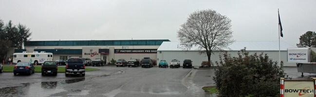
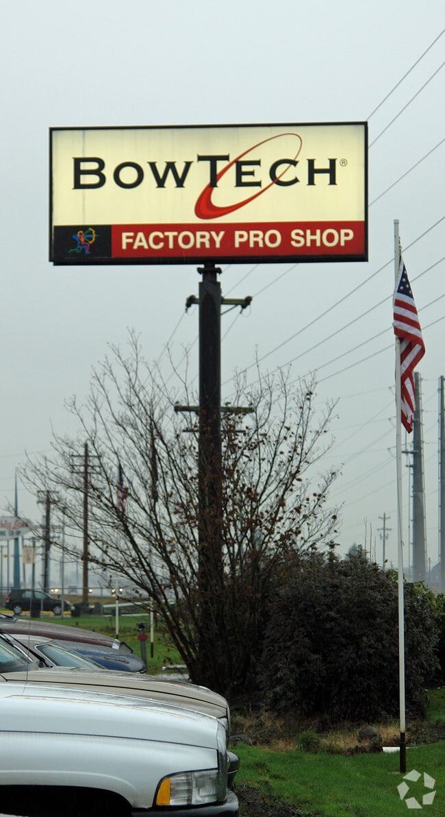
Property Record
90554 Highway 99 N, Eugene, OR 97402

Property Detail
90554 Highway 99 N
Eugene-Springfield, OR
TL 03000
0349603
Lane
Industrialgeneral
Oregon
AG
3000
B and X Area of moderate flood hazard, usually the area between the limits of the 100-year and 500-year floods.
5.26 AC
2025
Lane County
2025
Portland
001001
NEARBY LISTINGS FOR SALE OR LEASE
DEMOGRAPHICS near 90554 Highway 99 N
1 mile
3 mile
5 mile
2025 Total Population
147
30,028
75,047
2030 Population
144
29,462
74,095
Pop Growth 2025-2030
(2.04%)
(1.88%)
(1.27%)
Average Age
44
42
42
2025 Total Households
56
11,579
28,833
HH Growth 2025-2030
(1.79%)
(1.93%)
(1.39%)
Median Household Inc
$87,500
$81,281
$73,599
Avg Household Size
2.60
2.50
2.40
2025 Avg HH Vehicles
2.00
2.00
2.00
Median Home Value
$442,307
$415,305
$399,481
Median Year Built
1991
1985
1979
Nearby Places
Map Layers
Map Styles
 Street
 Aerial
Layers
 Traffic
 Biking
Places
Listings with unknown addresses are not visible on the map
- Restaurants
- Banks
- Shops
- Fitness
- Groceries
PUBLIC TRANSPORTATION
COMMUTER RAIL
Eugene (Amtrak Cascades - Amtrak, Coast Starlight - Amtrak)
Drive
Walk
Distance
Eugene (Amtrak Cascades - Amtrak, Coast Starlight - Amtrak)
13 min
7.7 mi
AIRPORT
Mahlon Sweet Field
Drive
Walk
Distance
Mahlon Sweet Field
7 min
3.0 mi
Freight Ports
Port of Coos Bay, OR
Drive
Walk
Distance
Port of Coos Bay, OR
152 min
109.3 mi
Nearby Properties
Address
Land Use
TOTAL SIZE
Lot Size
Zoning
Address
Land Use
TOTAL SIZE
Lot Size
Zoning
Address
Land Use
TOTAL SIZE
Lot Size
Zoning
664.30 AC
AO
Address
Land Use
TOTAL SIZE
Lot Size
Zoning
27.33 AC
M1
Address
Land Use
TOTAL SIZE
Lot Size
Zoning
121.21 AC
E40
Address
Land Use
TOTAL SIZE
Lot Size
Zoning
Address
Land Use
TOTAL SIZE
Lot Size
Zoning
Address
Land Use
TOTAL SIZE
Lot Size
Zoning
27.47 AC
R-1
Address
Land Use
TOTAL SIZE
Lot Size
Zoning
44.67 AC
I-2
Address
Land Use
TOTAL SIZE
Lot Size
Zoning
14.20 AC
R-1
Address
Land Use
TOTAL SIZE
Lot Size
Zoning
33.70 AC
R-1
Address
Land Use
TOTAL SIZE
Lot Size
Zoning
37.58 AC
PL
Address
Land Use
TOTAL SIZE
Lot Size
Zoning
Address
Land Use
TOTAL SIZE
Lot Size
Zoning
Address
Land Use
TOTAL SIZE
Lot Size
Zoning
8.13 AC
R-1
Address
Land Use
TOTAL SIZE
Lot Size
Zoning
31.30 AC
I-3
Address
Land Use
TOTAL SIZE
Lot Size
Zoning
4.62 AC
AG
Address
Land Use
TOTAL SIZE
Lot Size
Zoning
Address
Land Use
TOTAL SIZE
Lot Size
Zoning
Address
Land Use
TOTAL SIZE
Lot Size
Zoning
5.38 AC
I-2
Address
Land Use
TOTAL SIZE
Lot Size
Zoning
8.03 AC
C-2
Address
Land Use
TOTAL SIZE
Lot Size
Zoning
Address
Land Use
TOTAL SIZE
Lot Size
Zoning
Address
Land Use
TOTAL SIZE
Lot Size
Zoning
25.80 AC
I-3
Address
Land Use
TOTAL SIZE
Lot Size
Zoning
Address
Land Use
TOTAL SIZE
Lot Size
Zoning
2.44 AC
R-2
Address
Land Use
TOTAL SIZE
Lot Size
Zoning
3.60 AC
I-2
Address
Land Use
TOTAL SIZE
Lot Size
Zoning
10.92 AC
I-2
Address
Land Use
TOTAL SIZE
Lot Size
Zoning
Address
Land Use
TOTAL SIZE
Lot Size
Zoning
6.74 AC
I-2
Address
Land Use
TOTAL SIZE
Lot Size
Zoning
1,728 SF
10.69 AC
AG
The World's #1 Commercial Real Estate Marketplace
Connect with us
© 2026 CoStar Group
The information above has been obtained from sources believed reliable. While we do not doubt its accuracy we have not verified it and make no guarantee, warranty or representation about it. It is your responsibility to independently confirm its accuracy and completeness. Any projections, opinions, assumptions, or estimates used are for example only and do not represent the current or future performance of the property. The value of this transaction to you depends on tax and other factors which should be evaluated by your tax, financial, and legal advisors. You and your advisors should conduct a careful, independent investigation of the property to determine to your satisfaction the suitability of the property for your needs.