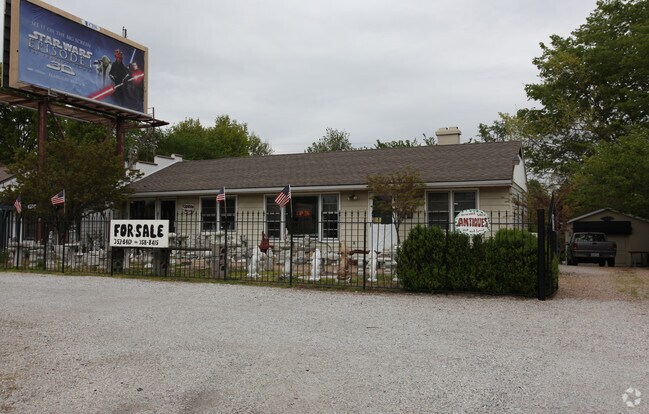
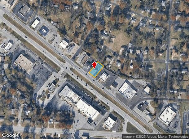
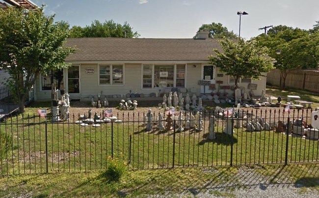
Property Record
9060 E State Route 350, Raytown, MO 64133

NEARBY LISTINGS FOR SALE OR LEASE
Property Detail
9060 E State Route 350
Kansas City, MO-KS
Laurel Heights
45-520-17-12-00-0-00-000
LAUREL HEIGHTS SELY 27.5 LOT 10 & NWLY 45 LOT 11 BLK 27
Storebuilding
Jackson
X
Missouri
29095C0401G
10,11
2024
0.24 AC
2025
East Jackson County
012600
Kansas City
2,544 SF
DEMOGRAPHICS near 9060 E State Route 350
1 Mile
3 Mile
5 Mile
2024 Total Population
7,009
52,886
125,740
2029 Population
6,980
52,499
125,616
Pop Growth 2024-2029
(0.41%)
(0.73%)
(0.10%)
Average Age
41
40
40
2024 Total Households
3,063
21,777
51,961
HH Growth 2024-2029
(0.52%)
(0.87%)
(0.20%)
Median Household Inc
$53,782
$59,084
$53,249
Avg Household Size
2.30
2.30
2.30
2024 Avg HH Vehicles
2.00
2.00
2.00
Median Home Value
$128,571
$150,718
$147,127
Median Year Built
1959
1965
1964
Nearby Places
Map Layers
Map Styles
 Street
 Aerial
- Restaurants
- Banks
- Shops
- Fitness
- Groceries
PUBLIC TRANSPORTATION
COMMUTER RAIL
Lee's Summit Amtrak (Lincoln Service Missouri River Runner - Amtrak, Missouri River Runner - Amtrak)
DRIVE
WALK
Distance
Lee's Summit Amtrak (Lincoln Service Missouri River Runner - Amtrak, Missouri River Runner - Amtrak)
15 min
8.9 mi
AIRPORT
Kansas City International
DRIVE
WALK
Distance
Kansas City International
42 min
33.8 mi
Freight Ports
Tulsa Port Of Catoosa
DRIVE
WALK
Distance
Tulsa Port Of Catoosa
265 min
235.7 mi
SALE & LEASE HISTORY
LISTING DATE
SALE/LEASE

Sep 23, 2016
For Sale
Mar 09, 2017
For Sale
Mar 08, 2017
For Sale
Nearby Properties
Address
Land Use
TOTAL SIZE
Lot Size
Zoning
Address
Land Use
TOTAL SIZE
Lot Size
Zoning
112,500 SF
26.32 AC
Address
Land Use
TOTAL SIZE
Lot Size
Zoning
246,115 SF
Address
Land Use
TOTAL SIZE
Lot Size
Zoning
175,318 SF
26.37 AC
Address
Land Use
TOTAL SIZE
Lot Size
Zoning
137,428 SF
27.76 AC
Address
Land Use
TOTAL SIZE
Lot Size
Zoning
168,184 SF
18.63 AC
Address
Land Use
TOTAL SIZE
Lot Size
Zoning
49,964 SF
39.88 AC
Address
Land Use
TOTAL SIZE
Lot Size
Zoning
389,227 SF
33.30 AC
Address
Land Use
TOTAL SIZE
Lot Size
Zoning
134,082 SF
1.79 AC
Address
Land Use
TOTAL SIZE
Lot Size
Zoning
34,832 SF
8.29 AC
Address
Land Use
TOTAL SIZE
Lot Size
Zoning
173,321 SF
40 AC
Address
Land Use
TOTAL SIZE
Lot Size
Zoning
82,607 SF
9.90 AC
Address
Land Use
TOTAL SIZE
Lot Size
Zoning
42,417 SF
21.81 AC
Address
Land Use
TOTAL SIZE
Lot Size
Zoning
Address
Land Use
TOTAL SIZE
Lot Size
Zoning
16,764 SF
154.60 AC
Address
Land Use
TOTAL SIZE
Lot Size
Zoning
286,210 SF
234.92 AC
Address
Land Use
TOTAL SIZE
Lot Size
Zoning
33,541 SF
21.83 AC
Address
Land Use
TOTAL SIZE
Lot Size
Zoning
145,569 SF
16.90 AC
Address
Land Use
TOTAL SIZE
Lot Size
Zoning
80,433 SF
7.24 AC
Address
Land Use
TOTAL SIZE
Lot Size
Zoning
176,132 SF
0.27 AC
Address
Land Use
TOTAL SIZE
Lot Size
Zoning
73,434 SF
10.35 AC
Address
Land Use
TOTAL SIZE
Lot Size
Zoning
82,432 SF
5.24 AC
Address
Land Use
TOTAL SIZE
Lot Size
Zoning
85,700 SF
21.88 AC
Address
Land Use
TOTAL SIZE
Lot Size
Zoning
43,200 SF
4.37 AC
Address
Land Use
TOTAL SIZE
Lot Size
Zoning
35,646 SF
3.25 AC
Address
Land Use
TOTAL SIZE
Lot Size
Zoning
82,042 SF
11.28 AC
Address
Land Use
TOTAL SIZE
Lot Size
Zoning
67,570 SF
5.71 AC
Address
Land Use
TOTAL SIZE
Lot Size
Zoning
47,099 SF
3.55 AC
Address
Land Use
TOTAL SIZE
Lot Size
Zoning
22,913 SF
151.50 AC
Address
Land Use
TOTAL SIZE
Lot Size
Zoning
12,382 SF
1 AC
Address
Land Use
TOTAL SIZE
Lot Size
Zoning
11,020 SF
36.08 AC
The World's #1 Commercial Real Estate Marketplace
Connect with us
© 2025 CoStar Group
The information above has been obtained from sources believed reliable. While we do not doubt its accuracy we have not verified it and make no guarantee, warranty or representation about it. It is your responsibility to independently confirm its accuracy and completeness. Any projections, opinions, assumptions, or estimates used are for example only and do not represent the current or future performance of the property. The value of this transaction to you depends on tax and other factors which should be evaluated by your tax, financial, and legal advisors. You and your advisors should conduct a careful, independent investigation of the property to determine to your satisfaction the suitability of the property for your needs.